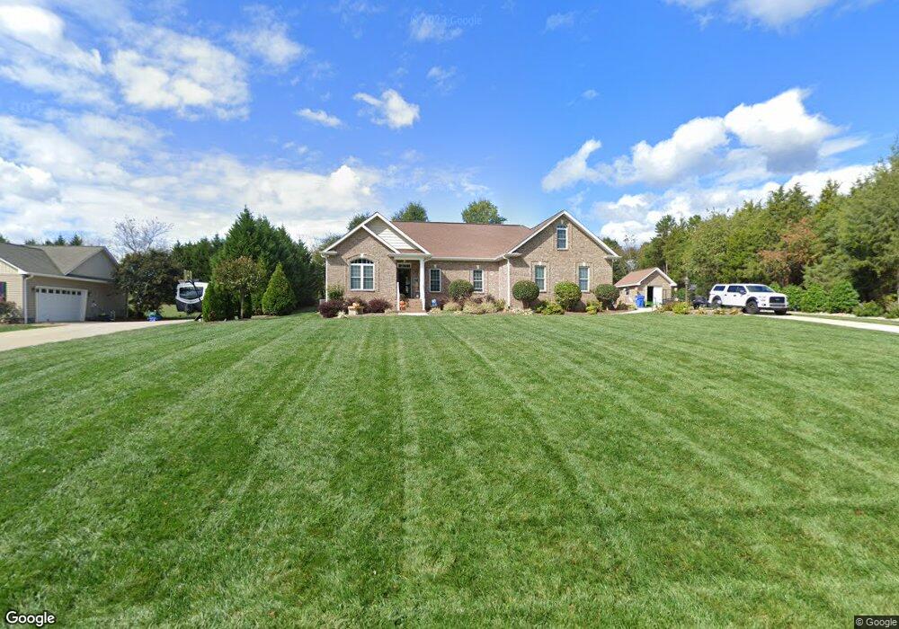
154 Sandtrap Dr Statesville, NC 28677
Estimated Value: $340,193 - $415,000
3
Beds
3
Baths
2,358
Sq Ft
$162/Sq Ft
Est. Value
About This Home
This home is located at 154 Sandtrap Dr, Statesville, NC 28677 and is currently estimated at $381,548, approximately $161 per square foot. 154 Sandtrap Dr is a home located in Iredell County with nearby schools including Celeste Henkel Elementary School, West Iredell Middle School, and West Iredell High School.
Ownership History
Date
Name
Owned For
Owner Type
Purchase Details
Closed on
Mar 26, 2019
Sold by
Wokatsch Jurgen and Gaddy Sarah Lou
Bought by
Mccombs Harold S and Mccombs Kathleen L
Current Estimated Value
Home Financials for this Owner
Home Financials are based on the most recent Mortgage that was taken out on this home.
Original Mortgage
$183,600
Outstanding Balance
$161,742
Interest Rate
4.4%
Mortgage Type
New Conventional
Estimated Equity
$219,806
Purchase Details
Closed on
Oct 14, 2008
Sold by
Hutchcraft Suzanne S and Hutchcraft Floyd E
Bought by
Wokatsch Jurgen and Gaddy Sarah Lou
Purchase Details
Closed on
Mar 1, 1997
Purchase Details
Closed on
Aug 1, 1994
Purchase Details
Closed on
Dec 1, 1988
Create a Home Valuation Report for This Property
The Home Valuation Report is an in-depth analysis detailing your home's value as well as a comparison with similar homes in the area
Home Values in the Area
Average Home Value in this Area
Purchase History
| Date | Buyer | Sale Price | Title Company |
|---|---|---|---|
| Mccombs Harold S | $230,000 | None Available | |
| Wokatsch Jurgen | $14,000 | None Available | |
| -- | -- | -- | |
| -- | -- | -- | |
| -- | -- | -- |
Source: Public Records
Mortgage History
| Date | Status | Borrower | Loan Amount |
|---|---|---|---|
| Open | Mccombs Harold S | $183,600 |
Source: Public Records
Tax History Compared to Growth
Tax History
| Year | Tax Paid | Tax Assessment Tax Assessment Total Assessment is a certain percentage of the fair market value that is determined by local assessors to be the total taxable value of land and additions on the property. | Land | Improvement |
|---|---|---|---|---|
| 2024 | $1,554 | $253,230 | $22,000 | $231,230 |
| 2023 | $1,554 | $253,230 | $22,000 | $231,230 |
| 2022 | $1,286 | $195,400 | $22,000 | $173,400 |
| 2021 | $1,282 | $195,400 | $22,000 | $173,400 |
| 2020 | $1,282 | $195,400 | $22,000 | $173,400 |
| 2019 | $1,263 | $195,400 | $22,000 | $173,400 |
| 2018 | $1,124 | $179,440 | $18,000 | $161,440 |
| 2017 | $1,124 | $179,440 | $18,000 | $161,440 |
| 2016 | $1,124 | $179,440 | $18,000 | $161,440 |
| 2015 | $1,124 | $179,440 | $18,000 | $161,440 |
| 2014 | -- | $191,070 | $16,000 | $175,070 |
Source: Public Records
Map
Nearby Homes
- 178 Old Airport Rd
- 133 Tower Dr Unit 35
- 130 Aviation Dr
- 103 Dublin Ct
- 130 Greenwich Dr
- 109 Gatwick Ct
- 1144 Old Mountain Rd
- 00 Jamie Dr Unit 6
- 3004 Newton Dr
- 289 Mary Locke Way
- 1129 Rita Ave
- 1120 Rita Ave
- 818 Candy Dr
- 812 Candy Dr
- Kipling Plan at Beaver Creek
- TA3000 Plan at Beaver Creek
- Hudson Plan at Beaver Creek
- Whitney Plan at Beaver Creek
- TA4000 Plan at Beaver Creek
- Devin Plan at Beaver Creek
- 154 Sandtrap Dr Unit 30
- 160 Sandtrap Dr
- 104 Sandtrap Dr
- Lot 31 Sandtrap Dr
- lot 7 Sandtrap Dr
- 155 Sandtrap Dr
- 222 Sandtrap Dr
- 222 Sandtrap Dr Unit 24
- 161 Sandtrap Dr Unit 11
- 228 Sandtrap Dr
- 214 Sandtrap Dr
- 139 Sandtrap Dr
- 11 Sandtrap Dr
- 31 Sandtrap Dr
- 6 Sandtrap Dr
- 139 New Center Dr
- 169 Sandtrap Dr
- 184 Sandtrap Dr
- 217 Sandtrap Dr
- 173 Sandtrap Dr