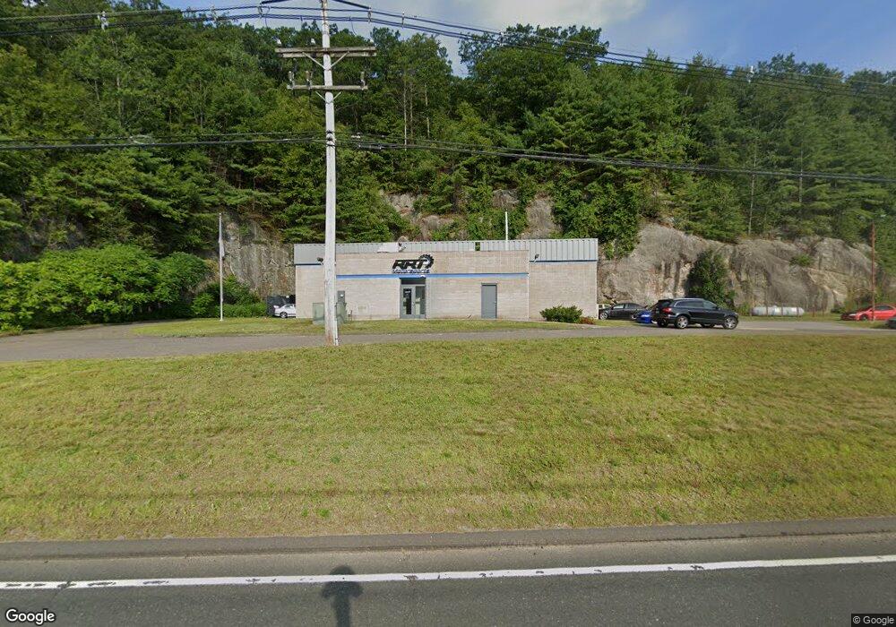
154 Torrington Rd Winsted, CT 06098
Estimated Value: $598,582
Studio
--
Bath
4,542
Sq Ft
$132/Sq Ft
Est. Value
About This Home
This home is located at 154 Torrington Rd, Winsted, CT 06098 and is currently estimated at $598,582, approximately $131 per square foot. 154 Torrington Rd is a home located in Litchfield County with nearby schools including Pearson School and St Anthony School.
Ownership History
Date
Name
Owned For
Owner Type
Purchase Details
Closed on
Jan 4, 2023
Sold by
New Endeavors Of Wolcott
Bought by
Shift Master Llc
Current Estimated Value
Purchase Details
Closed on
Apr 17, 2003
Sold by
Envirotest Systems Cor
Bought by
New Endeavors Wolcott
Create a Home Valuation Report for This Property
The Home Valuation Report is an in-depth analysis detailing your home's value as well as a comparison with similar homes in the area
Home Values in the Area
Average Home Value in this Area
Purchase History
| Date | Buyer | Sale Price | Title Company |
|---|---|---|---|
| Shift Master Llc | $459,900 | None Available | |
| Shift Master Llc | $459,900 | None Available | |
| New Endeavors Wolcott | $225,000 | -- | |
| New Endeavors Wolcott | $225,000 | -- |
Source: Public Records
Mortgage History
| Date | Status | Borrower | Loan Amount |
|---|---|---|---|
| Previous Owner | New Endeavors Wolcott | $95,000,000 |
Source: Public Records
Tax History
| Year | Tax Paid | Tax Assessment Tax Assessment Total Assessment is a certain percentage of the fair market value that is determined by local assessors to be the total taxable value of land and additions on the property. | Land | Improvement |
|---|---|---|---|---|
| 2025 | $6,467 | $221,690 | $34,230 | $187,460 |
| 2024 | $6,039 | $221,690 | $34,230 | $187,460 |
| 2023 | $5,850 | $221,690 | $34,230 | $187,460 |
| 2022 | $5,832 | $173,880 | $25,410 | $148,470 |
| 2021 | $5,832 | $173,880 | $25,410 | $148,470 |
| 2020 | $5,832 | $173,880 | $25,410 | $148,470 |
| 2019 | $5,832 | $173,880 | $25,410 | $148,470 |
| 2018 | $5,832 | $173,880 | $25,410 | $148,470 |
| 2017 | $5,254 | $156,660 | $24,220 | $132,440 |
| 2016 | $5,254 | $156,660 | $24,220 | $132,440 |
| 2015 | $5,123 | $156,660 | $24,220 | $132,440 |
| 2014 | $4,999 | $156,660 | $24,220 | $132,440 |
Source: Public Records
Map
Nearby Homes
- 257-259 Torringford St
- 107 Birdsall St
- 843-845 (lots - 10A, E Wakefield Blvd
- 605 E Wakefield Blvd
- 7 Stadler Heights
- 44 Lewis St
- 48 Bridge St
- 156 Shore Dr
- 124 Rockwell St
- 230 E Wakefield Blvd
- 35 Glendale Ave
- 436 Main St
- 39 S Main St
- 9 Central Ave
- 57 Main St
- 25 Center St
- 408 New Hartford Rd
- 95 Colony Dr
- 55 Walnut St
- 94 Holabird Ave
- 144 Torrington Rd
- 122 Torrington Rd
- 147 Torrington Rd
- 158 Torrington Rd
- 212 Torringford St
- 120 Torrington Rd
- 165 Torrington Rd
- 118 Torrington Rd
- 184 Torringford St
- 116 Torrington Rd
- 202 Torringford St
- 204 Torringford St
- 200 Torringford St
- 198 Torringford St
- 126 Standard Ave
- 174 Torringford St
- 291 Pratt St
- 114 Torrington Rd
- 124 Standard Ave
- 109 Roberts Ave
Your Personal Tour Guide
Ask me questions while you tour the home.