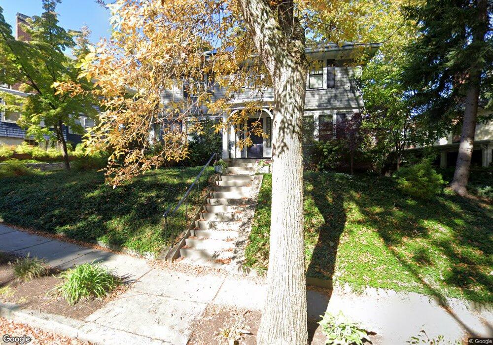
154 University Rd Brookline, MA 02445
Washington Square NeighborhoodEstimated Value: $1,725,000 - $2,480,000
4
Beds
3
Baths
2,060
Sq Ft
$1,028/Sq Ft
Est. Value
About This Home
This home is located at 154 University Rd, Brookline, MA 02445 and is currently estimated at $2,117,308, approximately $1,027 per square foot. 154 University Rd is a home located in Norfolk County with nearby schools including Torah Academy.
Ownership History
Date
Name
Owned For
Owner Type
Purchase Details
Closed on
Nov 29, 2004
Sold by
Brookline Town Of
Bought by
Allen Mark H and Greenfield Stefanie A
Current Estimated Value
Home Financials for this Owner
Home Financials are based on the most recent Mortgage that was taken out on this home.
Original Mortgage
$608,800
Outstanding Balance
$305,294
Interest Rate
5.75%
Mortgage Type
Purchase Money Mortgage
Estimated Equity
$1,812,014
Create a Home Valuation Report for This Property
The Home Valuation Report is an in-depth analysis detailing your home's value as well as a comparison with similar homes in the area
Home Values in the Area
Average Home Value in this Area
Purchase History
| Date | Buyer | Sale Price | Title Company |
|---|---|---|---|
| Allen Mark H | $761,100 | -- |
Source: Public Records
Mortgage History
| Date | Status | Borrower | Loan Amount |
|---|---|---|---|
| Open | Allen Mark H | $608,800 | |
| Closed | Allen Mark H | $76,100 |
Source: Public Records
Tax History Compared to Growth
Tax History
| Year | Tax Paid | Tax Assessment Tax Assessment Total Assessment is a certain percentage of the fair market value that is determined by local assessors to be the total taxable value of land and additions on the property. | Land | Improvement |
|---|---|---|---|---|
| 2025 | $21,185 | $2,146,400 | $1,222,700 | $923,700 |
| 2024 | $20,166 | $2,064,100 | $1,175,700 | $888,400 |
| 2023 | $18,189 | $1,824,400 | $972,200 | $852,200 |
| 2022 | $17,705 | $1,737,500 | $925,900 | $811,600 |
| 2021 | $16,373 | $1,670,700 | $890,300 | $780,400 |
| 2020 | $14,917 | $1,578,500 | $809,300 | $769,200 |
| 2019 | $14,087 | $1,503,400 | $770,800 | $732,600 |
| 2018 | $12,588 | $1,330,700 | $621,600 | $709,100 |
| 2017 | $12,403 | $1,255,400 | $586,400 | $669,000 |
| 2016 | $12,226 | $1,173,300 | $548,100 | $625,200 |
| 2015 | $11,071 | $1,036,600 | $465,600 | $571,000 |
| 2014 | $11,510 | $1,010,500 | $423,200 | $587,300 |
Source: Public Records
Map
Nearby Homes
- 589-591 Washington St
- 4 Fairbanks St Unit 2
- 1471 Beacon St Unit 7
- 1471 Beacon St Unit 1
- 84 Winthrop Rd Unit 1
- 84 Winthrop Rd
- 12 Colbourne Crescent Unit 1
- 648 Washington St Unit 7
- 15 Colbourne Crescent Unit 2
- 108-116 Winthrop Rd
- 59 Mason Terrace Unit 61
- 21 Hancock Rd
- 1572 Beacon St
- 57 University Rd Unit 3
- 29 Mason Terrace
- 80 Park St Unit 23
- 15 Short St Unit 4
- 90 Addington Rd Unit 1
- 80 Vernon St Unit 1-A
- 80 Vernon St Unit 2B
- 160 University Rd
- 146 University Rd
- 00 University
- 148 University Rd
- 148 University Rd Unit 1
- 148 University Rd Unit 148
- 580 Washington St Unit 2
- 580 Washington St Unit 1
- 153 University Rd
- 153 University Rd Unit 2
- 153 University Rd Unit room
- 153 University Rd Unit 1
- 576 Washington St Unit 1
- 576 Washington St Unit 7
- 576 Washington St Unit 6
- 576 Washington St Unit 5
- 576 Washington St Unit 4
- 576 Washington St Unit 3
- 576 Washington St Unit 2
- 142 University Rd Unit 144