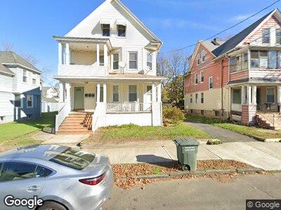
154 Wilson St Bridgeport, CT 06605
Black Rock NeighborhoodEstimated Value: $383,793 - $609,000
5
Beds
3
Baths
2,693
Sq Ft
$182/Sq Ft
Est. Value
About This Home
This home is located at 154 Wilson St, Bridgeport, CT 06605 and is currently estimated at $491,448, approximately $182 per square foot. 154 Wilson St is a home located in Fairfield County with nearby schools including Holland Hill Elementary, Fairfield Ludlowe High School, and Park City Prep Charter School.
Ownership History
Date
Name
Owned For
Owner Type
Purchase Details
Closed on
Oct 27, 1997
Sold by
Bouchard Eric C and Oneill Dianne E
Bought by
Mccarthy Jeremiah J
Current Estimated Value
Home Financials for this Owner
Home Financials are based on the most recent Mortgage that was taken out on this home.
Original Mortgage
$123,950
Interest Rate
2.75%
Mortgage Type
Unknown
Create a Home Valuation Report for This Property
The Home Valuation Report is an in-depth analysis detailing your home's value as well as a comparison with similar homes in the area
Home Values in the Area
Average Home Value in this Area
Purchase History
| Date | Buyer | Sale Price | Title Company |
|---|---|---|---|
| Mccarthy Jeremiah J | $125,000 | -- | |
| Mccarthy Jeremiah J | $125,000 | -- |
Source: Public Records
Mortgage History
| Date | Status | Borrower | Loan Amount |
|---|---|---|---|
| Open | Mccarthy Jeremiah J | $148,000 | |
| Closed | Mccarthy Jeremiah J | $123,950 |
Source: Public Records
Tax History Compared to Growth
Tax History
| Year | Tax Paid | Tax Assessment Tax Assessment Total Assessment is a certain percentage of the fair market value that is determined by local assessors to be the total taxable value of land and additions on the property. | Land | Improvement |
|---|---|---|---|---|
| 2024 | $9,865 | $227,040 | $109,070 | $117,970 |
| 2023 | $9,865 | $227,040 | $109,070 | $117,970 |
| 2022 | $9,865 | $227,040 | $109,070 | $117,970 |
| 2021 | $9,865 | $227,040 | $109,070 | $117,970 |
| 2020 | $9,112 | $168,770 | $70,810 | $97,960 |
| 2019 | $9,112 | $168,770 | $70,810 | $97,960 |
| 2018 | $9,176 | $168,770 | $70,810 | $97,960 |
| 2017 | $9,176 | $168,770 | $70,810 | $97,960 |
| 2016 | $9,176 | $168,770 | $70,810 | $97,960 |
| 2015 | $7,998 | $189,520 | $59,500 | $130,020 |
| 2014 | $7,998 | $189,520 | $59,500 | $130,020 |
Source: Public Records
Map
Nearby Homes
- 80 Fox St
- 2811 Fairfield Ave Unit 1
- 2937 Fairfield Ave Unit 2939
- 61 Rowsley St Unit 2
- 26 Rowsley St Unit 5
- 167 Scofield Ave
- 106 Nash Ln Unit 108
- 3250 Fairfield Ave Unit 302
- 3250 Fairfield Ave Unit 200
- 525 Midland St
- 409 Brewster St
- 592 Courtland Ave Unit 594
- 356-358 Midland St
- 525 Courtland Ave Unit 527
- 362 Grovers Ave
- 15 Ellsworth St Unit 22
- 271 Seaside Ave
- 75 Stone Ridge Way Unit 1D
- 75 Stone Ridge Way Unit 3B
- 40-42 Hansen Ave
- 154 Wilson St
- 168 Wilson St
- 144 Wilson St
- 134 Wilson St
- 178 Wilson St
- 189 Wilson St
- 791 Brewster St Unit 793
- 791 Brewster St Unit 1
- 783 Brewster St Unit 785
- 783 Brewster St Unit 3
- 797 Brewster St Unit 799
- 167 Wilson St Unit 3rd
- 167 Wilson St
- 167 Wilson St Unit 3rd Fl.
- 167 Wilson St Unit 1st
- 773 Brewster St Unit 775
- 130 Wilson St Unit 1
- 130 Wilson St
- 130 Wilson St Unit 2ND
- 130 Wilson St Unit 3