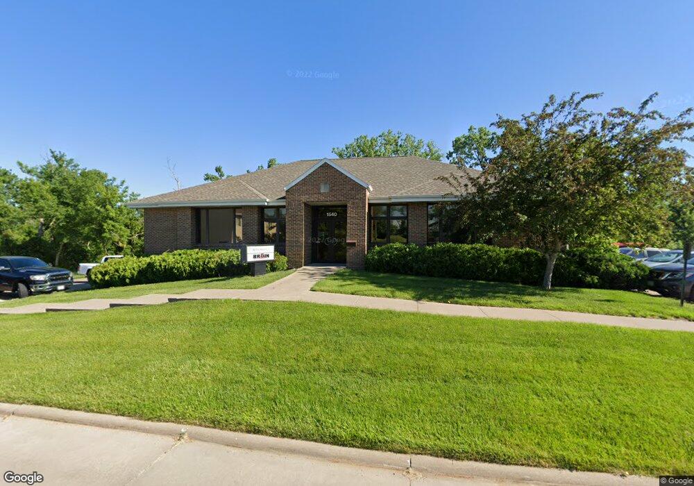
1540 Midland Ct NE Cedar Rapids, IA 52402
Noelridge Park NeighborhoodEstimated Value: $683,569
--
Bed
--
Bath
2,718
Sq Ft
$251/Sq Ft
Est. Value
About This Home
This home is located at 1540 Midland Ct NE, Cedar Rapids, IA 52402 and is currently estimated at $683,569, approximately $251 per square foot. 1540 Midland Ct NE is a home located in Linn County with nearby schools including T.C. Cherry Elementary School, Wright Elementary School, and Harding Middle School.
Ownership History
Date
Name
Owned For
Owner Type
Purchase Details
Closed on
Oct 29, 2020
Sold by
Brain Stephen Michael and Brain Mary Anne
Bought by
Colorado Holdings Llc
Current Estimated Value
Purchase Details
Closed on
Apr 17, 2003
Sold by
Council Square Llc
Bought by
Brain Stephen Michael and Brain Mary Anne
Purchase Details
Closed on
Nov 11, 1997
Sold by
Sunset Homes Inc
Bought by
Council Square Llc
Create a Home Valuation Report for This Property
The Home Valuation Report is an in-depth analysis detailing your home's value as well as a comparison with similar homes in the area
Home Values in the Area
Average Home Value in this Area
Purchase History
| Date | Buyer | Sale Price | Title Company |
|---|---|---|---|
| Colorado Holdings Llc | $545,000 | None Available | |
| Brain Stephen Michael | $449,500 | -- | |
| Council Square Llc | $78,500 | -- |
Source: Public Records
Tax History Compared to Growth
Tax History
| Year | Tax Paid | Tax Assessment Tax Assessment Total Assessment is a certain percentage of the fair market value that is determined by local assessors to be the total taxable value of land and additions on the property. | Land | Improvement |
|---|---|---|---|---|
| 2025 | $14,270 | $518,400 | $71,700 | $446,700 |
| 2024 | $16,838 | $488,000 | $71,700 | $416,300 |
| 2023 | $16,838 | $488,000 | $71,700 | $416,300 |
| 2022 | $15,884 | $543,700 | $71,700 | $472,000 |
| 2021 | $15,662 | $1,015,700 | $71,700 | $944,000 |
| 2020 | $15,662 | $1,002,200 | $62,800 | $939,400 |
| 2019 | $14,994 | $1,002,200 | $62,800 | $939,400 |
| 2018 | $14,928 | $532,500 | $62,800 | $469,700 |
| 2017 | $12,542 | $462,200 | $62,800 | $399,400 |
| 2016 | $15,895 | $462,200 | $62,800 | $399,400 |
| 2015 | $15,252 | $443,889 | $62,856 | $381,033 |
| 2014 | $12,846 | $443,889 | $62,856 | $381,033 |
| 2013 | $15,216 | $443,889 | $62,856 | $381,033 |
Source: Public Records
Map
Nearby Homes
- 327 Meadows Field Dr NE
- 1638 47th St NE
- 1006 Messina Dr NE
- 1138 Messina Dr NE
- 915 Suburban St NE
- 0 Council St NE
- 4523 Regal Ave NE
- 109 E Willman St
- 4309 Benton St NE
- 1101 Dover St NE
- 714 Blairs Ferry Rd NE
- 250 Cimarron Dr Unit 311
- 105 W Willman St
- 6410 Creekside Dr NE Unit 1
- 6410 Creekside Dr NE
- 6430 Creekside Dr NE Unit 4
- 5455 Blairs Ferry Rd NE
- 5794 Oakwood Ave NE Unit 2
- 1200 Murray St NE Unit 11
- 6505 Brookview Ln NE
- 1605 Midland Ct NE
- 1520 Midland Ct NE Unit 200
- 1520 Midland Ct NE Unit 300
- 5380 Council St NE Unit Lot 15
- 5380 Council St NE
- 5515 Council St NE Unit D
- 5515 Council St NE Unit B
- 5515 Council St NE Unit F
- 5515 Council St NE Unit E
- 5515 Council St NE Unit A
- 5515 Council St NE Unit C
- 5515 Council St NE Unit G
- 5515 Council St NE Unit I
- 5515 Council St NE Unit H
- 5350 Council St NE Unit F
- 5350 Council St NE Unit A
- 5350 Council St NE Unit C
- 5350 Council St NE Unit D
- 5350 Council St NE Unit C&D
- 5350 Council St NE Unit E