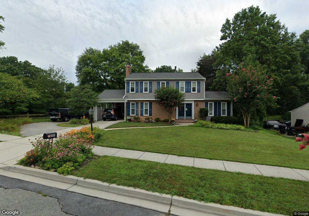
15404 Bounds Ave Laurel, MD 20707
West Laurel NeighborhoodEstimated Value: $447,718 - $558,000
Studio
3
Baths
1,624
Sq Ft
$309/Sq Ft
Est. Value
About This Home
This home is located at 15404 Bounds Ave, Laurel, MD 20707 and is currently estimated at $502,180, approximately $309 per square foot. 15404 Bounds Ave is a home located in Prince George's County with nearby schools including Bond Mill Elementary, Martin Luther King Jr. Middle School, and Laurel High School.
Ownership History
Date
Name
Owned For
Owner Type
Purchase Details
Closed on
May 24, 2016
Bought by
Farley Cynthia and Farley John
Current Estimated Value
Home Financials for this Owner
Home Financials are based on the most recent Mortgage that was taken out on this home.
Original Mortgage
$284,234
Outstanding Balance
$223,826
Interest Rate
3.58%
Estimated Equity
$278,354
Purchase Details
Closed on
Oct 29, 1998
Sold by
Farley John N
Bought by
Farley John N and Trstee Cynthia J
Purchase Details
Closed on
Aug 20, 1984
Sold by
Augustson James G
Bought by
Farley John N and Farley Cynthia J
Create a Home Valuation Report for This Property
The Home Valuation Report is an in-depth analysis detailing your home's value as well as a comparison with similar homes in the area
Home Values in the Area
Average Home Value in this Area
Purchase History
| Date | Buyer | Sale Price | Title Company |
|---|---|---|---|
| Farley Cynthia | -- | -- | |
| Farley John N | -- | -- | |
| Farley John N | $107,500 | -- |
Source: Public Records
Mortgage History
| Date | Status | Borrower | Loan Amount |
|---|---|---|---|
| Open | Farley Cynthia | $284,234 | |
| Closed | Farley Cynthia | -- |
Source: Public Records
Tax History
| Year | Tax Paid | Tax Assessment Tax Assessment Total Assessment is a certain percentage of the fair market value that is determined by local assessors to be the total taxable value of land and additions on the property. | Land | Improvement |
|---|---|---|---|---|
| 2025 | $5,247 | $413,800 | $143,700 | $270,100 |
| 2024 | $5,247 | $395,033 | -- | -- |
| 2023 | $5,070 | $376,267 | $0 | $0 |
| 2022 | $4,843 | $357,500 | $103,700 | $253,800 |
| 2021 | $4,677 | $349,767 | $0 | $0 |
| 2020 | $4,613 | $342,033 | $0 | $0 |
| 2019 | $4,526 | $334,300 | $101,800 | $232,500 |
| 2018 | $4,372 | $317,700 | $0 | $0 |
| 2017 | $4,244 | $301,100 | $0 | $0 |
| 2016 | -- | $284,500 | $0 | $0 |
| 2015 | $3,735 | $284,233 | $0 | $0 |
| 2014 | $3,735 | $283,967 | $0 | $0 |
Source: Public Records
Map
Nearby Homes
- 6003 Windham Rd
- 6918 Scotch Dr
- 14005 Barkham Ct
- 7002 Scotch Dr
- 7004 Fitzpatrick Dr
- 6201 Goodman Rd
- 7019 Fitzpatrick Dr
- 1012 Flester Ln
- 1016 Flester Ln
- 1027 Overlook Way
- 1023 Flester Ln
- 1106 Overlook Way
- 1024 Flester Ln
- 1023 Highpoint Trail
- 15712 Dorset Rd Unit 104
- 15611 Riding Stable Rd
- 14717 Exbury Ln
- 15708 Dorset Rd Unit 202
- 16140 Kenny Rd
- 15706 Dorset Rd Unit 102
- 15406 Bounds Ave
- 15400 Bounds Ave
- 6404 Orly Ln
- 15408 Bounds Ave
- 15403 Bounds Ave
- 15405 Bounds Ave
- 15401 Bounds Ave
- 6402 Orly Ln
- 15407 Bounds Ave
- 15500 Bounds Ave
- 15309 Bounds Ave
- 6405 Orly Ln
- 15414 Calshot Ct
- 6501 Walker Branch Dr
- 6413 Park Hall Dr
- 6411 Park Hall Dr
- 15412 Calshot Ct
- 15402 Calshot Ct
- 6400 Orly Ln
- 6403 Orly Ln
Your Personal Tour Guide
Ask me questions while you tour the home.