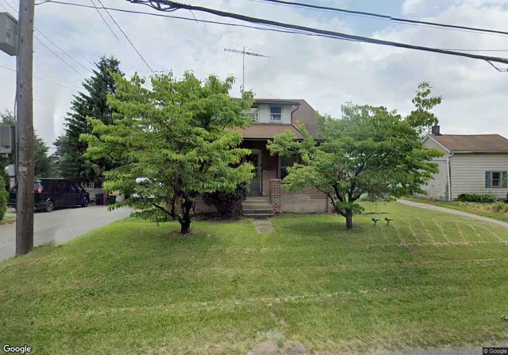
1541 Brookside Rd Allentown, PA 18106
Estimated Value: $270,849 - $336,000
3
Beds
1
Bath
1,260
Sq Ft
$246/Sq Ft
Est. Value
About This Home
This home is located at 1541 Brookside Rd, Allentown, PA 18106 and is currently estimated at $310,212, approximately $246 per square foot. 1541 Brookside Rd is a home located in Lehigh County with nearby schools including Wescosville Elementary School, Lower Macungie Middle School, and Emmaus High School.
Ownership History
Date
Name
Owned For
Owner Type
Purchase Details
Closed on
Jul 14, 2008
Sold by
Weinsteiger Terry R
Bought by
Voros Anthony
Current Estimated Value
Home Financials for this Owner
Home Financials are based on the most recent Mortgage that was taken out on this home.
Original Mortgage
$166,500
Outstanding Balance
$105,153
Interest Rate
6.17%
Mortgage Type
New Conventional
Estimated Equity
$205,059
Purchase Details
Closed on
Feb 24, 1986
Bought by
Weinsteiger Terry R and Weinsteiger Jeanne M
Purchase Details
Closed on
Oct 12, 1984
Sold by
Sassaman Mary A
Bought by
Weinsteiger Terry R
Purchase Details
Closed on
Dec 11, 1936
Bought by
Sassaman Mary A
Create a Home Valuation Report for This Property
The Home Valuation Report is an in-depth analysis detailing your home's value as well as a comparison with similar homes in the area
Home Values in the Area
Average Home Value in this Area
Purchase History
| Date | Buyer | Sale Price | Title Company |
|---|---|---|---|
| Voros Anthony | $185,000 | -- | |
| Weinsteiger Terry R | -- | -- | |
| Weinsteiger Terry R | $50,000 | -- | |
| Sassaman Mary A | -- | -- |
Source: Public Records
Mortgage History
| Date | Status | Borrower | Loan Amount |
|---|---|---|---|
| Open | Voros Anthony | $166,500 |
Source: Public Records
Tax History
| Year | Tax Paid | Tax Assessment Tax Assessment Total Assessment is a certain percentage of the fair market value that is determined by local assessors to be the total taxable value of land and additions on the property. | Land | Improvement |
|---|---|---|---|---|
| 2026 | $3,333 | $126,400 | $43,800 | $82,600 |
| 2025 | $3,227 | $126,400 | $43,800 | $82,600 |
| 2024 | $3,122 | $126,400 | $43,800 | $82,600 |
| 2023 | $3,060 | $126,400 | $43,800 | $82,600 |
| 2022 | $2,987 | $126,400 | $82,600 | $43,800 |
| 2021 | $2,924 | $126,400 | $43,800 | $82,600 |
| 2020 | $2,896 | $126,400 | $43,800 | $82,600 |
| 2019 | $2,847 | $126,400 | $43,800 | $82,600 |
| 2018 | $2,809 | $126,400 | $43,800 | $82,600 |
| 2017 | $2,760 | $126,400 | $43,800 | $82,600 |
| 2016 | -- | $126,400 | $43,800 | $82,600 |
| 2015 | -- | $126,400 | $43,800 | $82,600 |
| 2014 | -- | $126,400 | $43,800 | $82,600 |
Source: Public Records
Map
Nearby Homes
- 4994 Meadow Ln
- 5041 Cypress St
- 1037 Village Round Unit L
- 5622 Wedge Ln
- 5714 Greens Dr
- 5640 Kart Dr
- 2173 Brookside Rd
- 5475 Hamilton Blvd Unit 7
- 5475 Hamilton Blvd Unit 23
- 5619 Stonecroft Ln
- 1081 Barnside Rd
- 1701 Minesite Rd
- 5398 Princeton Rd
- 4698 Berwyn Ln
- 2621 Saddle Ln Unit 21C
- 1989 Forest Ln
- 6066 Timberknoll Dr
- 2153 Isabel Ln
- 1177 Clearview Cir
- 1800 Minesite Rd
- 1555 Brookside Rd
- 1529 Brookside Rd
- 5161 E Texas Rd
- 1520 Brookside Rd
- 5158 Cornerstone Rd
- 5129 E Texas Rd
- 5141 E Texas Rd
- 5136 Cornerstone Rd
- 1565 Brookside Rd
- 1589 N Brookside Rd
- 1565 N Brookside Rd
- 1590 Brookside Rd
- 5146 Meadow Ln
- 5122 Cornerstone Rd
- 1468 Dove Terrace
- 5235 E Texas Rd
- 5140 Meadow Ln
- 5131 E Texas Rd
- 5131 Cornerstone Rd
- 5102 Cornerstone Rd
Your Personal Tour Guide
Ask me questions while you tour the home.