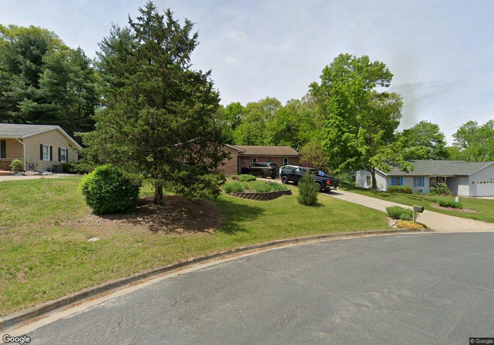
1541 Cedarbrook Dr Kalamazoo, MI 49048
Estimated Value: $285,000 - $334,000
4
Beds
3
Baths
2,642
Sq Ft
$117/Sq Ft
Est. Value
About This Home
This home is located at 1541 Cedarbrook Dr, Kalamazoo, MI 49048 and is currently estimated at $310,397, approximately $117 per square foot. 1541 Cedarbrook Dr is a home located in Kalamazoo County with nearby schools including Comstock Middle School and Comstock High School.
Ownership History
Date
Name
Owned For
Owner Type
Purchase Details
Closed on
Jul 10, 2025
Sold by
Ubl Kristin and Salem Kristin Jane
Bought by
Salem Kristin Jane and Salem John Joseph
Current Estimated Value
Purchase Details
Closed on
Nov 9, 2015
Sold by
Ubl Jacob M
Bought by
Ubl Kristin
Home Financials for this Owner
Home Financials are based on the most recent Mortgage that was taken out on this home.
Original Mortgage
$107,200
Interest Rate
3.78%
Mortgage Type
New Conventional
Purchase Details
Closed on
Nov 3, 2006
Sold by
Macpherson Todd W and Macpherson Denise R
Bought by
Ubl Jacob M and Ubl Kristin
Home Financials for this Owner
Home Financials are based on the most recent Mortgage that was taken out on this home.
Original Mortgage
$128,000
Interest Rate
6.38%
Mortgage Type
Purchase Money Mortgage
Create a Home Valuation Report for This Property
The Home Valuation Report is an in-depth analysis detailing your home's value as well as a comparison with similar homes in the area
Home Values in the Area
Average Home Value in this Area
Purchase History
| Date | Buyer | Sale Price | Title Company |
|---|---|---|---|
| Salem Kristin Jane | -- | None Listed On Document | |
| Ubl Kristin | -- | Midstate Title Agency Llc | |
| Ubl Jacob M | $160,000 | Metropolitan Title Company |
Source: Public Records
Mortgage History
| Date | Status | Borrower | Loan Amount |
|---|---|---|---|
| Previous Owner | Ubl Kristin | $107,200 | |
| Previous Owner | Ubl Jacob M | $128,000 |
Source: Public Records
Tax History
| Year | Tax Paid | Tax Assessment Tax Assessment Total Assessment is a certain percentage of the fair market value that is determined by local assessors to be the total taxable value of land and additions on the property. | Land | Improvement |
|---|---|---|---|---|
| 2025 | $2,012 | $118,300 | $0 | $0 |
| 2024 | $1,954 | $111,400 | $0 | $0 |
| 2023 | $1,863 | $97,400 | $0 | $0 |
| 2022 | $3,219 | $87,500 | $0 | $0 |
| 2021 | $3,131 | $84,300 | $0 | $0 |
| 2020 | $2,939 | $79,500 | $0 | $0 |
| 2019 | $2,718 | $75,600 | $0 | $0 |
| 2018 | $2,622 | $72,300 | $0 | $0 |
| 2017 | $0 | $68,000 | $0 | $0 |
| 2016 | -- | $65,400 | $0 | $0 |
| 2015 | -- | $68,200 | $7,200 | $61,000 |
| 2014 | -- | $68,200 | $0 | $0 |
Source: Public Records
Map
Nearby Homes
- 1187 Merry Brook St
- 5581 E Main St
- 428 Worden Ave
- 665 Shields St
- 2214 Hunters Pond
- 2612 Hunters Point
- 2626 Hunters Point
- 2680 Hunters Point
- 218 N 26th St
- 2648 Hunters Point
- 2669 Hunters Bluff Unit L23
- 2731 Hunters Point
- 0 Collette Ave
- 2869 Hunters Run
- 608 Pickard St
- 2891 Hunters Run
- 6168 E Michigan Ave
- 2924 Hunters Hill
- 2931 Hunters Hill
- 122 Brookview St
- 1569 Cedarbrook Dr
- 1513 Cedarbrook Dr
- 6313 Cedarbrook Dr
- 1505 Sprucebrook Dr
- 6309 Fawnbrook Cir
- 6329 Cedarbrook Dr
- 1451 Sprucebrook Dr
- 6345 Cedarbrook Dr
- 6300 Fawnbrook Cir
- 6100 E Main St
- 6213 E Main St
- 1506 Sprucebrook Dr
- 1506 Spruce Brook Rd
- 6361 Cedarbrook Dr
- 1478 Sprucebrook Dr
- 6310 Fawn Brook Cr
- 6310 Fawnbrook Cir
- 1450 Sprucebrook Dr
- 6320 Fawnbrook Cir
- 6377 Cedarbrook Dr
Your Personal Tour Guide
Ask me questions while you tour the home.