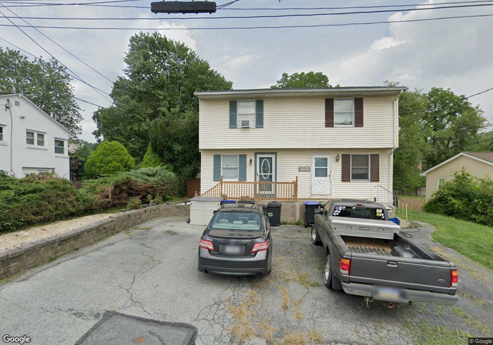
1541 Paxford Rd Allentown, PA 18103
Southside NeighborhoodEstimated Value: $242,000 - $306,000
2
Beds
2
Baths
1,056
Sq Ft
$258/Sq Ft
Est. Value
About This Home
This home is located at 1541 Paxford Rd, Allentown, PA 18103 and is currently estimated at $272,960, approximately $258 per square foot. 1541 Paxford Rd is a home located in Lehigh County with nearby schools including Salisbury Elementary School, Salisbury Middle School, and Salisbury Senior High School.
Ownership History
Date
Name
Owned For
Owner Type
Purchase Details
Closed on
Oct 25, 2007
Sold by
Knute Samuel
Bought by
Ortiz Richard J
Current Estimated Value
Home Financials for this Owner
Home Financials are based on the most recent Mortgage that was taken out on this home.
Original Mortgage
$145,960
Outstanding Balance
$92,778
Interest Rate
6.47%
Mortgage Type
FHA
Estimated Equity
$180,182
Purchase Details
Closed on
Jun 22, 2007
Sold by
Swaim Robah
Bought by
Knute Samuel
Home Financials for this Owner
Home Financials are based on the most recent Mortgage that was taken out on this home.
Original Mortgage
$111,920
Interest Rate
6.14%
Mortgage Type
New Conventional
Purchase Details
Closed on
Jul 20, 1983
Bought by
Swaim Robah and Swaim Gloria J
Create a Home Valuation Report for This Property
The Home Valuation Report is an in-depth analysis detailing your home's value as well as a comparison with similar homes in the area
Home Values in the Area
Average Home Value in this Area
Purchase History
| Date | Buyer | Sale Price | Title Company |
|---|---|---|---|
| Ortiz Richard J | $170,000 | -- | |
| Knute Samuel | $170,000 | -- | |
| Swaim Robah | $14,000 | -- |
Source: Public Records
Mortgage History
| Date | Status | Borrower | Loan Amount |
|---|---|---|---|
| Open | Ortiz Richard J | $145,960 | |
| Previous Owner | Knute Samuel | $111,920 |
Source: Public Records
Tax History Compared to Growth
Tax History
| Year | Tax Paid | Tax Assessment Tax Assessment Total Assessment is a certain percentage of the fair market value that is determined by local assessors to be the total taxable value of land and additions on the property. | Land | Improvement |
|---|---|---|---|---|
| 2025 | $3,345 | $106,200 | $17,000 | $89,200 |
| 2024 | $3,196 | $106,200 | $17,000 | $89,200 |
| 2023 | $3,031 | $106,200 | $17,000 | $89,200 |
| 2022 | $2,955 | $106,200 | $89,200 | $17,000 |
| 2021 | $2,837 | $106,200 | $17,000 | $89,200 |
| 2020 | $2,726 | $106,200 | $17,000 | $89,200 |
| 2019 | $2,627 | $106,200 | $17,000 | $89,200 |
| 2018 | $2,580 | $106,200 | $17,000 | $89,200 |
| 2017 | $2,514 | $106,200 | $17,000 | $89,200 |
| 2016 | -- | $106,200 | $17,000 | $89,200 |
| 2015 | -- | $106,200 | $17,000 | $89,200 |
| 2014 | -- | $106,200 | $17,000 | $89,200 |
Source: Public Records
Map
Nearby Homes
- 1340 Marlow St
- 1333 Maumee Ave
- 1113 E Emmaus Ave
- 1230 Salisbury Rd
- 1316 Maryland Ave
- 1342 van Vetchen Ave
- 1208 E Susquehanna St
- 1004 E Susquehanna St
- 727 E Federal St
- 1216 Fretz Ave
- 716 E Barner St
- 618 E Federal St
- 430 E Lynnwood St
- 1710 Illingsworth St
- 431 E Susquehanna St
- 1544 Church Rd
- 1618 Alex Ct
- 320 E Paoli St
- 1602 Hausman Ave
- 316 318 E Susquehanna St
- 1543 Paxford Rd
- 1535 Paxford Rd
- 1605 Paxford Rd
- 1523 Paxford Rd
- 1540 Paxford Rd
- 1530 Paxford Rd
- 1526 Paxford Rd
- 1606 Paxford Rd
- 1519 Paxford Rd
- 1619 Paxford Rd
- 1511 Paxford Rd
- 1514 Paxford Rd
- 1616 Paxford Rd
- 1545 Maumee Ave
- 1535 Maumee Ave
- 1605 Maumee Ave
- 1525 Maumee Ave
- 1705 Paxford Rd
- 1508 Paxford Rd
- 1503 Paxford Rd