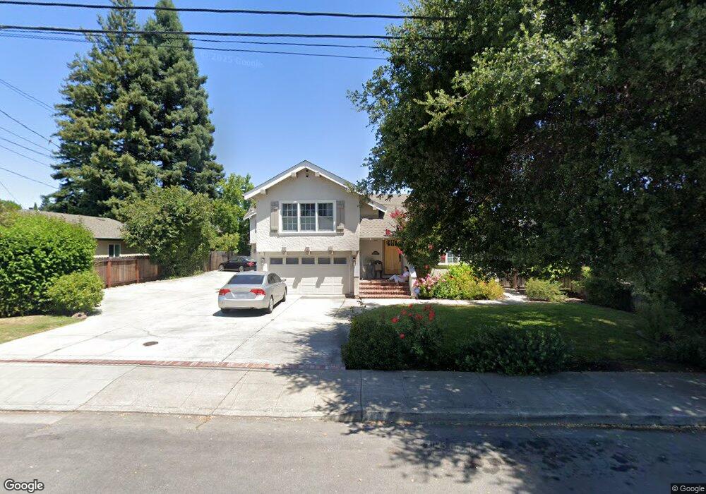
1541 Union Ave Redwood City, CA 94061
Palm Park NeighborhoodEstimated Value: $1,348,000 - $2,446,000
9
Beds
7
Baths
1,939
Sq Ft
$955/Sq Ft
Est. Value
About This Home
This home is located at 1541 Union Ave, Redwood City, CA 94061 and is currently estimated at $1,851,333, approximately $954 per square foot. 1541 Union Ave is a home located in San Mateo County with nearby schools including Henry Ford Elementary School, John F. Kennedy Middle School, and Woodside High School.
Ownership History
Date
Name
Owned For
Owner Type
Purchase Details
Closed on
Oct 7, 2005
Sold by
Mitchell Michael
Bought by
Roberts Mitchell Michael and Roberts Mitchell Diana
Current Estimated Value
Purchase Details
Closed on
Dec 19, 2002
Sold by
Mitchell David and Mitchell Mary
Bought by
Mitchell Michael
Home Financials for this Owner
Home Financials are based on the most recent Mortgage that was taken out on this home.
Original Mortgage
$650,000
Interest Rate
4.76%
Mortgage Type
Negative Amortization
Create a Home Valuation Report for This Property
The Home Valuation Report is an in-depth analysis detailing your home's value as well as a comparison with similar homes in the area
Home Values in the Area
Average Home Value in this Area
Purchase History
| Date | Buyer | Sale Price | Title Company |
|---|---|---|---|
| Roberts Mitchell Michael | -- | North American Title Co | |
| Mitchell Michael | -- | North American Title Co |
Source: Public Records
Mortgage History
| Date | Status | Borrower | Loan Amount |
|---|---|---|---|
| Closed | Mitchell Michael | $650,000 |
Source: Public Records
Tax History Compared to Growth
Tax History
| Year | Tax Paid | Tax Assessment Tax Assessment Total Assessment is a certain percentage of the fair market value that is determined by local assessors to be the total taxable value of land and additions on the property. | Land | Improvement |
|---|---|---|---|---|
| 2025 | $9,420 | $858,075 | $206,765 | $651,310 |
| 2023 | $9,420 | $824,757 | $198,737 | $626,020 |
| 2022 | $8,845 | $808,587 | $194,841 | $613,746 |
| 2021 | $8,760 | $792,733 | $191,021 | $601,712 |
| 2020 | $8,643 | $784,606 | $189,063 | $595,543 |
| 2019 | $8,611 | $769,222 | $185,356 | $583,866 |
| 2018 | $8,388 | $754,140 | $181,722 | $572,418 |
| 2017 | $8,298 | $739,354 | $178,159 | $561,195 |
| 2016 | $8,155 | $724,858 | $174,666 | $550,192 |
| 2015 | $7,852 | $713,971 | $172,043 | $541,928 |
| 2014 | $7,702 | $699,986 | $168,673 | $531,313 |
Source: Public Records
Map
Nearby Homes
- 1506 Kentfield Ave
- 1567 Hawes Ct
- 1625 Kentfield Ave
- 8 Kentfield Ct
- 1430 Gordon St Unit C
- 947 Woodside Rd
- 951 Woodside Rd
- 1 Doris Ct
- 1522 Hudson St
- 1227 Chantal Way
- 1458 Hudson St Unit 202
- 1458 Hudson St Unit 208
- 1458 Hudson St Unit 305
- 1458 Hudson St Unit 111
- 1029 Redwood Ave
- 1465 Bonnie Ct
- 1334 Norman St
- 1105 Oak Ave
- 175 Orchard Ave
- 55 Orchard Ave