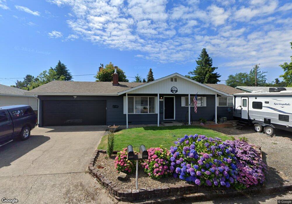
1541 W Quinalt St Springfield, OR 97477
West Springfield NeighborhoodEstimated Value: $366,321 - $400,000
3
Beds
2
Baths
1,000
Sq Ft
$380/Sq Ft
Est. Value
About This Home
This home is located at 1541 W Quinalt St, Springfield, OR 97477 and is currently estimated at $380,080, approximately $380 per square foot. 1541 W Quinalt St is a home located in Lane County with nearby schools including Centennial Elementary School, Hamlin Middle School, and Springfield High School.
Ownership History
Date
Name
Owned For
Owner Type
Purchase Details
Closed on
Feb 24, 2022
Sold by
Edward Martin Lawrence
Bought by
Martin Family Trust
Current Estimated Value
Purchase Details
Closed on
Feb 20, 2002
Sold by
Hiestand Glenn R
Bought by
Martin Lawrence Edward and Martin Cindy Mae
Home Financials for this Owner
Home Financials are based on the most recent Mortgage that was taken out on this home.
Original Mortgage
$90,400
Interest Rate
7.04%
Create a Home Valuation Report for This Property
The Home Valuation Report is an in-depth analysis detailing your home's value as well as a comparison with similar homes in the area
Home Values in the Area
Average Home Value in this Area
Purchase History
| Date | Buyer | Sale Price | Title Company |
|---|---|---|---|
| Martin Family Trust | -- | None Listed On Document | |
| Martin Lawrence Edward | $113,000 | Evergreen Land Title Co |
Source: Public Records
Mortgage History
| Date | Status | Borrower | Loan Amount |
|---|---|---|---|
| Previous Owner | Martin Lawrence Edward | $90,400 |
Source: Public Records
Tax History Compared to Growth
Tax History
| Year | Tax Paid | Tax Assessment Tax Assessment Total Assessment is a certain percentage of the fair market value that is determined by local assessors to be the total taxable value of land and additions on the property. | Land | Improvement |
|---|---|---|---|---|
| 2025 | $2,050 | $171,482 | -- | -- |
| 2024 | $1,994 | $166,488 | -- | -- |
| 2023 | $1,994 | $161,639 | $0 | $0 |
| 2022 | $1,895 | $156,932 | $0 | $0 |
| 2021 | $1,855 | $152,362 | $0 | $0 |
| 2020 | $1,801 | $147,925 | $0 | $0 |
| 2019 | $1,738 | $143,617 | $0 | $0 |
| 2018 | $1,672 | $135,373 | $0 | $0 |
| 2017 | $1,622 | $135,373 | $0 | $0 |
| 2016 | $1,585 | $131,430 | $0 | $0 |
| 2015 | $1,547 | $127,602 | $0 | $0 |
| 2014 | $1,481 | $123,885 | $0 | $0 |
Source: Public Records
Map
Nearby Homes
- 1310 W Quinalt St
- 1120 W Fairview Dr Unit 3
- 1130 Anderson Ln
- 1770 Brandy Way
- 872 W N St
- 1632 Dotie Dr
- 804 W N St
- 1723 Dotie Dr
- 955 Oak Meadows Place
- 1267 Kenray Loop
- 511 Panda Loop
- 835 Anderson Ln
- 3460 Oxbow Way
- 3515 Regent Ave
- 484 Scotts Glen Dr
- 511 Honeysuckle Ln
- 436 W M St
- 633 Rowan Ave
- 428 W Centennial Blvd
- 930 Prescott Ln
- 1519 W Quinalt St
- 1567 W Quinalt St
- 1508 W Fairview Dr
- 1500 W Fairview Dr
- 1524 W Fairview Dr
- 1515 W Quinalt St
- 1540 W Quinalt St
- 1520 W Quinalt St
- 1566 W Quinalt St
- 1583 W Quinalt St
- 1560 W Fairview Dr
- 1516 W Quinalt St
- 1580 W Quinalt St
- 1475 W Quinalt St
- 1466 W Fairview Dr
- 1470 W Quinalt St
- 1501 W Fairview Dr
- 1509 W Fairview Dr
- 1588 W Quinalt St
- 1481 W Fairview Dr