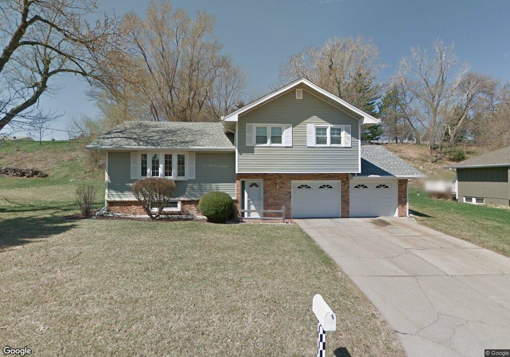
15426 Nall Rd Council Bluffs, IA 51503
Eastern Council Bluffs NeighborhoodEstimated Value: $314,611 - $348,000
4
Beds
2
Baths
1,116
Sq Ft
$299/Sq Ft
Est. Value
About This Home
This home is located at 15426 Nall Rd, Council Bluffs, IA 51503 and is currently estimated at $333,153, approximately $298 per square foot. 15426 Nall Rd is a home located in Pottawattamie County with nearby schools including E.A. Kreft Primary School, Titan Hill Intermediate School, and Lewis Central Middle School.
Ownership History
Date
Name
Owned For
Owner Type
Purchase Details
Closed on
Dec 10, 2021
Sold by
Delfs Darryl W
Bought by
Delfs Darryl W and Revocable Trust Agmt Of Darryl
Current Estimated Value
Purchase Details
Closed on
Feb 11, 2021
Sold by
Delfs Jean M
Bought by
Delfs Darryl W
Purchase Details
Closed on
Dec 21, 2017
Sold by
Delfs Jean M
Bought by
Delfs Darryl W
Purchase Details
Closed on
Dec 19, 2017
Sold by
Delfs Darryl W and Delfs Jean M
Bought by
Delfs Darryl W and Delfs Jean M
Create a Home Valuation Report for This Property
The Home Valuation Report is an in-depth analysis detailing your home's value as well as a comparison with similar homes in the area
Home Values in the Area
Average Home Value in this Area
Purchase History
| Date | Buyer | Sale Price | Title Company |
|---|---|---|---|
| Delfs Darryl W | -- | None Available | |
| Delfs Darryl W | -- | None Available | |
| Delfs Darryl W | -- | Clear Title & Abstract | |
| Delfs Darryl W | -- | None Available |
Source: Public Records
Tax History Compared to Growth
Tax History
| Year | Tax Paid | Tax Assessment Tax Assessment Total Assessment is a certain percentage of the fair market value that is determined by local assessors to be the total taxable value of land and additions on the property. | Land | Improvement |
|---|---|---|---|---|
| 2025 | $2,614 | $264,900 | $48,900 | $216,000 |
| 2024 | $2,614 | $241,000 | $42,500 | $198,500 |
| 2023 | $2,498 | $241,000 | $42,500 | $198,500 |
| 2022 | $2,458 | $202,400 | $39,600 | $162,800 |
| 2021 | $3,778 | $202,400 | $39,600 | $162,800 |
| 2020 | $2,386 | $202,400 | $39,600 | $162,800 |
| 2019 | $2,492 | $176,300 | $34,800 | $141,500 |
| 2018 | $2,434 | $176,300 | $34,800 | $141,500 |
| 2017 | $2,186 | $155,114 | $37,793 | $117,321 |
| 2015 | $2,164 | $155,114 | $37,793 | $117,321 |
| 2014 | $2,180 | $155,114 | $37,793 | $117,321 |
Source: Public Records
Map
Nearby Homes
- 20425 Greenview Rd
- 15365 Crestview Dr
- 218 Brent Ln
- 110 Wilshire Ave
- 411 Redwood Dr
- 20.57 AC. M L State Orchard Rd
- 1800 Sycamore St
- 1843 Sycamore St
- 3 Lilac Cir
- 31 Balsam Cir
- 1896 Balsam St
- 1780 Blackthorn St
- 23 Balsam Cir
- 1897 Hemlock St
- 1896 Hemlock St
- 19 Balsam Cir
- 3 Bayberry Cir
- 1885 Hemlock St
- 4 Balsam Cir
- 10 Balsam Cir
- 15446 Nall Rd
- 15398 Nall Rd
- 15427 Hilltop Rd
- 15409 Hilltop Rd
- 15464 Nall Rd
- 15425 Nall Rd
- 15447 Nall Rd
- 15389 Hilltop Rd
- 15465 Hilltop Rd
- 15465 Nall Rd
- 15393 Nall Rd
- 15478 Nall Rd
- 15475 Hilltop Rd
- 15361 Hilltop Rd
- 15426 Hilltop Rd
- 15485 Nall Rd
- 15408 Hilltop Rd
- 15448 Hilltop Rd
- 104 Golden Circle Dr
- 15500 Nall Rd