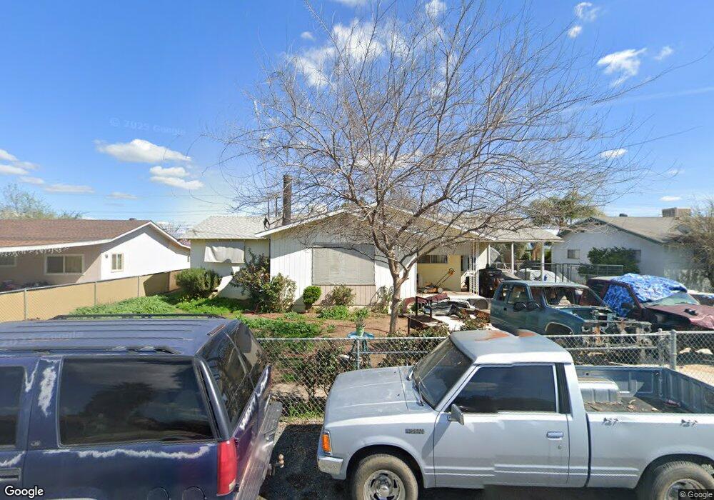
15434 Cedar Rd Porterville, CA 93257
Porterville Northwest NeighborhoodEstimated Value: $273,000 - $302,000
3
Beds
1
Bath
1,100
Sq Ft
$258/Sq Ft
Est. Value
About This Home
This home is located at 15434 Cedar Rd, Porterville, CA 93257 and is currently estimated at $283,989, approximately $258 per square foot. 15434 Cedar Rd is a home located in Tulare County with nearby schools including Rockford Elementary School, Monache High School, and Strathmore High School.
Ownership History
Date
Name
Owned For
Owner Type
Purchase Details
Closed on
Mar 14, 2007
Sold by
Platas Refugio
Bought by
Mayorquin Rogelio and Platas Micaela
Current Estimated Value
Home Financials for this Owner
Home Financials are based on the most recent Mortgage that was taken out on this home.
Original Mortgage
$95,000
Outstanding Balance
$60,400
Interest Rate
7.2%
Mortgage Type
Stand Alone First
Estimated Equity
$223,589
Purchase Details
Closed on
Jul 16, 2001
Sold by
Lewis Ronald Michael
Bought by
Platas Refugio and Ojeda Teresa
Home Financials for this Owner
Home Financials are based on the most recent Mortgage that was taken out on this home.
Original Mortgage
$76,813
Interest Rate
6.91%
Mortgage Type
FHA
Purchase Details
Closed on
Nov 4, 1994
Sold by
Lewis Augustina Luciana
Bought by
Lewis Ronald Michael and Lewis Augustina Luciana
Home Financials for this Owner
Home Financials are based on the most recent Mortgage that was taken out on this home.
Original Mortgage
$10,000
Interest Rate
8.92%
Create a Home Valuation Report for This Property
The Home Valuation Report is an in-depth analysis detailing your home's value as well as a comparison with similar homes in the area
Home Values in the Area
Average Home Value in this Area
Purchase History
| Date | Buyer | Sale Price | Title Company |
|---|---|---|---|
| Mayorquin Rogelio | $120,000 | Financial Title Company | |
| Platas Refugio | $77,500 | Fidelity National Title Co | |
| Lewis Ronald Michael | -- | -- |
Source: Public Records
Mortgage History
| Date | Status | Borrower | Loan Amount |
|---|---|---|---|
| Open | Mayorquin Rogelio | $95,000 | |
| Previous Owner | Platas Refugio | $76,813 | |
| Previous Owner | Lewis Ronald Michael | $10,000 |
Source: Public Records
Tax History Compared to Growth
Tax History
| Year | Tax Paid | Tax Assessment Tax Assessment Total Assessment is a certain percentage of the fair market value that is determined by local assessors to be the total taxable value of land and additions on the property. | Land | Improvement |
|---|---|---|---|---|
| 2025 | $2,381 | $235,015 | $80,575 | $154,440 |
| 2024 | $2,381 | $230,408 | $78,996 | $151,412 |
| 2023 | $1,950 | $185,000 | $46,000 | $139,000 |
| 2022 | $1,887 | $183,000 | $46,000 | $137,000 |
| 2021 | $1,651 | $159,000 | $40,000 | $119,000 |
| 2020 | $1,478 | $143,000 | $36,000 | $107,000 |
| 2019 | $1,601 | $155,000 | $39,000 | $116,000 |
| 2018 | $1,199 | $116,000 | $29,000 | $87,000 |
| 2017 | $1,243 | $120,000 | $30,000 | $90,000 |
| 2016 | $861 | $85,000 | $21,000 | $64,000 |
| 2015 | $882 | $87,000 | $22,000 | $65,000 |
| 2014 | $879 | $87,000 | $22,000 | $65,000 |
Source: Public Records
Map
Nearby Homes
- 15247 Road 223
- 249 S Westwood St
- 575 N Brandy Way
- 2540 W Porter Creek Ave
- 2320 W Kanai Ave
- 2300 W Morton Ave Unit 163
- 2300 W Morton Ave Unit 22
- 2300 W Morton Ave Unit 135
- 2179 W Della Ave
- 100 S Westwood St Unit 1
- 100 S Westwood St Unit 17
- 100 S Westwood St
- 100 S Westwood St Unit Lot 105
- 100 S Westwood St Unit 110
- 100 S Westwood St Unit Lot 71
- 100 S Westwood St Unit 92
- Sydney Plan at Laurelwood
- Carlton Plan at Laurelwood
- Carmel Plan at Laurelwood
- Aspen with Loft Plan at Laurelwood
- 15442 Cedar Rd
- 15422 Cedar Rd
- 15450 Cedar Rd
- 15410 Cedar Rd
- 15431 Cedar Rd
- 15464 Cedar Rd
- 15443 Cedar Rd
- 15421 Cedar Rd
- 15451 Cedar Rd
- 15413 Cedar Rd
- 15390 E Cedar
- 15390 Cedar Rd
- 15478 Cedar Rd
- 15465 Cedar Rd
- 15391 Cedar Rd
- 15380 Cedar Rd
- 15434 Magnolia Rd
- 15477 Cedar Rd
- 15422 Magnolia Rd
- 15446 Magnolia Rd