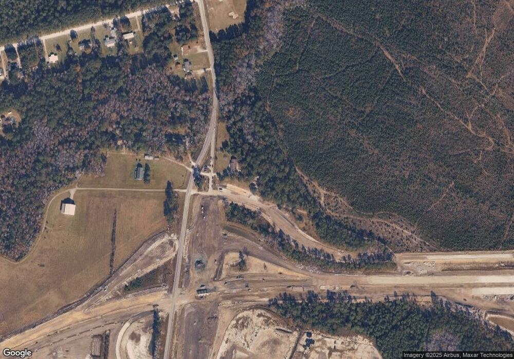
1544 Hoover Rd Hampstead, NC 28443
Estimated Value: $382,000 - $523,000
4
Beds
2
Baths
1,036
Sq Ft
$449/Sq Ft
Est. Value
About This Home
This home is located at 1544 Hoover Rd, Hampstead, NC 28443 and is currently estimated at $465,367, approximately $449 per square foot. 1544 Hoover Rd is a home located in Pender County with nearby schools including South Topsail Elementary School, Topsail Middle School, and Topsail High School.
Ownership History
Date
Name
Owned For
Owner Type
Purchase Details
Closed on
Mar 18, 2021
Sold by
Brown Elaine Spiller
Bought by
Department Of Transportation
Current Estimated Value
Purchase Details
Closed on
Mar 3, 2021
Sold by
Brown Thomas Michael
Bought by
Brown Elaine Spiller
Purchase Details
Closed on
Jul 17, 2017
Sold by
Brown Elaine Spiller and Brown Thomas Michael
Bought by
Brown Elaine Spiller and Brown Thomas Michael
Create a Home Valuation Report for This Property
The Home Valuation Report is an in-depth analysis detailing your home's value as well as a comparison with similar homes in the area
Home Values in the Area
Average Home Value in this Area
Purchase History
| Date | Buyer | Sale Price | Title Company |
|---|---|---|---|
| Department Of Transportation | $425,000 | None Available | |
| Brown Elaine Spiller | -- | None Available | |
| Brown Elaine Spiller | -- | Chicago Title Insurance Comp |
Source: Public Records
Tax History Compared to Growth
Tax History
| Year | Tax Paid | Tax Assessment Tax Assessment Total Assessment is a certain percentage of the fair market value that is determined by local assessors to be the total taxable value of land and additions on the property. | Land | Improvement |
|---|---|---|---|---|
| 2024 | $777 | $62,328 | $39,178 | $23,150 |
| 2023 | $777 | $62,328 | $39,178 | $23,150 |
| 2022 | $519 | $62,328 | $39,178 | $23,150 |
| 2021 | $1,567 | $161,834 | $45,057 | $116,777 |
| 2020 | $1,528 | $157,171 | $45,057 | $112,114 |
| 2019 | $1,528 | $157,171 | $45,057 | $112,114 |
| 2018 | $1,154 | $107,054 | $28,526 | $78,528 |
| 2017 | $1,154 | $107,054 | $28,526 | $78,528 |
| 2016 | $1,006 | $103,863 | $25,335 | $78,528 |
| 2015 | $18 | $103,863 | $25,335 | $78,528 |
| 2014 | $803 | $107,054 | $28,526 | $78,528 |
| 2013 | -- | $136,726 | $58,198 | $78,528 |
Source: Public Records
Map
Nearby Homes
- 28 W Farley Dr Unit 98
- 24 W Farley Dr Unit 99
- 18 E Pioneer Way Unit 74
- 17 E Farley Dr Unit 70
- 25 E Farley Dr Unit 69
- 155 Cobbler Way Unit 48
- 131 Cobbler Way Unit 45
- 115 Cobbler Way Unit 43
- 107 Cobbler Way Unit 42
- 99 Cobbler Way Unit 41
- 91 Cobbler Way Unit 40
- 92 Cobbler Way Unit 55
- 83 Cobbler Way Unit 39
- 68 Cobbler Way Unit 52
- 115 Castle Bay Dr
- 137 Castle Bay Dr
- 50 Cobbler Way Unit 50
- Rosebay Plan at Brookfield Branch
- Fern Plan at Brookfield Branch
- Honeybird Plan at Brookfield Branch
- 1564 Hoover Rd
- 1464 Hoover Rd
- 1585 Hoover Rd
- 1533 Hoover Rd
- 1719 Hoover Rd
- 1743 Hoover Rd
- 3 Godfrey Creek Rd
- 117 Godfrey Creek Rd
- 323 Godfrey Creek Rd
- 24 W Farley Dr Unit 98
- 1251 Hoover Rd
- 301 Godfrey Creek Rd
- 301 Godfrey Creek Rd
- 1194 Hoover Rd
- 1161 Hoover Rd
- 38 Castle Bay Dr
- 98 Castle Bay Dr
- 54 Castle Bay Dr
- 98 Castle Bay Dr
- 82 Castle Bay Dr
