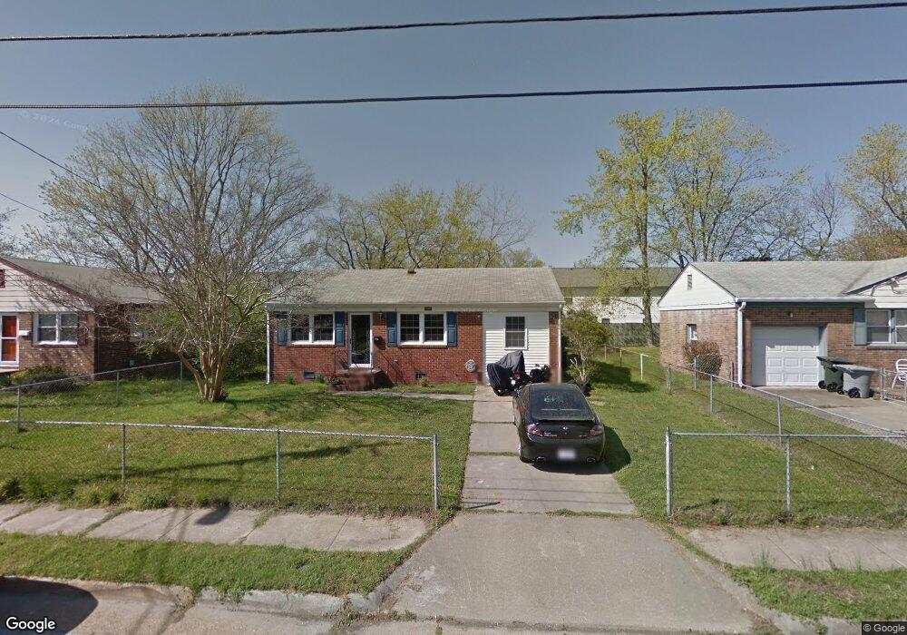
1545 Grove St Hampton, VA 23664
Buckroe Beach NeighborhoodEstimated Value: $237,000 - $259,000
3
Beds
2
Baths
1,471
Sq Ft
$169/Sq Ft
Est. Value
About This Home
This home is located at 1545 Grove St, Hampton, VA 23664 and is currently estimated at $248,766, approximately $169 per square foot. 1545 Grove St is a home located in Hampton City with nearby schools including Jane H. Bryan Elementary School, Benjamin Syms Middle School, and Phoebus High School.
Ownership History
Date
Name
Owned For
Owner Type
Purchase Details
Closed on
Jun 19, 2009
Sold by
Sayed Joseph Abdel
Bought by
Paulette James K
Current Estimated Value
Home Financials for this Owner
Home Financials are based on the most recent Mortgage that was taken out on this home.
Original Mortgage
$170,749
Outstanding Balance
$108,694
Interest Rate
4.91%
Mortgage Type
FHA
Estimated Equity
$140,072
Purchase Details
Closed on
Dec 8, 2008
Sold by
Morris February
Bought by
Abdel Sayed Joseph
Create a Home Valuation Report for This Property
The Home Valuation Report is an in-depth analysis detailing your home's value as well as a comparison with similar homes in the area
Home Values in the Area
Average Home Value in this Area
Purchase History
| Date | Buyer | Sale Price | Title Company |
|---|---|---|---|
| Paulette James K | $173,900 | -- | |
| Abdel Sayed Joseph | $80,000 | -- |
Source: Public Records
Mortgage History
| Date | Status | Borrower | Loan Amount |
|---|---|---|---|
| Open | Paulette James K | $170,749 |
Source: Public Records
Tax History
| Year | Tax Paid | Tax Assessment Tax Assessment Total Assessment is a certain percentage of the fair market value that is determined by local assessors to be the total taxable value of land and additions on the property. | Land | Improvement |
|---|---|---|---|---|
| 2025 | $2,567 | $218,200 | $60,000 | $158,200 |
| 2024 | $2,351 | $204,400 | $60,000 | $144,400 |
| 2023 | $2,173 | $187,300 | $55,000 | $132,300 |
| 2022 | $2,069 | $175,300 | $45,000 | $130,300 |
| 2021 | $2,012 | $151,800 | $40,000 | $111,800 |
| 2020 | $1,794 | $144,700 | $36,400 | $108,300 |
| 2019 | $1,794 | $144,700 | $36,400 | $108,300 |
| 2018 | $1,862 | $140,500 | $36,400 | $104,100 |
| 2017 | $1,836 | $0 | $0 | $0 |
| 2016 | $1,836 | $140,500 | $0 | $0 |
| 2015 | $1,836 | $0 | $0 | $0 |
| 2014 | $1,908 | $147,100 | $36,400 | $110,700 |
Source: Public Records
Map
Nearby Homes
- 1527 Grove St
- 2112 E Pembroke Ave
- 714 Grove St
- 733 Burgess Ave
- 532 Slater Ave
- 731 Burgess Ave
- 5B Mallory
- 9 Bayview Ct
- 1642 N Mallory St
- 2013 Whitman Place
- 604 Old Buckroe Rd
- 1622 Old Buckroe Rd
- 17 Seaview Dr
- 155 Atlantic Ave
- 155 Atlantic Ave Unit C2
- 1640 Old Buckroe Rd
- 1642 Old Buckroe Rd
- 1915 Long Green Ln
- 1909 Long Green Ln
- 2013 N Mallory St
- 1543 Grove St
- 1547 Grove St
- 1549 Grove St
- 1541 Grove St
- 2018 E Pembroke Ave Unit G
- 39 Reynolds Dr
- 40 Reynolds Dr
- 1539 Grove St
- 1542 Grove St
- 730 Grove St
- 1540 Grove St
- 38 Reynolds Dr
- 2100 E Pembroke Ave
- 1537 Grove St
- 731 Grove St
- 1538 Grove St
- 2102 E Pembroke Ave
- 36 Reynolds Dr
- 1543 Slater Ave
- 728 Grove St
Your Personal Tour Guide
Ask me questions while you tour the home.