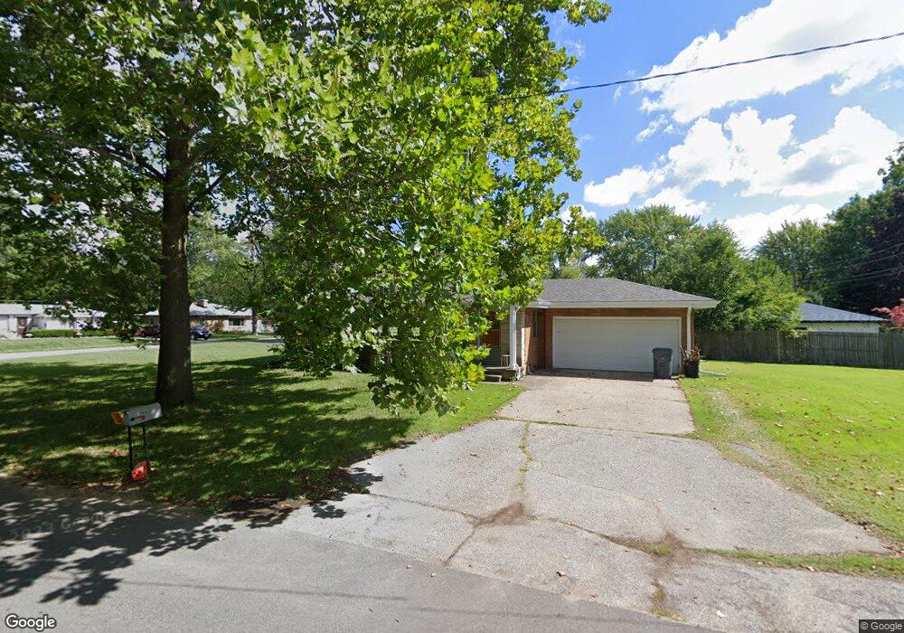
1545 Shawnee Rd Benton Harbor, MI 49022
Fair Plain NeighborhoodEstimated Value: $166,068 - $191,000
2
Beds
1
Bath
1,000
Sq Ft
$180/Sq Ft
Est. Value
About This Home
This home is located at 1545 Shawnee Rd, Benton Harbor, MI 49022 and is currently estimated at $180,267, approximately $180 per square foot. 1545 Shawnee Rd is a home located in Berrien County with nearby schools including Fair Plain Middle School, Benton Harbor High School, and Benton Harbor Charter School Academy.
Ownership History
Date
Name
Owned For
Owner Type
Purchase Details
Closed on
Mar 8, 2017
Sold by
Hoffmann Lara H and Hoffmann Simon P
Bought by
Greenwood Center Llc
Current Estimated Value
Purchase Details
Closed on
Jul 30, 1993
Purchase Details
Closed on
Nov 8, 1988
Purchase Details
Closed on
Apr 4, 1986
Purchase Details
Closed on
Mar 25, 1981
Create a Home Valuation Report for This Property
The Home Valuation Report is an in-depth analysis detailing your home's value as well as a comparison with similar homes in the area
Home Values in the Area
Average Home Value in this Area
Purchase History
| Date | Buyer | Sale Price | Title Company |
|---|---|---|---|
| Greenwood Center Llc | -- | None Available | |
| -- | -- | -- | |
| -- | $42,000 | -- | |
| -- | $36,000 | -- | |
| -- | $34,000 | -- |
Source: Public Records
Tax History
| Year | Tax Paid | Tax Assessment Tax Assessment Total Assessment is a certain percentage of the fair market value that is determined by local assessors to be the total taxable value of land and additions on the property. | Land | Improvement |
|---|---|---|---|---|
| 2025 | $2,095 | $67,800 | $0 | $0 |
| 2024 | $1,566 | $54,200 | $0 | $0 |
| 2023 | $1,492 | $46,300 | $0 | $0 |
| 2022 | $1,421 | $44,300 | $0 | $0 |
| 2021 | $1,832 | $48,300 | $20,100 | $28,200 |
| 2020 | $1,746 | $47,700 | $0 | $0 |
| 2019 | $1,685 | $38,800 | $4,000 | $34,800 |
| 2018 | $1,611 | $38,800 | $0 | $0 |
| 2017 | $1,584 | $38,600 | $0 | $0 |
| 2016 | $1,553 | $38,900 | $0 | $0 |
| 2015 | $1,549 | $36,500 | $0 | $0 |
| 2014 | $1,222 | $39,800 | $0 | $0 |
Source: Public Records
Map
Nearby Homes
- 298 Bradford Rd
- 379 Western Ave
- 1295 Pontiac Rd
- 1772 Lombard St
- 1298 Colfax Ave
- 180 Emery Ave
- V/L Mcalister
- 1968 Colfax Ave
- 161 Eloise Dr
- 266 Parker Ave
- 389 Parker Ave
- 1238 Broadway
- 377 Parker Ave
- 1216 Broadway
- 478 Gary Ave
- 2511 Riverwood Terrace
- 1593 Columbus Ave
- 1000 Riverview Dr Unit 11
- 167 E Delaware Ave
- 177 Hastings Ave
- 366 Bradford Rd
- 1555 Shawnee Rd
- 1540 Shawnee Rd
- 362 Bradford Rd
- 400 Bradford Rd
- 1573 Shawnee Rd
- 350 Bradford Rd
- 373 Bradford Rd
- 1554 Shawnee Rd
- 389 Bradford Rd
- 1556 Hadley Rd
- 1556 Hadley Rd
- 361 Bradford Rd
- 414 Bradford Rd
- 338 Bradford Rd
- 1574 Shawnee Rd
- 347 Bradford Rd
- 401 Bradford Rd
- 349 Chippewa Rd
- 335 Chippewa Rd
Your Personal Tour Guide
Ask me questions while you tour the home.