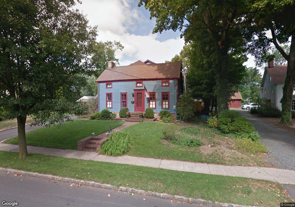
1545 Springfield Ave New Providence, NJ 07974
Estimated Value: $1,006,306 - $1,199,000
--
Bed
--
Bath
3,639
Sq Ft
$301/Sq Ft
Est. Value
About This Home
This home is located at 1545 Springfield Ave, New Providence, NJ 07974 and is currently estimated at $1,095,077, approximately $300 per square foot. 1545 Springfield Ave is a home located in Union County with nearby schools including New Providence High School and The Academy of Our Lady of Peace.
Ownership History
Date
Name
Owned For
Owner Type
Purchase Details
Closed on
Jun 27, 2002
Sold by
Dorman Michael
Bought by
Genualdi Richard P and Genualdi Christine M
Current Estimated Value
Home Financials for this Owner
Home Financials are based on the most recent Mortgage that was taken out on this home.
Original Mortgage
$300,000
Outstanding Balance
$203,795
Interest Rate
5.56%
Mortgage Type
Stand Alone First
Estimated Equity
$891,282
Create a Home Valuation Report for This Property
The Home Valuation Report is an in-depth analysis detailing your home's value as well as a comparison with similar homes in the area
Home Values in the Area
Average Home Value in this Area
Purchase History
| Date | Buyer | Sale Price | Title Company |
|---|---|---|---|
| Genualdi Richard P | $359,000 | Chicago Title Insurance Co |
Source: Public Records
Mortgage History
| Date | Status | Borrower | Loan Amount |
|---|---|---|---|
| Open | Genualdi Richard P | $300,000 |
Source: Public Records
Tax History Compared to Growth
Tax History
| Year | Tax Paid | Tax Assessment Tax Assessment Total Assessment is a certain percentage of the fair market value that is determined by local assessors to be the total taxable value of land and additions on the property. | Land | Improvement |
|---|---|---|---|---|
| 2025 | $16,740 | $324,300 | $133,200 | $191,100 |
| 2024 | $16,238 | $324,300 | $133,200 | $191,100 |
| 2023 | $16,238 | $324,300 | $133,200 | $191,100 |
| 2022 | $16,014 | $324,300 | $133,200 | $191,100 |
| 2021 | $15,897 | $324,300 | $133,200 | $191,100 |
| 2020 | $15,891 | $324,300 | $133,200 | $191,100 |
| 2019 | $15,793 | $324,300 | $133,200 | $191,100 |
| 2018 | $15,712 | $324,300 | $133,200 | $191,100 |
| 2017 | $15,456 | $324,300 | $133,200 | $191,100 |
| 2016 | $15,239 | $324,300 | $133,200 | $191,100 |
| 2015 | $15,028 | $324,300 | $133,200 | $191,100 |
| 2014 | $14,801 | $324,300 | $133,200 | $191,100 |
Source: Public Records
Map
Nearby Homes
- 16 Terrace Rd
- 36 Terrace Rd
- 19 Slope Dr
- 14 Holmes Oval
- 567 River Rd
- 11 Earl Place
- 132 Fairview Ave
- 20 High St
- 19 Guenevere Way Ondo
- 32 Charnwood Rd
- 41 Meadowview Ln
- 16 Riverbend Ct
- 32 Marion Ave
- 282 South St
- 1200 Springfield Ave Unit 1B
- 29 Walton Ave
- 131 van Houton Ave
- 30 Robbins Ave
- 38 Meyersville Rd
- 34 Grant Ave
- 1555 Springfield Ave
- 1539 Springfield Ave
- 1561 Springfield Ave
- 20 Oxbow Dr
- 14 Oxbow Dr
- 295 Runnymede Pkwy
- 305 Runnymede Pkwy
- 28 Oxbow Dr
- 1542 Springfield Ave
- 1558 Springfield Ave
- 1567 Springfield Ave
- 281 Runnymede Pkwy
- 1552 Springfield Ave
- 1536 Springfield Ave
- 1562 Springfield Ave
- 1532 Springfield Ave
- 137 Evergreen Ave
- 1573 Springfield Ave
- 1570 Springfield Ave
- 131 Evergreen Ave