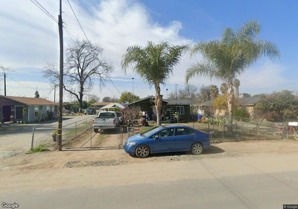
15459 Road 223 Porterville, CA 93257
Porterville Northwest NeighborhoodEstimated Value: $194,259 - $219,000
2
Beds
1
Bath
620
Sq Ft
$336/Sq Ft
Est. Value
About This Home
This home is located at 15459 Road 223, Porterville, CA 93257 and is currently estimated at $208,065, approximately $335 per square foot. 15459 Road 223 is a home located in Tulare County with nearby schools including William R. Buckley Elementary School, Burton Middle School, and Monache High School.
Ownership History
Date
Name
Owned For
Owner Type
Purchase Details
Closed on
Feb 6, 2012
Sold by
Curts Richard Glenn
Bought by
Tapia Alejandro and Tapia Maribel M
Current Estimated Value
Home Financials for this Owner
Home Financials are based on the most recent Mortgage that was taken out on this home.
Original Mortgage
$53,000
Outstanding Balance
$36,223
Interest Rate
3.84%
Mortgage Type
Seller Take Back
Estimated Equity
$171,842
Purchase Details
Closed on
Aug 18, 2011
Sold by
Dennis John A
Bought by
Curts Richard Glenn and Curts Leeanne E
Purchase Details
Closed on
Mar 12, 1997
Sold by
Reynaga Maribel
Bought by
Dennis John A
Create a Home Valuation Report for This Property
The Home Valuation Report is an in-depth analysis detailing your home's value as well as a comparison with similar homes in the area
Home Values in the Area
Average Home Value in this Area
Purchase History
| Date | Buyer | Sale Price | Title Company |
|---|---|---|---|
| Tapia Alejandro | $65,000 | Chicago Title Company | |
| Curts Richard Glenn | $58,949 | Chicago Title Company | |
| Dennis John A | -- | Chicago Title Co |
Source: Public Records
Mortgage History
| Date | Status | Borrower | Loan Amount |
|---|---|---|---|
| Open | Tapia Alejandro | $53,000 |
Source: Public Records
Tax History Compared to Growth
Tax History
| Year | Tax Paid | Tax Assessment Tax Assessment Total Assessment is a certain percentage of the fair market value that is determined by local assessors to be the total taxable value of land and additions on the property. | Land | Improvement |
|---|---|---|---|---|
| 2025 | $858 | $81,642 | $37,680 | $43,962 |
| 2024 | $858 | $80,042 | $36,942 | $43,100 |
| 2023 | $860 | $78,473 | $36,218 | $42,255 |
| 2022 | $827 | $76,935 | $35,508 | $41,427 |
| 2021 | $814 | $75,427 | $34,812 | $40,615 |
| 2020 | $799 | $74,654 | $34,455 | $40,199 |
| 2019 | $799 | $73,190 | $33,779 | $39,411 |
| 2018 | $764 | $71,755 | $33,117 | $38,638 |
| 2017 | $751 | $70,348 | $32,468 | $37,880 |
| 2016 | $750 | $68,968 | $31,831 | $37,137 |
| 2015 | $690 | $67,932 | $31,353 | $36,579 |
| 2014 | $690 | $66,601 | $30,739 | $35,862 |
Source: Public Records
Map
Nearby Homes
- 15247 Road 223
- 2300 W Morton Ave Unit 163
- 2300 W Morton Ave Unit 22
- 2300 W Morton Ave Unit 135
- 575 N Brandy Way
- 2179 W Della Ave
- 2070 W Harrison Ave
- 313 Balmoral Dr
- 100 S Westwood St Unit 52
- 100 S Westwood St Unit 1
- 100 S Westwood St Unit 17
- 100 S Westwood St
- 100 S Westwood St Unit Lot 105
- 100 S Westwood St Unit 110
- 100 S Westwood St Unit Lot 71
- 100 S Westwood St Unit 128
- 100 S Westwood St Unit 92
- 100 S Westwood St Unit 20
- 249 S Westwood St
- 226 S Argyle Place
- 15469 Road 223
- 15479 Road 223
- 15485 Road 223
- 15441 Road 223
- 15431 Road 223
- 15493 Road 223
- 15421 Road 223
- 15480 Road 222
- 15460 Road 222
- 15468 Road 222
- 15446 Road 222
- 22266 Avenue 154
- 15468 Road 223
- 15494 Road 222
- 22279 W Thurman Ave
- 15430 Road 223
- 22291 W Thurman Ave
- 22236 Avenue 154
- 22267 W Thurman Ave
- 22284 Avenue 154