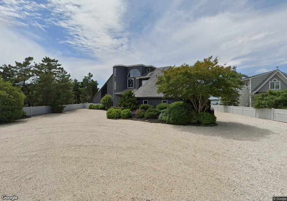
1548 Runyon Ln Mantoloking, NJ 08738
Estimated Value: $5,009,219 - $7,480,000
6
Beds
5
Baths
5,052
Sq Ft
$1,190/Sq Ft
Est. Value
About This Home
This home is located at 1548 Runyon Ln, Mantoloking, NJ 08738 and is currently estimated at $6,009,740, approximately $1,189 per square foot. 1548 Runyon Ln is a home located in Ocean County with nearby schools including G Harold Antrim Elementary School and Point Pleasant Beach High School.
Ownership History
Date
Name
Owned For
Owner Type
Purchase Details
Closed on
Jun 1, 2014
Sold by
Dunn Robert T and Trebus Elizabeth T
Bought by
Enr Llc
Current Estimated Value
Purchase Details
Closed on
Dec 26, 2012
Sold by
Dunn Robert A and Dunn Elizabeth J
Bought by
Dunn Robert J and Trebus Elizabeth T
Purchase Details
Closed on
Mar 20, 2008
Sold by
Dunn Robert and Dunn Elizabeth J
Bought by
Dunn Robert A and Dunn Elizabeth J
Create a Home Valuation Report for This Property
The Home Valuation Report is an in-depth analysis detailing your home's value as well as a comparison with similar homes in the area
Home Values in the Area
Average Home Value in this Area
Purchase History
| Date | Buyer | Sale Price | Title Company |
|---|---|---|---|
| Enr Llc | -- | None Available | |
| Dunn Robert J | -- | None Available | |
| Dunn Robert A | -- | None Available | |
| Dunn Robert A | -- | None Available |
Source: Public Records
Tax History Compared to Growth
Tax History
| Year | Tax Paid | Tax Assessment Tax Assessment Total Assessment is a certain percentage of the fair market value that is determined by local assessors to be the total taxable value of land and additions on the property. | Land | Improvement |
|---|---|---|---|---|
| 2025 | $33,686 | $3,926,100 | $2,119,400 | $1,806,700 |
| 2024 | $32,037 | $3,926,100 | $2,119,400 | $1,806,700 |
| 2023 | $27,483 | $3,926,100 | $2,119,400 | $1,806,700 |
| 2022 | $27,483 | $3,926,100 | $2,119,400 | $1,806,700 |
| 2021 | $27,640 | $3,926,100 | $2,119,400 | $1,806,700 |
| 2020 | $27,954 | $3,926,100 | $2,119,400 | $1,806,700 |
| 2019 | $27,561 | $3,926,100 | $2,119,400 | $1,806,700 |
| 2018 | $27,108 | $3,917,400 | $2,119,400 | $1,798,000 |
| 2017 | $27,304 | $3,917,400 | $2,119,400 | $1,798,000 |
| 2016 | $26,765 | $3,856,600 | $2,119,400 | $1,737,200 |
| 2015 | $26,094 | $3,820,500 | $2,119,400 | $1,701,100 |
| 2014 | $23,955 | $3,820,500 | $2,119,400 | $1,701,100 |
Source: Public Records
Map
Nearby Homes
- 1519 Runyon Ln
- 122 Squan Beach Dr
- 233 Curtis Point Dr
- 150 Sunset Ln
- 275 Curtis Point Dr
- 304 Schooner Ln
- 1318 Ocean Ave
- 1207 Ocean Ave
- 1201 Ocean Ave
- 308 Cove Dr
- 1097 Barnegat Ln
- 366 Highway 35 N
- 1063 Ocean Ave
- 438 Highway 35 N Unit 1304
- 12 Shell Rd
- 1027 Ocean Ave
- 21 Scoop Rd
- 64 W Granada Dr
- 515 New Jersey 35
- 25 Scoop Rd
- 1544 Runyon Ln
- 1552 Runyon Ln
- 1540 Runyon Ln
- 1556 Runyon Ln
- 1550 Ocean Ave
- 1544 Ocean Ave
- 1538 Runyon Ln
- 115 Curtis Point Dr
- 1542 Ocean Ave
- 1558 Ocean Ave
- 1536 Runyon Ln
- 1558 Runyon Ln
- 1536 Ocean Ave
- 1562 Ocean Ave
- 1535 Runyon Ln
- 100 Curtis Point Dr
- 1530 Runyon Ln
- 101 Highway 35 S
- 1547 Ocean Ave
- 119 Curtis Point Dr