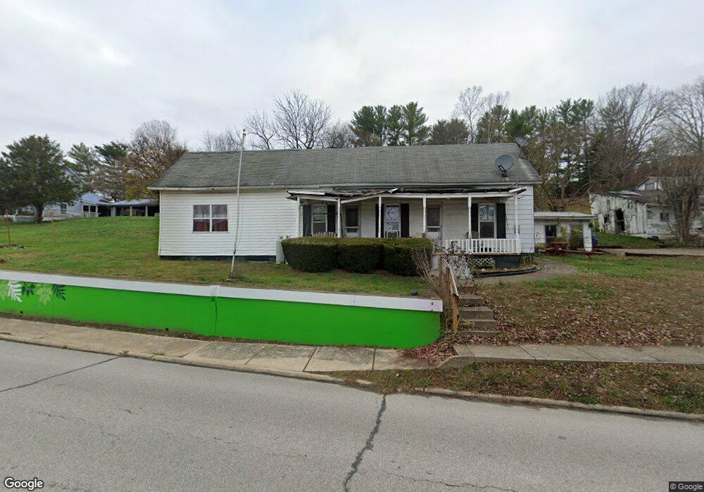
15480 State Route 160 Vinton, OH 45686
Estimated Value: $94,102 - $201,000
3
Beds
1
Bath
1,495
Sq Ft
$87/Sq Ft
Est. Value
About This Home
This home is located at 15480 State Route 160, Vinton, OH 45686 and is currently estimated at $130,276, approximately $87 per square foot. 15480 State Route 160 is a home located in Gallia County with nearby schools including Vinton Elementary School.
Ownership History
Date
Name
Owned For
Owner Type
Purchase Details
Closed on
Sep 28, 2012
Sold by
Deckard Robin L and Holley Bonnie S
Bought by
Martin Darryl and Clark Debra J
Current Estimated Value
Home Financials for this Owner
Home Financials are based on the most recent Mortgage that was taken out on this home.
Original Mortgage
$23,437
Outstanding Balance
$4,053
Interest Rate
3.58%
Mortgage Type
New Conventional
Estimated Equity
$126,223
Purchase Details
Closed on
Mar 29, 1996
Sold by
Deckard Robin
Bought by
Holley Bonnie
Purchase Details
Closed on
Oct 1, 1991
Sold by
Stepp Margie
Bought by
Deckard Robin
Create a Home Valuation Report for This Property
The Home Valuation Report is an in-depth analysis detailing your home's value as well as a comparison with similar homes in the area
Home Values in the Area
Average Home Value in this Area
Purchase History
| Date | Buyer | Sale Price | Title Company |
|---|---|---|---|
| Martin Darryl | $31,250 | None Available | |
| Holley Bonnie | -- | -- | |
| Deckard Robin | $16,600 | -- | |
| -- | $18,000 | -- |
Source: Public Records
Mortgage History
| Date | Status | Borrower | Loan Amount |
|---|---|---|---|
| Open | Martin Darryl | $23,437 |
Source: Public Records
Tax History Compared to Growth
Tax History
| Year | Tax Paid | Tax Assessment Tax Assessment Total Assessment is a certain percentage of the fair market value that is determined by local assessors to be the total taxable value of land and additions on the property. | Land | Improvement |
|---|---|---|---|---|
| 2024 | $1,458 | $23,350 | $3,460 | $19,890 |
| 2023 | $1,931 | $23,350 | $3,460 | $19,890 |
| 2022 | $825 | $19,730 | $3,150 | $16,580 |
| 2021 | $823 | $19,730 | $3,150 | $16,580 |
| 2020 | $823 | $19,730 | $3,150 | $16,580 |
| 2019 | $767 | $18,360 | $3,150 | $15,210 |
| 2018 | $767 | $18,360 | $3,150 | $15,210 |
| 2017 | $2,786 | $18,360 | $3,150 | $15,210 |
| 2016 | $744 | $17,940 | $3,150 | $14,790 |
| 2015 | $1,158 | $17,940 | $3,150 | $14,790 |
| 2013 | $733 | $17,480 | $3,150 | $14,330 |
| 2012 | $732 | $17,480 | $3,150 | $14,330 |
Source: Public Records
Map
Nearby Homes
- 7710 Bull Run Rd
- 1275 Sailor Rd
- 1035 Eagle Rd
- 0 Coal Valley Rd
- 0 Deer Creek Rd
- 0 Coal Valley Road Lot Unit Wp 002
- 46400 Ohio 160
- 31166 Edmundson Rd
- 206 Airline Rd
- 3229 Painter Ridge Rd
- 9675 Ohio 554
- 9215 Ohio 160
- 31152 Edmundson Rd
- 0 Porter Rd
- 0 Edmundson Rd Unit 23607169
- 0 Edmundson Rd Unit (Tract 2 at Big Timb
- 0 Edmundson Rd Unit 23597084
- 0 Edmundson Rd Unit 23463048
- 0 Edmundson Rd Unit (Tract 5 at Big Timb
- 0 Edmundson Rd Unit (Tract 6 at Big Timb
- 0 Keystone Rd
- 0 Keystone Rd Unit 166457
- 0 Keystone Rd Unit 165312
- 0 Keystone Rd Unit 11259227
- 0 Keystone Rd Unit 181361
- 0 Keystone Rd Unit 180162
- 0 Keystone Rd Unit 2431839
- 15470 State Route 160
- 15500 State Route 160
- 15432 State Route 160
- 15500 St Rt 160
- 15500 Ohio 160
- 15428 State Route 160
- 15439 State Route 160
- 31 Keystone Rd
- 15394 State Route 160
- 15526 State Route 160
- 15540 State Route 160
- 15392 State Route 160
- 61 Keystone Rd