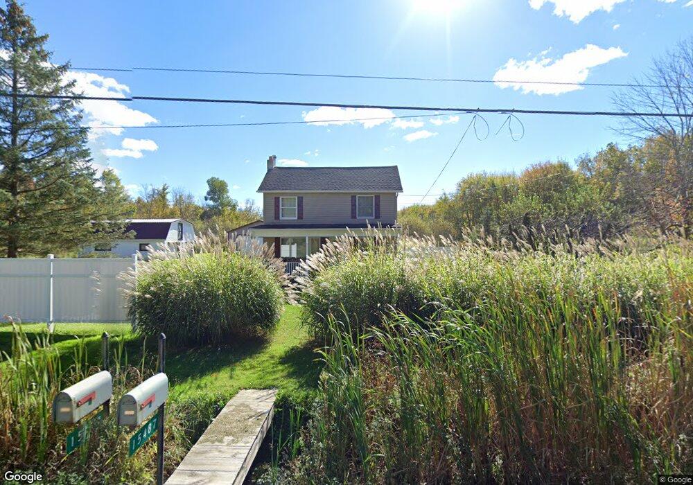
15487 Thompson Rd Thompson, OH 44086
Estimated Value: $200,000 - $285,000
2
Beds
2
Baths
1,092
Sq Ft
$222/Sq Ft
Est. Value
About This Home
This home is located at 15487 Thompson Rd, Thompson, OH 44086 and is currently estimated at $242,136, approximately $221 per square foot. 15487 Thompson Rd is a home located in Geauga County.
Ownership History
Date
Name
Owned For
Owner Type
Purchase Details
Closed on
Dec 27, 1994
Sold by
Misch Michael J
Bought by
Peters Paul
Current Estimated Value
Home Financials for this Owner
Home Financials are based on the most recent Mortgage that was taken out on this home.
Original Mortgage
$60,800
Interest Rate
9.19%
Mortgage Type
New Conventional
Purchase Details
Closed on
May 7, 1991
Bought by
Misch Michael J
Create a Home Valuation Report for This Property
The Home Valuation Report is an in-depth analysis detailing your home's value as well as a comparison with similar homes in the area
Purchase History
| Date | Buyer | Sale Price | Title Company |
|---|---|---|---|
| Peters Paul | $64,000 | -- | |
| Misch Michael J | $60,000 | -- |
Source: Public Records
Mortgage History
| Date | Status | Borrower | Loan Amount |
|---|---|---|---|
| Previous Owner | Peters Paul | $60,800 |
Source: Public Records
Tax History
| Year | Tax Paid | Tax Assessment Tax Assessment Total Assessment is a certain percentage of the fair market value that is determined by local assessors to be the total taxable value of land and additions on the property. | Land | Improvement |
|---|---|---|---|---|
| 2024 | $2,872 | $70,320 | $26,950 | $43,370 |
| 2023 | $2,882 | $70,320 | $26,950 | $43,370 |
| 2022 | $2,418 | $54,570 | $22,720 | $31,850 |
| 2021 | $2,416 | $54,570 | $22,720 | $31,850 |
| 2020 | $2,467 | $54,570 | $22,720 | $31,850 |
| 2019 | $2,198 | $50,410 | $22,720 | $27,690 |
| 2018 | $2,383 | $50,410 | $22,720 | $27,690 |
| 2017 | $2,198 | $50,410 | $22,720 | $27,690 |
| 2016 | $1,713 | $40,190 | $20,340 | $19,850 |
| 2015 | $1,639 | $40,190 | $20,340 | $19,850 |
| 2014 | $1,639 | $40,190 | $20,340 | $19,850 |
| 2013 | $1,465 | $35,390 | $20,340 | $15,050 |
Source: Public Records
Map
Nearby Homes
- 6615 Clay St
- 15594 Moseley Rd
- 16107 Moseley Rd
- 6042 Ford Rd
- 5810 Dewey Rd
- 7771 Lester Dr
- 13849 Painesville Warren Rd
- V/L Leroy Center Rd
- 7857 Lester Dr
- 13537 Shirley Dr
- VL 15 Acres Madison Rd
- 14700 Rock Creek Rd
- 5040 River Rd
- 14161 Radcliffe Rd
- 5004 River Rd
- V/L 4 Painesville Warren Rd
- 4785 Riverwood Dr
- V/L 5 Painesville Warren Rd
- V/L 2 Leroy Center Rd
- V/L 3 Painesville Warren Rd
- 15463 Thompson Rd
- 15470 Thompson Rd
- 15460 Thompson Rd
- 15480 Thompson Rd
- 15440 Thompson Rd
- 15581 Trask Rd
- 15420 Thompson Rd
- 15571 Trask Rd
- 15537 Thompson Rd
- 15528 Thompson Rd
- 15555 Trask Rd
- 15561 Trask Rd
- 15555 Thompson Rd
- 15559 Thompson Rd
- 15344 Thompson Rd
- V/L Trask Rd
- 15541 Trask Rd
- 15548 Trask Rd
- 15300 Leroy Rd
- 15323 Leroy Rd
Your Personal Tour Guide
Ask me questions while you tour the home.