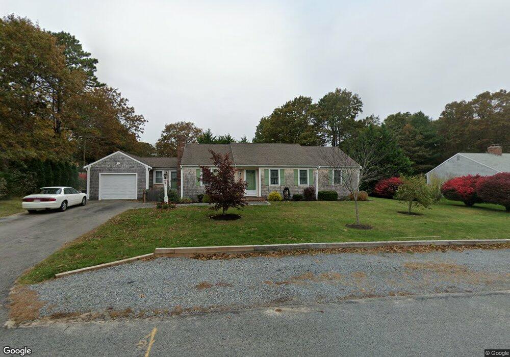
155 Ansel Howland Rd Centerville, MA 02632
Centerville NeighborhoodEstimated Value: $612,000 - $670,000
2
Beds
2
Baths
1,201
Sq Ft
$525/Sq Ft
Est. Value
About This Home
This home is located at 155 Ansel Howland Rd, Centerville, MA 02632 and is currently estimated at $630,669, approximately $525 per square foot. 155 Ansel Howland Rd is a home located in Barnstable County with nearby schools including West Villages Elementary School, Barnstable United Elementary School, and Barnstable Intermediate School.
Ownership History
Date
Name
Owned For
Owner Type
Purchase Details
Closed on
Jun 19, 2012
Sold by
Bennett Diane E
Bought by
Bennett Ft
Current Estimated Value
Purchase Details
Closed on
Dec 27, 2011
Sold by
Kuznarowis Diane E
Bought by
Bennett Diane E
Home Financials for this Owner
Home Financials are based on the most recent Mortgage that was taken out on this home.
Original Mortgage
$211,000
Interest Rate
3.99%
Mortgage Type
Purchase Money Mortgage
Purchase Details
Closed on
Jun 21, 1996
Sold by
Perry Norma A
Bought by
Kuznarowis Diane E
Home Financials for this Owner
Home Financials are based on the most recent Mortgage that was taken out on this home.
Original Mortgage
$67,750
Interest Rate
8.21%
Mortgage Type
Purchase Money Mortgage
Create a Home Valuation Report for This Property
The Home Valuation Report is an in-depth analysis detailing your home's value as well as a comparison with similar homes in the area
Home Values in the Area
Average Home Value in this Area
Purchase History
| Date | Buyer | Sale Price | Title Company |
|---|---|---|---|
| Bennett Ft | -- | -- | |
| Bennett Diane E | -- | -- | |
| Kuznarowis Diane E | $115,000 | -- |
Source: Public Records
Mortgage History
| Date | Status | Borrower | Loan Amount |
|---|---|---|---|
| Previous Owner | Bennett Diane E | $211,000 | |
| Previous Owner | Kuznarowis Diane E | $100,000 | |
| Previous Owner | Kuznarowis Diane E | $75,450 | |
| Previous Owner | Kuznarowis Diane E | $67,750 |
Source: Public Records
Tax History Compared to Growth
Tax History
| Year | Tax Paid | Tax Assessment Tax Assessment Total Assessment is a certain percentage of the fair market value that is determined by local assessors to be the total taxable value of land and additions on the property. | Land | Improvement |
|---|---|---|---|---|
| 2025 | $4,836 | $597,800 | $151,900 | $445,900 |
| 2024 | $4,640 | $594,100 | $151,900 | $442,200 |
| 2023 | $4,366 | $523,500 | $138,100 | $385,400 |
| 2022 | $4,198 | $435,500 | $102,300 | $333,200 |
| 2021 | $3,920 | $373,700 | $102,300 | $271,400 |
| 2020 | $3,976 | $362,800 | $102,300 | $260,500 |
| 2019 | $3,756 | $333,000 | $102,300 | $230,700 |
| 2018 | $3,351 | $298,700 | $107,700 | $191,000 |
| 2017 | $3,114 | $289,400 | $107,700 | $181,700 |
| 2016 | $3,163 | $290,200 | $108,500 | $181,700 |
| 2015 | $3,007 | $277,100 | $105,100 | $172,000 |
Source: Public Records
Map
Nearby Homes
- 315 Prince Hinckley Rd
- 87 Foxglove Rd
- 21 Shannon Way
- 296 Buckskin Path
- 900 Old Stage Rd
- 205 James Otis Rd
- 1028 Old Falmouth Rd
- 1044 Old Falmouth Rd
- 81 Monomoy Cir
- 16 Bridgets Path
- 62 Three Ponds Dr
- 7 Ebenezer
- 17 Ebenezer Rd
- 88 Joe Thompson Rd
- 73 Tern Ln
- 66 Tern Ln
- 74 Saddler Ln
- 80 Saddler Ln
- 40 Appaloosa Way
- 143 Ansel Howland Rd
- 248 Nottingham Dr
- 167 Ansel Howland Rd
- 236 Nottingham Dr
- 152 Ansel Howland Rd
- 260 Nottingham Dr
- 164 Ansel Howland Rd
- 133 Ansel Howland Rd
- 140 Ansel Howland Rd
- 176 Ansel Howland Rd
- 181 Ansel Howland Rd
- 222 Nottingham Dr
- 274 Nottingham Dr
- 123 Ansel Howland Rd
- 63 Elijah Childs Ln
- 253 Nottingham Dr
- 77 Elijah Childs Ln
- 243 Nottingham Dr
- 128 Ansel Howland Rd
- 263 Nottingham Dr