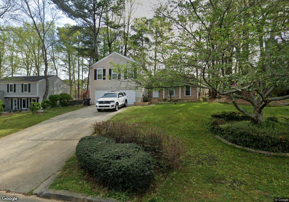
155 Barrington Dr E Roswell, GA 30076
Barrington NeighborhoodEstimated Value: $470,000 - $506,000
4
Beds
3
Baths
1,900
Sq Ft
$256/Sq Ft
Est. Value
About This Home
This home is located at 155 Barrington Dr E, Roswell, GA 30076 and is currently estimated at $485,459, approximately $255 per square foot. 155 Barrington Dr E is a home located in Fulton County with nearby schools including Northwood Elementary School, Haynes Bridge Middle School, and Centennial High School.
Ownership History
Date
Name
Owned For
Owner Type
Purchase Details
Closed on
May 9, 2017
Sold by
Not Provided
Bought by
Srp Sub Llc
Current Estimated Value
Purchase Details
Closed on
Jan 31, 2014
Sold by
Srp Sub Llc
Bought by
Tarbert Llc
Purchase Details
Closed on
Jun 4, 2013
Sold by
Daneshvari Parvin B
Bought by
Srp Sub Llc
Purchase Details
Closed on
Nov 8, 2000
Sold by
Geis Barkley M
Bought by
Daneshvari Parvin B
Home Financials for this Owner
Home Financials are based on the most recent Mortgage that was taken out on this home.
Original Mortgage
$133,110
Interest Rate
7.87%
Mortgage Type
New Conventional
Create a Home Valuation Report for This Property
The Home Valuation Report is an in-depth analysis detailing your home's value as well as a comparison with similar homes in the area
Home Values in the Area
Average Home Value in this Area
Purchase History
| Date | Buyer | Sale Price | Title Company |
|---|---|---|---|
| Srp Sub Llc | -- | -- | |
| Tarbert Llc | -- | -- | |
| Srp Sub Llc | $134,399 | -- | |
| Daneshvari Parvin B | $147,900 | -- |
Source: Public Records
Mortgage History
| Date | Status | Borrower | Loan Amount |
|---|---|---|---|
| Previous Owner | Daneshvari Parvin B | $133,110 |
Source: Public Records
Tax History
| Year | Tax Paid | Tax Assessment Tax Assessment Total Assessment is a certain percentage of the fair market value that is determined by local assessors to be the total taxable value of land and additions on the property. | Land | Improvement |
|---|---|---|---|---|
| 2025 | $801 | $154,480 | $37,400 | $117,080 |
| 2023 | $801 | $154,920 | $38,080 | $116,840 |
| 2022 | $3,541 | $134,600 | $24,080 | $110,520 |
| 2021 | $3,073 | $113,520 | $27,440 | $86,080 |
| 2020 | $3,505 | $107,040 | $25,720 | $81,320 |
| 2019 | $521 | $105,120 | $25,240 | $79,880 |
| 2018 | $2,729 | $96,680 | $18,840 | $77,840 |
| 2017 | $2,101 | $72,000 | $11,920 | $60,080 |
| 2016 | $2,101 | $72,000 | $11,920 | $60,080 |
| 2015 | $2,503 | $72,000 | $11,920 | $60,080 |
| 2014 | $2,207 | $72,000 | $11,920 | $60,080 |
Source: Public Records
Map
Nearby Homes
- 970 Laurel Mill Dr
- 1120 Northpoint Trace
- 1150 Northpoint Trace
- 485 Sheringham Ct
- 2415 Roxburgh Dr
- 130 Spring Ridge Ct
- 137 Weatherburne Dr
- 260 Spring Ridge Dr
- 625 Cranberry Trail
- 780 Crab Orchard Dr
- 725 Crab Orchard Dr
- 635 Cranberry Trail
- 350 S Satinwood Place
- 590 Ridgemont Dr
- 2025 Kristian Way
- 525 Ansley Dr
- 10120 Kinross Rd
- 1005 Cranberry Creek
- 115 Ansley Ct
- 655 Cranberry Ct
- 155 Barrington Dr E
- 165 Barrington Dr E
- 145 Barrington Dr E
- 910 Laurel Mill Dr
- 900 Laurel Mill Dr Unit 9
- 175 Barrington Dr E
- 135 Barrington Dr E
- 920 Laurel Mill Dr
- 150 Barrington Dr E
- 160 Barrington Dr E
- 890 Laurel Mill Dr Unit 9
- 605 Barrington Way
- 170 Barrington Dr E Unit 4
- 930 Laurel Mill Dr
- 185 Barrington Dr E
- 185 Barrington Dr E Unit 4
- 125 Barrington Dr E Unit O
- 125 Barrington Dr E
- 880 Laurel Mill Dr Unit 9
- 180 Barrington Dr E
Your Personal Tour Guide
Ask me questions while you tour the home.