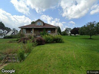
155 Bridge St Rockwood, PA 15557
Estimated Value: $144,375 - $204,000
2
Beds
1
Bath
1,216
Sq Ft
$148/Sq Ft
Est. Value
About This Home
This home is located at 155 Bridge St, Rockwood, PA 15557 and is currently estimated at $179,844, approximately $147 per square foot. 155 Bridge St is a home located in Somerset County with nearby schools including Rockwood Area Elementary School and Rockwood Area Junior/Senior High School.
Ownership History
Date
Name
Owned For
Owner Type
Purchase Details
Closed on
Oct 24, 2006
Sold by
Deutsche National Trust Co
Bought by
Seeley John and Seeley Geraldine
Current Estimated Value
Home Financials for this Owner
Home Financials are based on the most recent Mortgage that was taken out on this home.
Original Mortgage
$80,000
Outstanding Balance
$50,334
Interest Rate
6.36%
Mortgage Type
New Conventional
Purchase Details
Closed on
Jul 7, 2006
Sold by
Zelenske Eric
Bought by
Deutsche Bank National Trust Co and Long Beach Mortgage Loan Trust
Create a Home Valuation Report for This Property
The Home Valuation Report is an in-depth analysis detailing your home's value as well as a comparison with similar homes in the area
Home Values in the Area
Average Home Value in this Area
Purchase History
| Date | Buyer | Sale Price | Title Company |
|---|---|---|---|
| Seeley John | $80,000 | None Available | |
| Deutsche Bank National Trust Co | $5,945 | None Available |
Source: Public Records
Mortgage History
| Date | Status | Borrower | Loan Amount |
|---|---|---|---|
| Open | Seeley John | $80,000 |
Source: Public Records
Tax History Compared to Growth
Tax History
| Year | Tax Paid | Tax Assessment Tax Assessment Total Assessment is a certain percentage of the fair market value that is determined by local assessors to be the total taxable value of land and additions on the property. | Land | Improvement |
|---|---|---|---|---|
| 2024 | $1,151 | $28,950 | $0 | $0 |
| 2023 | $1,074 | $28,950 | $0 | $0 |
| 2022 | $1,052 | $28,950 | $0 | $0 |
| 2021 | $1,052 | $28,950 | $0 | $0 |
| 2020 | $1,052 | $28,950 | $0 | $0 |
| 2019 | $1,052 | $28,950 | $0 | $0 |
| 2018 | $1,052 | $28,950 | $5,250 | $23,700 |
| 2017 | $1,052 | $28,950 | $5,250 | $23,700 |
| 2016 | -- | $28,950 | $5,250 | $23,700 |
| 2015 | -- | $28,950 | $5,250 | $23,700 |
| 2014 | -- | $28,950 | $5,250 | $23,700 |
Source: Public Records
Map
Nearby Homes
- 208 W Mud Pike
- 494 Harvest Dr
- SR 653 Lake Pyle
- . Mcguire Rd
- 1011 Broadway St
- 186 Lake Road Ln
- 750 Main St
- Lot #2 Ream Rd
- 119 Hilltop Dr
- 0 New Centerville Rd Unit 1661467
- Lot #6 Ream Rd
- 4834 Kingwood Rd
- 1139 Chickentown Rd
- 135 Hillvale Rd
- 0 Mcguire Rd Unit 96028323
- 671 Hauger Rd
- 0 Trent Rd Unit 1670823
- 707 Golden Ridge Dr
- 0 Whipkey Dam Road Lot
- 557 Poverty Hollow Rd
- 155 Bridge St
- 157 Bridge St
- 152 School St
- 144 Bridge St
- 181 Bridge St
- 138 Bridge St
- 127 Bridge St
- 185 Bridge St
- 134 Bridge St Unit Felgar Rd
- 133 Reese St
- 143 Reese St
- 109 Reese St
- 126 Bridge St
- 199 Bridge St
- 66 Reese St
- 198 Bridge St
- 158 Reese St
- 3003 Kingwood Rd
- 175 Reese St
- 2931 New Centerville Rd