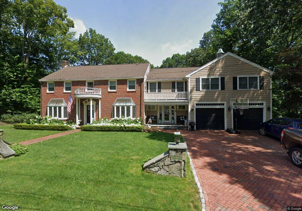
155 Cabot St Milton, MA 02186
Milton Hill NeighborhoodEstimated Value: $1,359,000 - $2,488,000
6
Beds
7
Baths
3,847
Sq Ft
$528/Sq Ft
Est. Value
About This Home
This home is located at 155 Cabot St, Milton, MA 02186 and is currently estimated at $2,030,444, approximately $527 per square foot. 155 Cabot St is a home located in Norfolk County with nearby schools including Milton High School, St. Agatha School, and Saint John Paul II Catholic Academy.
Ownership History
Date
Name
Owned For
Owner Type
Purchase Details
Closed on
Oct 29, 2021
Sold by
Taylor Mark A and Taylor Sheila O
Bought by
155 Cabot Street Rt
Current Estimated Value
Purchase Details
Closed on
Jan 29, 2009
Sold by
Oconnor Austin F and Oconnor Margaret M
Bought by
Taylor Mark A and Taylor Sheila O
Create a Home Valuation Report for This Property
The Home Valuation Report is an in-depth analysis detailing your home's value as well as a comparison with similar homes in the area
Home Values in the Area
Average Home Value in this Area
Purchase History
| Date | Buyer | Sale Price | Title Company |
|---|---|---|---|
| 155 Cabot Street Rt | -- | None Available | |
| Taylor Mark A | $800,000 | -- |
Source: Public Records
Tax History Compared to Growth
Tax History
| Year | Tax Paid | Tax Assessment Tax Assessment Total Assessment is a certain percentage of the fair market value that is determined by local assessors to be the total taxable value of land and additions on the property. | Land | Improvement |
|---|---|---|---|---|
| 2025 | $19,768 | $1,782,500 | $668,800 | $1,113,700 |
| 2024 | $19,127 | $1,751,600 | $637,900 | $1,113,700 |
| 2023 | $17,802 | $1,561,600 | $608,000 | $953,600 |
| 2022 | $16,832 | $1,349,800 | $608,000 | $741,800 |
| 2021 | $17,028 | $1,296,900 | $590,200 | $706,700 |
| 2020 | $16,939 | $1,291,100 | $590,600 | $700,500 |
| 2019 | $16,258 | $1,233,500 | $573,400 | $660,100 |
| 2018 | $15,941 | $1,154,300 | $509,500 | $644,800 |
| 2017 | $14,923 | $1,100,500 | $485,100 | $615,400 |
| 2016 | $13,179 | $976,200 | $485,100 | $491,100 |
| 2015 | $12,203 | $875,400 | $426,300 | $449,100 |
Source: Public Records
Map
Nearby Homes
- 71 Cabot St
- 55 Christopher Dr
- 400 Adams St Unit A
- 400 Adams St Unit B
- 397 Adams St
- 639 Pleasant St Unit 639
- 639 Pleasant St
- 26 Berlin Ave
- 51 Denmark Ave
- 461 Centre St
- 65 Barham Ave
- 312 Edge Hill Rd
- 46 Century Ln
- 22 Branchfield St Unit D4
- 795 Brook Rd
- 1076 Adams St
- 418 Pleasant St
- 21A High St Unit 2
- 1245 Adams St Unit B406
- 1245 Adams St Unit B210