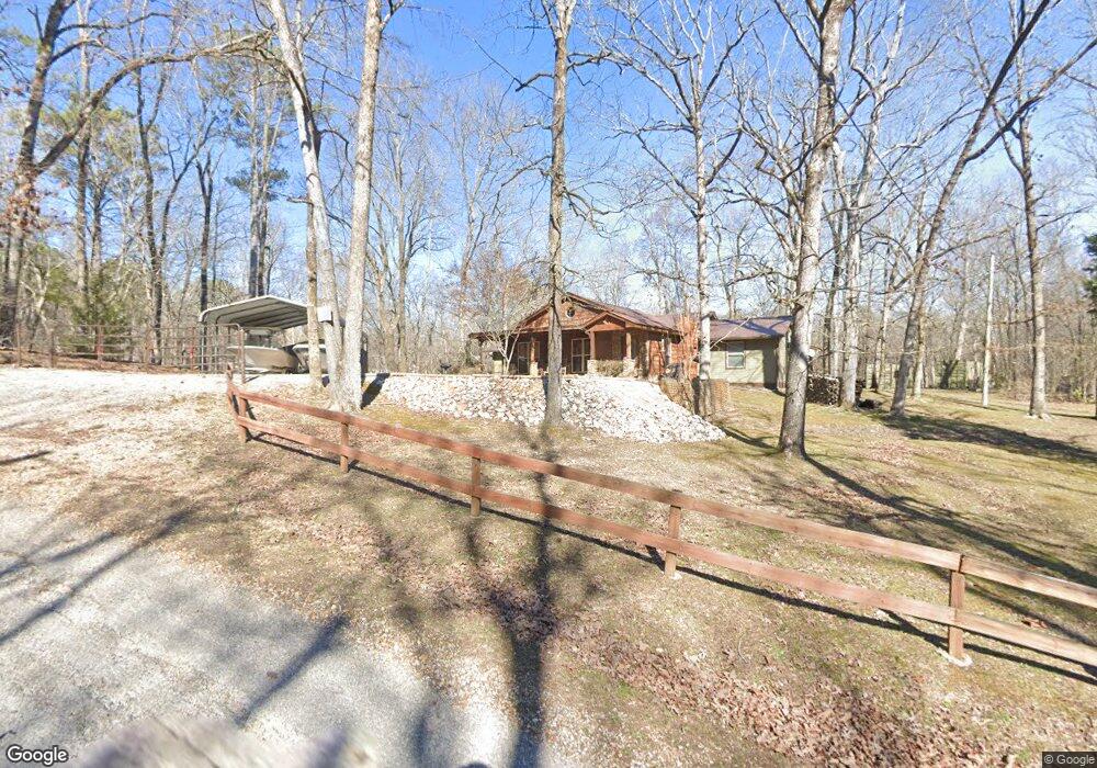
155 Contreau Rd Counce, TN 38326
Estimated Value: $328,688 - $411,000
Studio
2
Baths
1,790
Sq Ft
$203/Sq Ft
Est. Value
About This Home
This home is located at 155 Contreau Rd, Counce, TN 38326 and is currently estimated at $362,672, approximately $202 per square foot. 155 Contreau Rd is a home located in Hardin County with nearby schools including Hardin County High School.
Ownership History
Date
Name
Owned For
Owner Type
Purchase Details
Closed on
Feb 6, 2012
Sold by
Macon Square Llc
Bought by
Bell Davis William
Current Estimated Value
Purchase Details
Closed on
Jan 22, 2008
Sold by
Simmons Horace D
Bought by
Macon Square Llc
Purchase Details
Closed on
May 17, 2002
Sold by
Norton Charlotte
Bought by
Simmons Horace D
Purchase Details
Closed on
Dec 11, 1997
Sold by
Norton Richard
Bought by
Lane Max
Home Financials for this Owner
Home Financials are based on the most recent Mortgage that was taken out on this home.
Original Mortgage
$72,000
Interest Rate
7.23%
Purchase Details
Closed on
Jun 26, 1997
Sold by
Ligon Robt K
Bought by
Norton Richard
Home Financials for this Owner
Home Financials are based on the most recent Mortgage that was taken out on this home.
Original Mortgage
$57,800
Interest Rate
7.98%
Purchase Details
Closed on
Dec 19, 1972
Bought by
Ligon Robt K and Ligon Anne
Create a Home Valuation Report for This Property
The Home Valuation Report is an in-depth analysis detailing your home's value as well as a comparison with similar homes in the area
Purchase History
| Date | Buyer | Sale Price | Title Company |
|---|---|---|---|
| Bell Davis William | -- | -- | |
| Davis William Bell | -- | -- | |
| Macon Square Llc | $165,000 | -- | |
| Simmons Horace D | $75,000 | -- | |
| Lane Max | $90,000 | -- | |
| Norton Richard | $68,000 | -- | |
| Ligon Robt K | -- | -- |
Source: Public Records
Mortgage History
| Date | Status | Borrower | Loan Amount |
|---|---|---|---|
| Previous Owner | Ligon Robt K | $72,000 | |
| Previous Owner | Ligon Robt K | $57,800 |
Source: Public Records
Tax History
| Year | Tax Paid | Tax Assessment Tax Assessment Total Assessment is a certain percentage of the fair market value that is determined by local assessors to be the total taxable value of land and additions on the property. | Land | Improvement |
|---|---|---|---|---|
| 2025 | $1,317 | $75,250 | $16,250 | $59,000 |
| 2024 | $1,317 | $75,250 | $16,250 | $59,000 |
| 2023 | $1,317 | $75,250 | $16,250 | $59,000 |
| 2022 | $980 | $47,550 | $16,250 | $31,300 |
| 2021 | $980 | $47,550 | $16,250 | $31,300 |
| 2020 | $980 | $47,550 | $16,250 | $31,300 |
| 2019 | $980 | $47,550 | $16,250 | $31,300 |
| 2018 | $947 | $47,550 | $16,250 | $31,300 |
| 2017 | $945 | $45,450 | $16,250 | $29,200 |
| 2016 | $941 | $45,250 | $16,250 | $29,000 |
| 2015 | $824 | $45,250 | $16,250 | $29,000 |
| 2014 | $824 | $45,250 | $16,250 | $29,000 |
Source: Public Records
Map
Nearby Homes
- 80 Contreau Rd
- 30 Chardonnay Way
- 540 Muscatel Ln
- 150 Turley Ln
- 460 Port Ln
- 215 Glading Place Ln
- 95 Cottonwood Cove
- 25 Caney Hollow Rd
- LOT 16 Moss Trail
- 140 Spumante Ln
- 330 Cr 380 #3 Rd
- 135 Spumante Ln
- 455 Lakeshore Ln
- 1200 Holiday Hills Ln
- 54 Whispering Ln
- 180 Strobbe Ln
- 70 Lakeshore Ln
- 80 View Point Cove
- 685 River Cliff Ln
- 145 Chval Dr
Your Personal Tour Guide
Ask me questions while you tour the home.