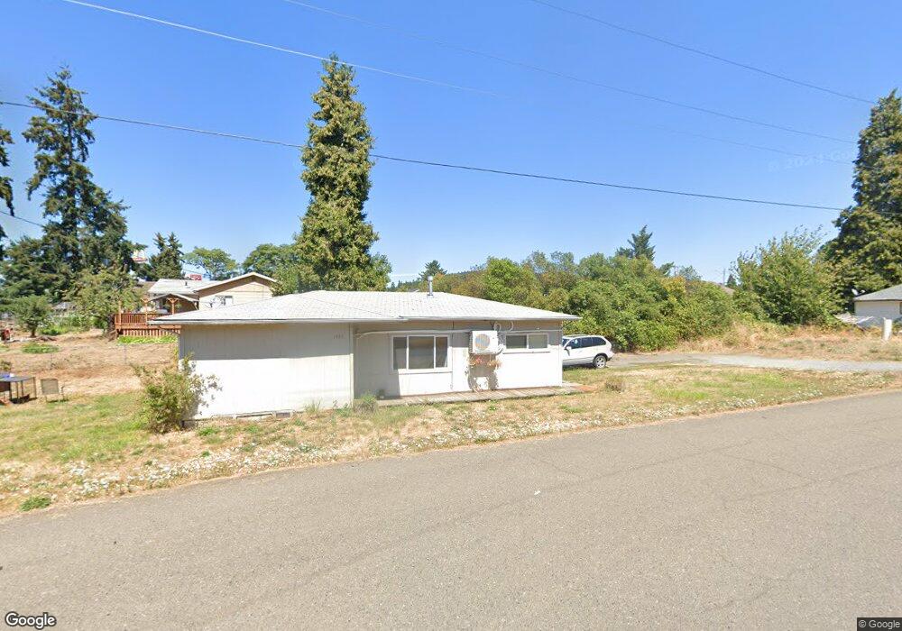
155 S Comstock Ave Sutherlin, OR 97479
Estimated Value: $273,000 - $339,000
3
Beds
2
Baths
1,308
Sq Ft
$233/Sq Ft
Est. Value
About This Home
This home is located at 155 S Comstock Ave, Sutherlin, OR 97479 and is currently estimated at $304,685, approximately $232 per square foot. 155 S Comstock Ave is a home located in Douglas County with nearby schools including East Sutherlin Primary School, West Sutherlin Intermediate School, and Sutherlin Middle School.
Ownership History
Date
Name
Owned For
Owner Type
Purchase Details
Closed on
May 2, 2008
Sold by
Culberson Marva D and Culberson Brian D
Bought by
Wells Fargo Bank Na and Option One Mortgage Loan Trust 2007-2 As
Current Estimated Value
Purchase Details
Closed on
Mar 11, 2008
Sold by
Robinson Sam C and Robinson Gladys F
Bought by
Robinson Sam C and Robinson Gladys F
Purchase Details
Closed on
May 5, 2005
Sold by
Robinson Sam C and Robinson Gladys F
Bought by
Robinson Sam C and Robinson Gladys F
Create a Home Valuation Report for This Property
The Home Valuation Report is an in-depth analysis detailing your home's value as well as a comparison with similar homes in the area
Home Values in the Area
Average Home Value in this Area
Purchase History
| Date | Buyer | Sale Price | Title Company |
|---|---|---|---|
| Wells Fargo Bank Na | $213,219 | First American Title Ins Co | |
| Robinson Sam C | -- | Amerititle | |
| Robinson Sam C | -- | Amerititle |
Source: Public Records
Tax History Compared to Growth
Tax History
| Year | Tax Paid | Tax Assessment Tax Assessment Total Assessment is a certain percentage of the fair market value that is determined by local assessors to be the total taxable value of land and additions on the property. | Land | Improvement |
|---|---|---|---|---|
| 2024 | $2,125 | $177,622 | -- | -- |
| 2023 | $2,064 | $172,449 | $0 | $0 |
| 2022 | $2,005 | $167,427 | $0 | $0 |
| 2021 | $1,947 | $162,551 | $0 | $0 |
| 2020 | $1,890 | $157,817 | $0 | $0 |
| 2019 | $1,835 | $153,221 | $0 | $0 |
| 2018 | $1,781 | $148,759 | $0 | $0 |
| 2017 | $1,825 | $144,427 | $0 | $0 |
| 2016 | $1,773 | $140,221 | $0 | $0 |
| 2015 | $1,721 | $136,137 | $0 | $0 |
| 2014 | $1,670 | $132,172 | $0 | $0 |
| 2013 | -- | $128,323 | $0 | $0 |
Source: Public Records
Map
Nearby Homes
- 165 Robinson St
- 1223 Duke Ave
- 0 Dakota St Unit B 500248401
- 181 SW Hutchins St
- 1386 Airway Ave
- 819 S Comstock Ave Unit 13
- 1688 W Central Ave
- 279 Grant St
- 226 Miller St
- 220 Miller St
- 420 Backwater Loop
- 851 S Comstock Rd
- 892 Fir Grove Ln
- 908 Fir Grove Ln
- 1660 Scardi Blvd
- 1716 Scardi Blvd Unit 174
- 126 Coles Valley St
- 154 Coles Valley St
- 1878 Trails End Ln
- 149 Coles Valley St
- 157 S Comstock Rd
- 157 S Comstock Ave
- 163 S Comstock Ave
- 151 S Comstock Rd
- 159 S Comstock Ave
- 151 S Comstock Ave
- 165 S Comstock Ave
- 161 S Comstock Rd
- 131 S Comstock Ave
- 131 S Comstock Rd
- 175 S Comstock Ave
- 1333 Hospitality Way
- 1430 W Central Ave Unit 8
- 1430 W Central Ave Unit 1
- 1430 W Central Ave Unit SP11
- 1430 W Central Ave
- 1386 W Central Ave
- 1358 W Central Ave Unit 2
- 1356 Hospitality Way
- 213 S Comstock Ave