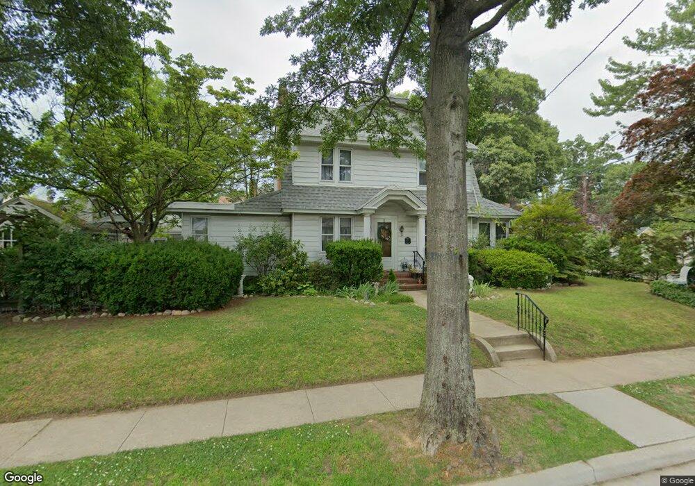
155 Sherman St Lynbrook, NY 11563
Estimated Value: $750,922 - $772,000
--
Bed
2
Baths
1,762
Sq Ft
$432/Sq Ft
Est. Value
About This Home
This home is located at 155 Sherman St, Lynbrook, NY 11563 and is currently estimated at $761,461, approximately $432 per square foot. 155 Sherman St is a home with nearby schools including Lynbrook Senior High School, Our Lady Of Peace School, and Our Lady of Lourdes School.
Ownership History
Date
Name
Owned For
Owner Type
Purchase Details
Closed on
May 6, 2022
Sold by
Maloney Cecil P and Maloney Delores F
Bought by
Bevan Marybeth and Cecil And Dolores Maloney Irrevocable Tr
Current Estimated Value
Purchase Details
Closed on
Sep 20, 1995
Sold by
Hargrove William and Hargrove Ruth
Bought by
Duignan Richard and Duignan Doris
Home Financials for this Owner
Home Financials are based on the most recent Mortgage that was taken out on this home.
Original Mortgage
$80,000
Interest Rate
7.89%
Create a Home Valuation Report for This Property
The Home Valuation Report is an in-depth analysis detailing your home's value as well as a comparison with similar homes in the area
Home Values in the Area
Average Home Value in this Area
Purchase History
| Date | Buyer | Sale Price | Title Company |
|---|---|---|---|
| Bevan Marybeth | -- | Big Apple Abstract Corp | |
| Bevan Marybeth | -- | Big Apple Abstract Corp | |
| Bevan Marybeth | -- | Big Apple Abstract Corp | |
| Duignan Richard | $130,000 | -- | |
| Duignan Richard | $130,000 | -- |
Source: Public Records
Mortgage History
| Date | Status | Borrower | Loan Amount |
|---|---|---|---|
| Previous Owner | Duignan Richard | $80,000 |
Source: Public Records
Tax History Compared to Growth
Tax History
| Year | Tax Paid | Tax Assessment Tax Assessment Total Assessment is a certain percentage of the fair market value that is determined by local assessors to be the total taxable value of land and additions on the property. | Land | Improvement |
|---|---|---|---|---|
| 2025 | $10,465 | $499 | $209 | $290 |
| 2024 | $1,067 | $514 | $216 | $298 |
| 2023 | $8,316 | $508 | $213 | $295 |
| 2022 | $8,316 | $539 | $226 | $313 |
| 2021 | $7,198 | $528 | $217 | $311 |
| 2020 | $6,348 | $508 | $447 | $61 |
| 2019 | $853 | $544 | $448 | $96 |
| 2018 | $891 | $581 | $0 | $0 |
| 2017 | $5,469 | $617 | $453 | $164 |
| 2016 | $6,361 | $653 | $416 | $237 |
| 2015 | $1,024 | $690 | $392 | $298 |
| 2014 | $1,024 | $690 | $392 | $298 |
| 2013 | $1,023 | $751 | $426 | $325 |
Source: Public Records
Map
Nearby Homes
- 57 Nieman Ave
- 29 Summit Ave
- 127 Smith St
- 232 Sherman St
- 103 Smith St Unit 1
- 181 Walnut St
- 504 Merrick Rd Unit 4J
- 504 Merrick Rd Unit 4E
- 504 Merrick Rd Unit 2k
- 60 Harvard Ave
- 237 Central Ave
- 2 Fowler Ave Unit 228
- 67 Burtis St
- 20 Daley Place Unit 128
- 30 Daley Place Unit 247
- 20 Daley Place Unit 104
- 20 Daley Place Unit 225
- 20 Daley Place Unit 127
- 75 Noble St Unit 219
- 75 Noble St Unit 126
- 3 Arthur Ave
- 165 Sherman St
- 5 Arthur Ave
- 147 Sherman St
- 169 Sherman St
- 7 Arthur Ave
- 158 Sherman St
- 98 Curtis Place
- 34 Hillside Ave
- 154 Sherman St
- 143 Sherman St
- 30 Hillside Ave
- 170 Sherman St
- 150 Sherman St
- 11 Arthur Ave Unit 2
- 11 Arthur Ave
- 2 Arthur Ave
- 139 Sherman St
- 28 Hillside Ave
- 90 Curtis Place