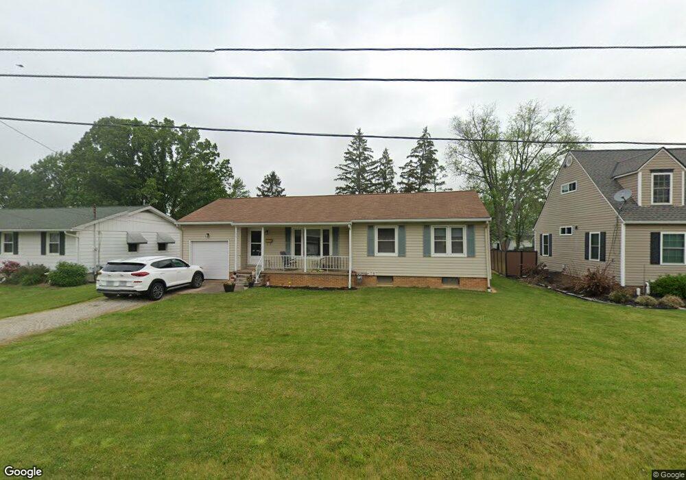
155 Sipple Ave Amherst, OH 44001
Estimated Value: $135,877 - $223,000
3
Beds
1
Bath
1,050
Sq Ft
$177/Sq Ft
Est. Value
About This Home
This home is located at 155 Sipple Ave, Amherst, OH 44001 and is currently estimated at $186,219, approximately $177 per square foot. 155 Sipple Ave is a home located in Lorain County with nearby schools including Powers Elementary School, Walter G. Nord Middle School, and Amherst Junior High School.
Ownership History
Date
Name
Owned For
Owner Type
Purchase Details
Closed on
Sep 8, 2021
Sold by
Ford Lisa K and Estate Of Robert L Spratt
Bought by
Benoit Joseph A
Current Estimated Value
Home Financials for this Owner
Home Financials are based on the most recent Mortgage that was taken out on this home.
Original Mortgage
$66,400
Outstanding Balance
$60,419
Interest Rate
2.8%
Mortgage Type
New Conventional
Estimated Equity
$125,800
Purchase Details
Closed on
Jul 29, 2014
Sold by
Spratt Robert L and Spratt Joyce M
Bought by
Spratt Robert L and Spratt Joyce M
Create a Home Valuation Report for This Property
The Home Valuation Report is an in-depth analysis detailing your home's value as well as a comparison with similar homes in the area
Home Values in the Area
Average Home Value in this Area
Purchase History
| Date | Buyer | Sale Price | Title Company |
|---|---|---|---|
| Benoit Joseph A | $83,000 | None Available | |
| Spratt Robert L | -- | None Available |
Source: Public Records
Mortgage History
| Date | Status | Borrower | Loan Amount |
|---|---|---|---|
| Open | Benoit Joseph A | $66,400 |
Source: Public Records
Tax History
| Year | Tax Paid | Tax Assessment Tax Assessment Total Assessment is a certain percentage of the fair market value that is determined by local assessors to be the total taxable value of land and additions on the property. | Land | Improvement |
|---|---|---|---|---|
| 2024 | $2,092 | $50,565 | $11,697 | $38,868 |
| 2023 | $1,887 | $38,437 | $11,323 | $27,115 |
| 2022 | $1,812 | $38,437 | $11,323 | $27,115 |
| 2021 | $1,367 | $38,437 | $11,323 | $27,115 |
| 2020 | $1,191 | $31,710 | $9,480 | $22,230 |
| 2019 | $1,167 | $31,710 | $9,480 | $22,230 |
| 2018 | $1,153 | $31,710 | $9,480 | $22,230 |
| 2017 | $1,133 | $29,560 | $6,640 | $22,920 |
| 2016 | $1,142 | $29,560 | $6,640 | $22,920 |
| 2015 | $1,136 | $29,560 | $6,640 | $22,920 |
| 2014 | $1,186 | $30,380 | $6,820 | $23,560 |
| 2013 | $1,190 | $30,380 | $6,820 | $23,560 |
Source: Public Records
Map
Nearby Homes
- 578 N Main St
- 156 Beaver Ct
- 267 Milan Ave
- 363 Seeley St
- 147 Central Dr
- 640 W Martin Ave
- 105 N Woodhill Dr
- 495 Church St
- 151 Woodhill Dr
- 120 Springvale Dr
- 950 Park Ave
- 764 Forde Ave
- 1150 Woodside Dr
- 875 Princeton Ave
- 830 Forde Ave
- 1011 N Main St
- 795 Tarry Ln
- 588 Jackson St
- 380 Broadway St
- 107 Keswick Ct
Your Personal Tour Guide
Ask me questions while you tour the home.