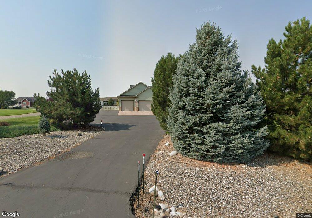
1550 Green Bluff Ave Laurel, MT 59044
Estimated Value: $663,000 - $794,000
5
Beds
3
Baths
3,880
Sq Ft
$187/Sq Ft
Est. Value
About This Home
This home is located at 1550 Green Bluff Ave, Laurel, MT 59044 and is currently estimated at $725,785, approximately $187 per square foot. 1550 Green Bluff Ave is a home located in Yellowstone County with nearby schools including Fred W. Graff School, West School, and Laurel Middle School.
Ownership History
Date
Name
Owned For
Owner Type
Purchase Details
Closed on
Aug 26, 2016
Sold by
Hill Garth S and Hill Natisha M
Bought by
Brown Michael T and Brown Tami A
Current Estimated Value
Home Financials for this Owner
Home Financials are based on the most recent Mortgage that was taken out on this home.
Original Mortgage
$404,975
Interest Rate
3.89%
Mortgage Type
New Conventional
Purchase Details
Closed on
Oct 20, 2008
Sold by
Marlow Russell C and Marlow Virginia B
Bought by
Hill Garth S and Hill Natisha M
Home Financials for this Owner
Home Financials are based on the most recent Mortgage that was taken out on this home.
Original Mortgage
$296,000
Interest Rate
6.31%
Mortgage Type
Purchase Money Mortgage
Purchase Details
Closed on
Jan 18, 2007
Sold by
Foos Clarence A and Foos Naomi
Bought by
Marlow Russell C and Marlow Virginia B
Home Financials for this Owner
Home Financials are based on the most recent Mortgage that was taken out on this home.
Original Mortgage
$264,000
Interest Rate
6.09%
Mortgage Type
Unknown
Create a Home Valuation Report for This Property
The Home Valuation Report is an in-depth analysis detailing your home's value as well as a comparison with similar homes in the area
Home Values in the Area
Average Home Value in this Area
Purchase History
| Date | Buyer | Sale Price | Title Company |
|---|---|---|---|
| Brown Michael T | -- | Chicago Title | |
| Hill Garth S | -- | None Available | |
| Marlow Russell C | -- | American Title & Escrow |
Source: Public Records
Mortgage History
| Date | Status | Borrower | Loan Amount |
|---|---|---|---|
| Previous Owner | Brown Michael T | $404,975 | |
| Previous Owner | Hill Garth S | $296,000 | |
| Previous Owner | Marlow Russell C | $264,000 |
Source: Public Records
Tax History
| Year | Tax Paid | Tax Assessment Tax Assessment Total Assessment is a certain percentage of the fair market value that is determined by local assessors to be the total taxable value of land and additions on the property. | Land | Improvement |
|---|---|---|---|---|
| 2025 | $3,984 | $707,200 | $109,928 | $597,272 |
| 2024 | $3,984 | $573,500 | $85,122 | $488,378 |
| 2023 | $3,983 | $573,500 | $85,122 | $488,378 |
| 2022 | $2,931 | $454,100 | $0 | $0 |
| 2021 | $3,239 | $454,100 | $0 | $0 |
| 2020 | $3,269 | $442,100 | $0 | $0 |
| 2019 | $3,150 | $442,100 | $0 | $0 |
| 2018 | $3,493 | $426,100 | $0 | $0 |
| 2017 | $3,172 | $423,400 | $0 | $0 |
| 2016 | $3,030 | $409,800 | $0 | $0 |
| 2015 | $2,985 | $409,800 | $0 | $0 |
| 2014 | $2,683 | $196,205 | $0 | $0 |
Source: Public Records
Map
Nearby Homes
- 1031 Fir Ave
- 1319 Valley Dr
- 1631 Valley Dr
- 809 Pennsylvania Ave
- 1104 E 8th St
- 1108 E 8th St
- 605 Date Ave
- 1665 Wild Lupine Ln
- 717 E 5th, 506 Alder Ave
- 717 E 5th St
- 601 E 5th St
- 516 Pennsylvania Ave
- 1254 W Beartooth Dr
- 1216 W 12th Street Cir
- 801 E 4th St
- 414 Wyoming Ave
- 1735 Lobo Dr
- 110 E 5th St
- 1109 10th Ave
- 603 5th Ave
- 1520 Green Bluff Ave
- 1555 Alder Ave
- 1545 Green Bluff Ave
- 1565 Green Bluff Ave
- 1570 Green Bluff Ave
- 1525 Alder Ave
- 1505 Green Bluff Ave
- 840 Clarhill Rd
- 990 Clarhill Rd
- 1460 Green Bluff Ave
- 1465 Alder Ave
- 1440 Green Bluff Ave
- 1455 Green Bluff Ave
- 1515 Green Bluff Ave
- 1445 Alder Ave
- 1540 Hill Crest Ave
- 1548 Hill Crest Ave
- 975 Rockfork Cir
- 1405 Green Bluff Ave
- 985 Rockfork Cir
Your Personal Tour Guide
Ask me questions while you tour the home.