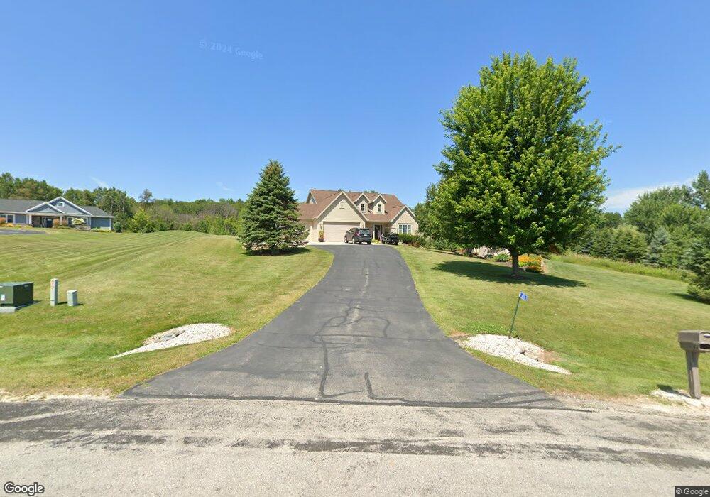
1550 Lake Cato Dr Reedsville, WI 54230
Estimated Value: $517,000 - $557,185
--
Bed
--
Bath
--
Sq Ft
1.62
Acres
About This Home
This home is located at 1550 Lake Cato Dr, Reedsville, WI 54230 and is currently estimated at $537,093. 1550 Lake Cato Dr is a home located in Manitowoc County with nearby schools including Valders Elementary School, Valders Middle School, and Valders High School.
Ownership History
Date
Name
Owned For
Owner Type
Purchase Details
Closed on
Jun 7, 2013
Sold by
Keesling Gary G
Bought by
Fitzgerald Jay and Fitzgerald Debra K
Current Estimated Value
Purchase Details
Closed on
Jun 20, 2011
Sold by
Keesling Nicole M
Bought by
Keesling Gary G
Home Financials for this Owner
Home Financials are based on the most recent Mortgage that was taken out on this home.
Original Mortgage
$239,500
Interest Rate
4.64%
Mortgage Type
New Conventional
Create a Home Valuation Report for This Property
The Home Valuation Report is an in-depth analysis detailing your home's value as well as a comparison with similar homes in the area
Home Values in the Area
Average Home Value in this Area
Purchase History
| Date | Buyer | Sale Price | Title Company |
|---|---|---|---|
| Fitzgerald Jay | $325,000 | -- | |
| Keesling Gary G | -- | None Available |
Source: Public Records
Mortgage History
| Date | Status | Borrower | Loan Amount |
|---|---|---|---|
| Previous Owner | Keesling Gary G | $239,500 |
Source: Public Records
Tax History Compared to Growth
Tax History
| Year | Tax Paid | Tax Assessment Tax Assessment Total Assessment is a certain percentage of the fair market value that is determined by local assessors to be the total taxable value of land and additions on the property. | Land | Improvement |
|---|---|---|---|---|
| 2024 | $5,763 | $383,400 | $34,300 | $349,100 |
| 2023 | $5,298 | $339,900 | $34,300 | $305,600 |
| 2022 | $5,152 | $339,900 | $34,300 | $305,600 |
| 2021 | $4,775 | $339,900 | $34,300 | $305,600 |
| 2020 | $4,700 | $249,200 | $16,600 | $232,600 |
| 2019 | $4,630 | $249,200 | $16,600 | $232,600 |
| 2018 | $4,700 | $249,200 | $16,600 | $232,600 |
| 2017 | $4,637 | $249,200 | $16,600 | $232,600 |
| 2016 | $4,724 | $249,200 | $16,600 | $232,600 |
| 2015 | $4,909 | $249,200 | $16,600 | $232,600 |
| 2014 | $4,986 | $249,200 | $16,600 | $232,600 |
| 2013 | $5,176 | $249,200 | $16,600 | $232,600 |
Source: Public Records
Map
Nearby Homes
- Lt1 Morgan Rd
- 535 W Menasha Ave
- 179 Hoover St
- 222 W Menasha Ave
- 0 Hickory St
- 0 Hickory St
- 156 W Menasha Ave
- 0 E Menasha Ave
- 354 E Menasha Ave
- 4064 Tuschl Ln
- 9213 Hilltop Rd
- 16904 Lax Chapel Rd
- 11530 San Rd
- 11319 U S 151
- 1922 Madson Rd
- 3227 Branch River Rd
- 7901 Middle Rd
- 8177 Middle Rd
- 227 S Calumet Rd
- 5509 Thunder Rd
- 1560 Golfside Ct
- 1538 Lake Cato Dr
- 1545 Golfside Ct
- 1573 Lake Cato Dr
- 1510 Lake Cato Dr
- 1553 Lake Cato Dr
- 1443 Lake Cato Dr
- 1575 Golfside Ct
- 1593 Lake Cato Dr
- 1555 Hempton Cir
- 1557 Hempton Cir
- 1650 Golfside Ct
- 1625 Golfside Ct
- 1468 Lake Cato Dr
- 1200 Lake Cato Dr
- 11820 Hillside Dr
- 1260 Lake Cato Dr
- 1549 Hempton Cir
- 1220 Lake Cato Dr
- 1561 Hempton Cir