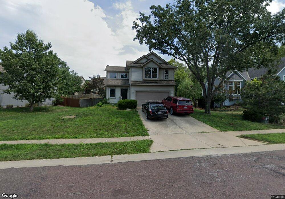
15501 Foster St Overland Park, KS 66223
South Overland Park NeighborhoodEstimated Value: $385,856 - $401,000
3
Beds
3
Baths
1,390
Sq Ft
$281/Sq Ft
Est. Value
About This Home
This home is located at 15501 Foster St, Overland Park, KS 66223 and is currently estimated at $391,214, approximately $281 per square foot. 15501 Foster St is a home located in Johnson County with nearby schools including Blue River Elementary School, Blue Valley Middle School, and Blue Valley High School.
Ownership History
Date
Name
Owned For
Owner Type
Purchase Details
Closed on
Oct 18, 2007
Sold by
Sissiqui Asif I and Sissiqui Momi
Bought by
J L White Company Llc
Current Estimated Value
Purchase Details
Closed on
Mar 17, 2004
Sold by
Mcnally Russell
Bought by
Siddiqui Asif I and Siddiqui Momi
Home Financials for this Owner
Home Financials are based on the most recent Mortgage that was taken out on this home.
Original Mortgage
$128,296
Interest Rate
5.71%
Mortgage Type
FHA
Create a Home Valuation Report for This Property
The Home Valuation Report is an in-depth analysis detailing your home's value as well as a comparison with similar homes in the area
Home Values in the Area
Average Home Value in this Area
Purchase History
| Date | Buyer | Sale Price | Title Company |
|---|---|---|---|
| J L White Company Llc | -- | Metro One Title | |
| Siddiqui Asif I | -- | Chicago Title Ins Co |
Source: Public Records
Mortgage History
| Date | Status | Borrower | Loan Amount |
|---|---|---|---|
| Previous Owner | Siddiqui Asif I | $128,296 |
Source: Public Records
Tax History Compared to Growth
Tax History
| Year | Tax Paid | Tax Assessment Tax Assessment Total Assessment is a certain percentage of the fair market value that is determined by local assessors to be the total taxable value of land and additions on the property. | Land | Improvement |
|---|---|---|---|---|
| 2024 | $4,378 | $43,056 | $8,543 | $34,513 |
| 2023 | $4,216 | $40,618 | $8,543 | $32,075 |
| 2022 | $3,563 | $33,775 | $8,543 | $25,232 |
| 2021 | $3,712 | $33,246 | $7,432 | $25,814 |
| 2020 | $3,619 | $32,212 | $5,949 | $26,263 |
| 2019 | $3,545 | $30,831 | $3,965 | $26,866 |
| 2018 | $3,251 | $27,772 | $3,966 | $23,806 |
| 2017 | $3,075 | $25,817 | $3,966 | $21,851 |
| 2016 | $2,959 | $24,828 | $3,966 | $20,862 |
| 2015 | $2,831 | $23,678 | $3,966 | $19,712 |
| 2013 | -- | $21,095 | $3,966 | $17,129 |
Source: Public Records
Map
Nearby Homes
- 15530 Marty St
- 15416 Floyd St
- 15607 Conser St
- 15409 Conser St
- 15715 Travis St
- 15612 Barkley St
- 7842 W 156th Place
- 7907 W 154th St
- 7905 W 155th Place
- 15021 Broadmoor St
- 7863 W 158th St
- 7862 W 158th Ct
- 15686 Lowell Ln
- 6115 W 157th St
- 15090 Walmer St
- 8503 W 153rd St
- 14927 Riggs St
- 15590 Antioch Rd
- 7633 W 148th Terrace
- 15450 Antioch Rd
- 15473 Foster St
- 15505 Foster St
- 15436 Marty St
- 15469 Foster St
- 15509 Foster St
- 15432 Marty St
- 15428 Marty St
- 15500 Foster St
- 15440 Marty St
- 15474 Foster St
- 15504 Foster St
- 15465 Foster St
- 15470 Foster St
- 15424 Marty St
- 15442 Marty St
- 15513 Foster St
- 15508 Foster St
- 15466 Foster St
- 15461 Foster St
- 15446 Marty St