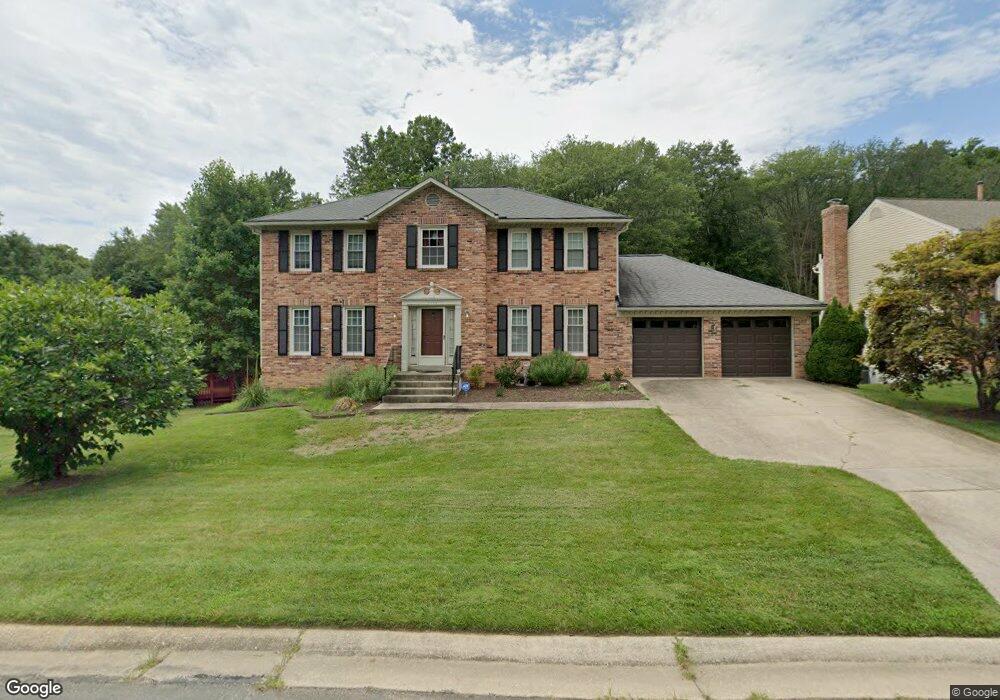
15504 Langside St Silver Spring, MD 20905
Estimated Value: $654,323 - $792,000
4
Beds
4
Baths
2,180
Sq Ft
$331/Sq Ft
Est. Value
About This Home
This home is located at 15504 Langside St, Silver Spring, MD 20905 and is currently estimated at $721,081, approximately $330 per square foot. 15504 Langside St is a home located in Montgomery County with nearby schools including Cloverly Elementary School, Briggs Chaney Middle School, and Paint Branch High School.
Ownership History
Date
Name
Owned For
Owner Type
Purchase Details
Closed on
Jun 28, 2011
Sold by
Mirotznik Mark S and Mirotznik Rukmini R
Bought by
Biswas Gopa
Current Estimated Value
Home Financials for this Owner
Home Financials are based on the most recent Mortgage that was taken out on this home.
Original Mortgage
$432,000
Outstanding Balance
$298,183
Interest Rate
4.58%
Mortgage Type
New Conventional
Estimated Equity
$422,898
Purchase Details
Closed on
Jul 2, 1998
Sold by
B Carey T and B Fisher M
Bought by
R Mark S and R Mirotznik R
Create a Home Valuation Report for This Property
The Home Valuation Report is an in-depth analysis detailing your home's value as well as a comparison with similar homes in the area
Home Values in the Area
Average Home Value in this Area
Purchase History
| Date | Buyer | Sale Price | Title Company |
|---|---|---|---|
| Biswas Gopa | $480,000 | First American Title Insuran | |
| R Mark S | $265,000 | -- |
Source: Public Records
Mortgage History
| Date | Status | Borrower | Loan Amount |
|---|---|---|---|
| Open | Biswas Gopa | $432,000 |
Source: Public Records
Tax History
| Year | Tax Paid | Tax Assessment Tax Assessment Total Assessment is a certain percentage of the fair market value that is determined by local assessors to be the total taxable value of land and additions on the property. | Land | Improvement |
|---|---|---|---|---|
| 2025 | $6,612 | $586,833 | -- | -- |
| 2024 | $6,612 | $535,467 | $0 | $0 |
| 2023 | $6,689 | $484,100 | $216,300 | $267,800 |
| 2022 | $4,945 | $473,867 | $0 | $0 |
| 2021 | $4,640 | $463,633 | $0 | $0 |
| 2020 | $4,640 | $453,400 | $216,300 | $237,100 |
| 2019 | $4,625 | $453,400 | $216,300 | $237,100 |
| 2018 | $4,626 | $453,400 | $216,300 | $237,100 |
| 2017 | $4,949 | $474,000 | $0 | $0 |
| 2016 | -- | $466,200 | $0 | $0 |
| 2015 | $4,984 | $458,400 | $0 | $0 |
| 2014 | $4,984 | $450,600 | $0 | $0 |
Source: Public Records
Map
Nearby Homes
- 1320 Rainbow Dr
- 1600 Rainbow Dr
- 15408 Valencia St
- 15801 New Hampshire Ave
- 1400 Spencerville Rd
- 1225 Spencerville Rd
- 15533 Thompson Rd
- 1701 Maydale Dr
- 14917 Claude Ln
- 1804 Briggs Chaney Rd
- 2307 Spencerville Rd
- 15330 Hildegard Ln
- 1401 Elm Grove Cir
- 15022 Snowden Dr
- 550 Bryants Nursery Rd
- 401 Bryants Nursery Rd
- 2304 Holly Spring Dr
- 4 Ansted Ct
- 1309 Swingingdale Dr
- 16612 Medinah Ct
- 15508 Langside St
- 15500 Langside St
- 15512 Langside St
- 15505 Langside St
- 15511 Langside St
- 1500 Rainbow Dr
- 15516 Langside St
- 1413 Rainbow Dr
- 1505 Urciolo Ct
- 1504 Urciolo Ct
- 15515 Langside St
- 1504 Rainbow Dr
- 1501 Rainbow Dr
- 15520 Langside St
- 1512 Urciolo Ct
- 15519 Langside St
- 15416 Langside St
- 1509 Urciolo Ct
- 1508 Rainbow Dr
- 1501 Foster Rd
Your Personal Tour Guide
Ask me questions while you tour the home.