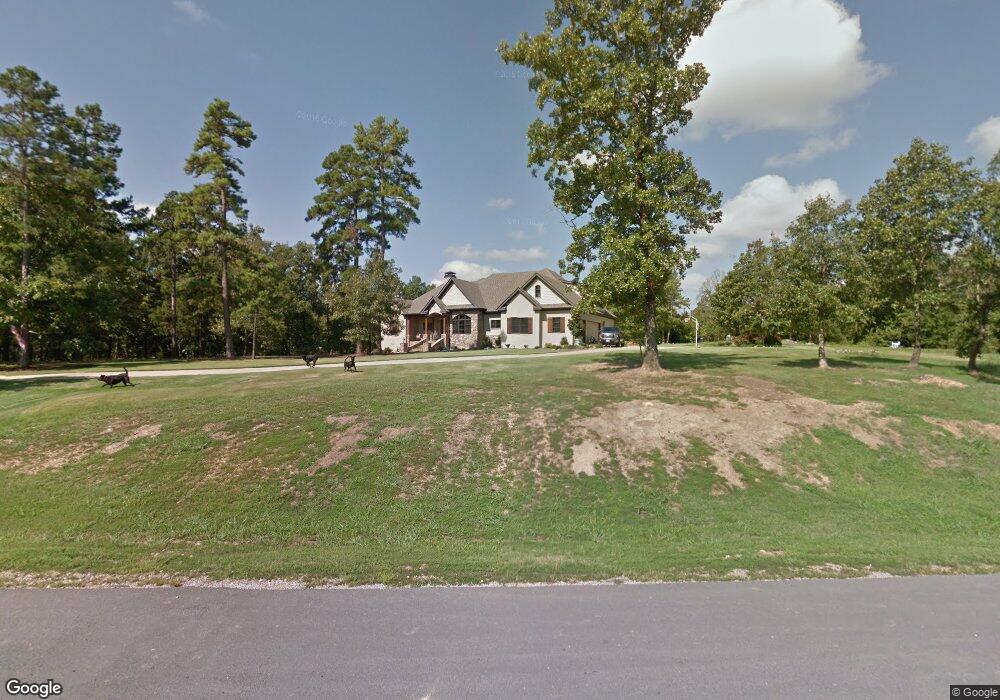
1551 N Silverthorne Dr Little Rock, AR 72210
Estimated Value: $641,000 - $811,000
--
Bed
3
Baths
3,768
Sq Ft
$189/Sq Ft
Est. Value
About This Home
This home is located at 1551 N Silverthorne Dr, Little Rock, AR 72210 and is currently estimated at $713,753, approximately $189 per square foot. 1551 N Silverthorne Dr is a home located in Saline County with nearby schools including Chenal Elementary School, Joe T. Robinson Middle School, and Joe T. Robinson High School.
Ownership History
Date
Name
Owned For
Owner Type
Purchase Details
Closed on
Aug 3, 2020
Sold by
Conyer Jerry D and Daerr Lisa Rene
Bought by
Conyer Jerry D and Daerr Lisa Rene
Current Estimated Value
Home Financials for this Owner
Home Financials are based on the most recent Mortgage that was taken out on this home.
Original Mortgage
$357,500
Outstanding Balance
$253,847
Interest Rate
3%
Mortgage Type
New Conventional
Estimated Equity
$459,906
Purchase Details
Closed on
Jun 2, 2006
Sold by
Ives & Associates Inc
Bought by
Conyer Jerry D and Conyer Lisa Rene
Create a Home Valuation Report for This Property
The Home Valuation Report is an in-depth analysis detailing your home's value as well as a comparison with similar homes in the area
Home Values in the Area
Average Home Value in this Area
Purchase History
| Date | Buyer | Sale Price | Title Company |
|---|---|---|---|
| Conyer Jerry D | -- | Pulaski County Title | |
| Conyer Jerry D | -- | -- | |
| Conyer Jerry D | $114,000 | -- |
Source: Public Records
Mortgage History
| Date | Status | Borrower | Loan Amount |
|---|---|---|---|
| Open | Conyer Jerry D | $357,500 |
Source: Public Records
Tax History Compared to Growth
Tax History
| Year | Tax Paid | Tax Assessment Tax Assessment Total Assessment is a certain percentage of the fair market value that is determined by local assessors to be the total taxable value of land and additions on the property. | Land | Improvement |
|---|---|---|---|---|
| 2025 | $5,091 | $109,357 | $20,944 | $88,413 |
| 2024 | $5,091 | $109,357 | $20,944 | $88,413 |
| 2023 | $5,690 | $109,357 | $20,944 | $88,413 |
| 2022 | $5,473 | $109,357 | $20,944 | $88,413 |
| 2021 | $5,252 | $87,840 | $17,140 | $70,700 |
| 2020 | $5,252 | $87,840 | $17,140 | $70,700 |
| 2019 | $5,252 | $87,840 | $17,140 | $70,700 |
| 2018 | $5,277 | $87,840 | $17,140 | $70,700 |
| 2017 | $5,164 | $87,840 | $17,140 | $70,700 |
| 2016 | $4,108 | $81,510 | $17,140 | $64,370 |
| 2015 | $4,908 | $81,510 | $17,140 | $64,370 |
| 2014 | $4,908 | $81,510 | $17,140 | $64,370 |
Source: Public Records
Map
Nearby Homes
- 1703 Crested Butte Cir
- 2056 Gunnison Dr
- 20377 Congo Ferndale Rd
- 12433 Raindrop Ln
- 0 Serenity Dr
- 000 W Colonel Glenn Rd
- 28721 Kanis Rd
- 23 Witness Tree Ln
- 32315 Kanis Rd
- 466 Rock Ridge Rd
- 39 Golden Eagle Dr
- 3110 Ferndale Cut Off Rd
- 211 County Line Rd
- 24923 Colonel Glenn Rd
- 225 Red Hawk Cir
- 6111 Crestwood Ln
- 44 Bald Eagle Dr
- 0 Bandy South E Unit 22022758
- 1516 E Lawson Rd Unit 1512
- 0 Bandy Road South W Unit 22020705
- Lot 9 Silverthorne
- 1539 N Silverthorne Dr
- 1816 Somerset Cove
- 1807 Somerset Cove
- 1564 N Silverthorne Dr
- 1817 Somerset Cove
- 1529 N Silverthorne Dr
- 1528 N Silverthorne Dr
- 2000 Boulder Cir
- 0 Boulder Cir
- 1718 Vail Cove
- 3001 Montrose Cir
- 2001 Boulder Cir
- 1519 N Silverthorne Dr
- 1128 Westcliffe Dr
- 3000 Montrose Cir
- 1730 Vail Cove
- 1719 Vail Cove
- 1110 Westcliffe Dr
- 1122 Westcliffe Dr