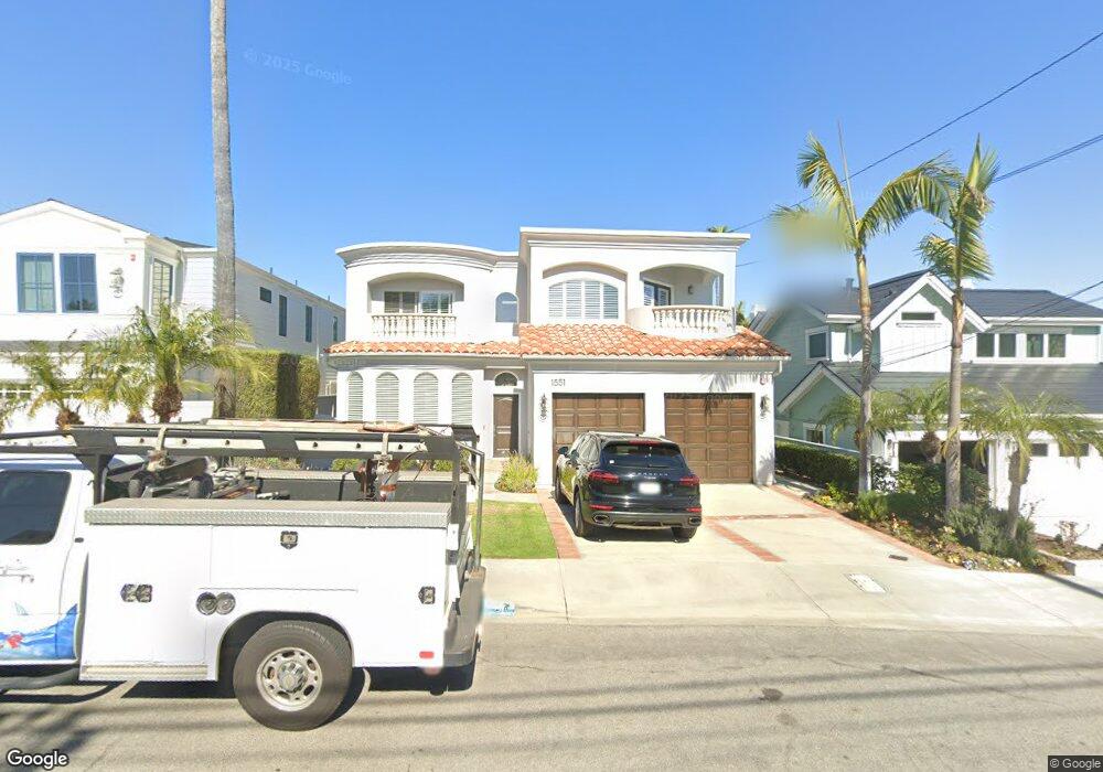
1551 Voorhees Ave Manhattan Beach, CA 90266
Estimated Value: $2,918,000 - $3,573,000
3
Beds
2
Baths
1,167
Sq Ft
$2,891/Sq Ft
Est. Value
About This Home
This home is located at 1551 Voorhees Ave, Manhattan Beach, CA 90266 and is currently estimated at $3,373,892, approximately $2,891 per square foot. 1551 Voorhees Ave is a home located in Los Angeles County with nearby schools including Aurelia Pennekamp Elementary School, Manhattan Beach Middle School, and Mira Costa High School.
Ownership History
Date
Name
Owned For
Owner Type
Purchase Details
Closed on
Aug 7, 2003
Sold by
Young Michael David and Young Debra Lynn
Bought by
Young Michael David
Current Estimated Value
Purchase Details
Closed on
Nov 21, 1995
Sold by
Moloney Dennis
Bought by
Young Michael D and Young Debra Lyn
Home Financials for this Owner
Home Financials are based on the most recent Mortgage that was taken out on this home.
Original Mortgage
$614,400
Outstanding Balance
$8,446
Interest Rate
7.42%
Estimated Equity
$3,365,446
Purchase Details
Closed on
Feb 10, 1995
Sold by
Morgen Andrew Charles and Morgen Delphia A
Bought by
Moloney Dennis
Home Financials for this Owner
Home Financials are based on the most recent Mortgage that was taken out on this home.
Original Mortgage
$481,000
Interest Rate
8.81%
Mortgage Type
Construction
Create a Home Valuation Report for This Property
The Home Valuation Report is an in-depth analysis detailing your home's value as well as a comparison with similar homes in the area
Home Values in the Area
Average Home Value in this Area
Purchase History
| Date | Buyer | Sale Price | Title Company |
|---|---|---|---|
| Young Michael David | -- | -- | |
| Young Michael D | $768,000 | Commonwealth Land Title | |
| Moloney Dennis | $331,000 | Commonwealth Land Title |
Source: Public Records
Mortgage History
| Date | Status | Borrower | Loan Amount |
|---|---|---|---|
| Open | Young Michael D | $614,400 | |
| Previous Owner | Moloney Dennis | $481,000 | |
| Closed | Young Michael D | $22,000 |
Source: Public Records
Tax History Compared to Growth
Tax History
| Year | Tax Paid | Tax Assessment Tax Assessment Total Assessment is a certain percentage of the fair market value that is determined by local assessors to be the total taxable value of land and additions on the property. | Land | Improvement |
|---|---|---|---|---|
| 2025 | $15,208 | $1,317,097 | $549,039 | $768,058 |
| 2024 | $15,208 | $1,291,273 | $538,274 | $752,999 |
| 2023 | $14,736 | $1,265,955 | $527,720 | $738,235 |
| 2022 | $14,485 | $1,241,133 | $517,373 | $723,760 |
| 2021 | $14,248 | $1,216,798 | $507,229 | $709,569 |
| 2019 | $13,871 | $1,180,709 | $492,185 | $688,524 |
| 2018 | $13,550 | $1,157,559 | $482,535 | $675,024 |
| 2016 | $12,492 | $1,112,612 | $463,799 | $648,813 |
| 2015 | $12,236 | $1,095,901 | $456,833 | $639,068 |
| 2014 | $12,070 | $1,074,435 | $447,885 | $626,550 |
Source: Public Records
Map
Nearby Homes
- 1500 2nd St
- 1756 Ruhland Ave
- 1758 Reed St
- 1752 Dixon St
- 1752 Carver St
- 207 S Aviation Blvd
- 1643 3rd St
- 1742 Reed St
- 2406 Aviation Blvd Unit C
- 1902 Gates Ave
- 615 Aviation Way
- 2700 Aviation Blvd
- 1711 Axenty Way
- 1623 Carver St
- 1906 Plant Ave
- 1900 Vanderbilt Ln
- 461 Chabela Dr
- 1861 Harper Ave
- 1722 Rockefeller Ln
- 1757 8th St
- 1555 Voorhees Ave
- 1545 Voorhees Ave
- 1561 Voorhees Ave
- 1541 Voorhees Ave
- 1535 Voorhees Ave
- 1550 Curtis Ave
- 1554 Curtis Ave
- 1544 Curtis Ave
- 1560 Curtis Ave
- 1540 Curtis Ave
- 1550 Voorhees Ave
- 1601 Voorhees Ave
- 1544 Voorhees Ave
- 1554 Voorhees Ave
- 1531 Voorhees Ave
- 1534 Curtis Ave
- 1540 Voorhees Ave
- 1560 Voorhees Ave
- 1600 Curtis Ave
- 1607 Voorhees Ave