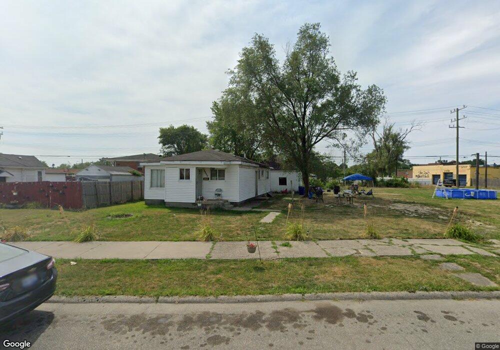
15510 Evanston St Detroit, MI 48224
Outer Drive-Hayes NeighborhoodEstimated Value: $41,202 - $82,000
--
Bed
1
Bath
680
Sq Ft
$94/Sq Ft
Est. Value
About This Home
This home is located at 15510 Evanston St, Detroit, MI 48224 and is currently estimated at $63,801, approximately $93 per square foot. 15510 Evanston St is a home located in Wayne County with nearby schools including Wayne Elementary School, Edward 'Duke' Ellington Conservatory of Music and Art, and Charles L. Spain Elementary-Middle School.
Ownership History
Date
Name
Owned For
Owner Type
Purchase Details
Closed on
Apr 8, 2017
Sold by
The Detroit Land Bank Authority
Bought by
Brown Tyisha
Current Estimated Value
Purchase Details
Closed on
May 19, 2014
Sold by
The City Of Detroit
Bought by
The Detroit Land Bank Authority
Purchase Details
Closed on
Jan 19, 2010
Sold by
Wojtowicz Raymond J
Bought by
Planning & Development Dept City Of Detr
Purchase Details
Closed on
Nov 7, 2002
Sold by
Douglas Brenda
Bought by
Credit Based Asset Servicing & Secu
Create a Home Valuation Report for This Property
The Home Valuation Report is an in-depth analysis detailing your home's value as well as a comparison with similar homes in the area
Home Values in the Area
Average Home Value in this Area
Purchase History
| Date | Buyer | Sale Price | Title Company |
|---|---|---|---|
| Brown Tyisha | -- | None Available | |
| The Detroit Land Bank Authority | -- | None Available | |
| Planning & Development Dept City Of Detr | -- | None Available | |
| Credit Based Asset Servicing & Secu | $29,095 | -- |
Source: Public Records
Tax History Compared to Growth
Tax History
| Year | Tax Paid | Tax Assessment Tax Assessment Total Assessment is a certain percentage of the fair market value that is determined by local assessors to be the total taxable value of land and additions on the property. | Land | Improvement |
|---|---|---|---|---|
| 2025 | $23 | $700 | $0 | $0 |
| 2024 | $23 | $300 | $0 | $0 |
| 2023 | $23 | $300 | $0 | $0 |
| 2022 | $26 | $300 | $0 | $0 |
| 2021 | $26 | $300 | $0 | $0 |
| 2020 | $26 | $300 | $0 | $0 |
| 2019 | $0 | $0 | $0 | $0 |
| 2018 | $0 | $0 | $0 | $0 |
| 2017 | -- | $0 | $0 | $0 |
| 2016 | -- | $0 | $0 | $0 |
| 2015 | -- | $0 | $0 | $0 |
| 2013 | $857 | $0 | $0 | $0 |
| 2010 | -- | $9,418 | $597 | $8,821 |
Source: Public Records
Map
Nearby Homes
- 9437 Beaconsfield St
- 9205 Mckinney St
- 5920 Nottingham Rd
- 15231 Evanston St
- 9833 Berkshire St
- 9803 Nottingham Rd
- 15837 Evanston St
- 9500 Lakepointe St
- 5766 Nottingham Rd
- 9154 Wayburn St
- 9204 Wayburn St
- 5808 Lakepointe St
- 5903 Lakepointe St
- 9300 Mckinney St
- 9509 Lakepointe St
- 9316 Mckinney St
- 9910 Somerset Ave
- 5759 Barham St
- 10043 Berkshire St
- 9131 Wayburn St
- 15502 Evanston St
- 15520 Evanston St
- 15524 Evanston St
- 15532 Evanston St
- 15537 Harper Ave Unit 8
- 15537 Harper Ave
- 15540 Evanston St
- 9114 Nottingham Rd
- 15445 Harper Ave
- 9105 Somerset Ave
- 15414 Evanston St
- 9119 Nottingham Rd
- 9403 Somerset Ave
- 15408 Evanston St
- 15415 Harper Ave
- 9110 Beaconsfield St
- 9100 Beaconsfield St
- 9118 Beaconsfield St
- 9124 Beaconsfield St
- 9403 Nottingham Rd