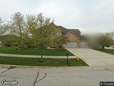
15516 Julies Way Orland Park, IL 60462
Centennial NeighborhoodEstimated Value: $674,562 - $765,000
4
Beds
3
Baths
3,078
Sq Ft
$236/Sq Ft
Est. Value
About This Home
This home is located at 15516 Julies Way, Orland Park, IL 60462 and is currently estimated at $727,141, approximately $236 per square foot. 15516 Julies Way is a home located in Cook County with nearby schools including Centennial School, Meadow Ridge School, and Century Junior High School.
Ownership History
Date
Name
Owned For
Owner Type
Purchase Details
Closed on
Feb 24, 2006
Sold by
State Bank Of Countryside
Bought by
Sanders James and Sanders Jacqueline
Current Estimated Value
Home Financials for this Owner
Home Financials are based on the most recent Mortgage that was taken out on this home.
Original Mortgage
$488,000
Interest Rate
6.33%
Mortgage Type
Fannie Mae Freddie Mac
Create a Home Valuation Report for This Property
The Home Valuation Report is an in-depth analysis detailing your home's value as well as a comparison with similar homes in the area
Home Values in the Area
Average Home Value in this Area
Purchase History
| Date | Buyer | Sale Price | Title Company |
|---|---|---|---|
| Sanders James | $610,000 | Atg |
Source: Public Records
Mortgage History
| Date | Status | Borrower | Loan Amount |
|---|---|---|---|
| Open | Sanders James | $335,000 | |
| Closed | Sanders James | $342,500 | |
| Closed | Sanders James | $411,000 | |
| Closed | Sanders James | $417,000 | |
| Closed | Sanders James | $416,000 | |
| Closed | Sanders James | $50,400 | |
| Closed | Sanders James | $488,000 |
Source: Public Records
Tax History Compared to Growth
Tax History
| Year | Tax Paid | Tax Assessment Tax Assessment Total Assessment is a certain percentage of the fair market value that is determined by local assessors to be the total taxable value of land and additions on the property. | Land | Improvement |
|---|---|---|---|---|
| 2024 | $10,543 | $60,830 | $10,320 | $50,510 |
| 2023 | $10,543 | $65,000 | $10,320 | $54,680 |
| 2022 | $10,543 | $38,616 | $8,944 | $29,672 |
| 2021 | $10,208 | $38,616 | $8,944 | $29,672 |
| 2020 | $11,215 | $43,376 | $8,944 | $34,432 |
| 2019 | $11,784 | $46,362 | $8,256 | $38,106 |
| 2018 | $11,460 | $46,362 | $8,256 | $38,106 |
| 2017 | $11,216 | $46,362 | $8,256 | $38,106 |
| 2016 | $9,918 | $38,040 | $7,568 | $30,472 |
| 2015 | $11,738 | $45,097 | $7,568 | $37,529 |
| 2014 | $11,579 | $45,097 | $7,568 | $37,529 |
| 2013 | $13,029 | $53,462 | $7,568 | $45,894 |
Source: Public Records
Map
Nearby Homes
- 10607 Paige Cir
- 10609 Owain Way
- 10821 Jillian Rd
- 10649 Gabrielle Ln
- 10651 Gabrielle Ln
- 15391 Silver Bell Rd
- 15753 Scotsglen Rd
- 15810 Scotsglen Rd
- 15760 108th Ave
- 10855 W 153rd St
- 15150 109th Ave
- 10227 Hilltop Dr
- 15217 Penrose Ct
- 15125 Penrose Ct
- 15245 Penrose Ct
- 11155 Lizmore Ln Unit 35B
- 11060 Lizmore Ln Unit 27B
- 15603 112th Ct
- 15156 Highland Ave
- 10639 Misty Hill Rd
- 15516 Julies Way
- 10625 Penfield Dr
- 15524 Julies Way
- 10624 Bonnieglen Place
- 10633 Penfield Dr
- 10632 Bonnieglen Place
- 15509 Julies Way
- 10616 Penfield Dr
- 10624 Penfield Dr
- 15525 Julies Way
- 10641 Penfield Dr
- 10632 Penfield Dr
- 10608 Penfield Dr
- 15544 Julies Way
- 10640 Bonnieglen Place
- 15533 Julies Way
- 10625 Bonnieglen Place
- 10640 Penfield Dr
- 10608 Paige Cir
- 10701 Penfield Dr