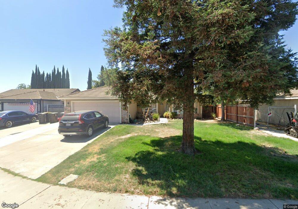
15521 Pamela Ct Lathrop, CA 95330
East Lathrop NeighborhoodEstimated Value: $384,000 - $527,000
3
Beds
2
Baths
1,568
Sq Ft
$309/Sq Ft
Est. Value
About This Home
This home is located at 15521 Pamela Ct, Lathrop, CA 95330 and is currently estimated at $484,618, approximately $309 per square foot. 15521 Pamela Ct is a home located in San Joaquin County with nearby schools including Lathrop Elementary School, Lathrop High School, and Nextgeneration Steam Academy.
Ownership History
Date
Name
Owned For
Owner Type
Purchase Details
Closed on
Jul 23, 2018
Sold by
Corona Jose and Corona Sylvia
Bought by
Corona Jose Santana and Corona Sylvia Soto
Current Estimated Value
Purchase Details
Closed on
Jan 24, 1996
Sold by
Thomsen Christopher William and Hartman Katherine Ann
Bought by
Corona Jose and Corona Sylvia
Home Financials for this Owner
Home Financials are based on the most recent Mortgage that was taken out on this home.
Original Mortgage
$129,847
Outstanding Balance
$3,467
Interest Rate
7.18%
Mortgage Type
FHA
Estimated Equity
$481,151
Create a Home Valuation Report for This Property
The Home Valuation Report is an in-depth analysis detailing your home's value as well as a comparison with similar homes in the area
Home Values in the Area
Average Home Value in this Area
Purchase History
| Date | Buyer | Sale Price | Title Company |
|---|---|---|---|
| Corona Jose Santana | -- | None Available | |
| Corona Jose | $130,500 | Fidelity National Title |
Source: Public Records
Mortgage History
| Date | Status | Borrower | Loan Amount |
|---|---|---|---|
| Open | Corona Jose | $129,847 |
Source: Public Records
Tax History Compared to Growth
Tax History
| Year | Tax Paid | Tax Assessment Tax Assessment Total Assessment is a certain percentage of the fair market value that is determined by local assessors to be the total taxable value of land and additions on the property. | Land | Improvement |
|---|---|---|---|---|
| 2025 | $2,820 | $217,288 | $83,054 | $134,234 |
| 2024 | $2,779 | $213,028 | $81,426 | $131,602 |
| 2023 | $2,684 | $208,852 | $79,830 | $129,022 |
| 2022 | $2,646 | $204,758 | $78,265 | $126,493 |
| 2021 | $2,618 | $200,744 | $76,731 | $124,013 |
| 2020 | $2,524 | $198,687 | $75,945 | $122,742 |
| 2019 | $2,494 | $194,792 | $74,456 | $120,336 |
| 2018 | $2,462 | $190,974 | $72,997 | $117,977 |
| 2017 | $2,430 | $187,230 | $71,566 | $115,664 |
| 2016 | $2,377 | $183,559 | $70,163 | $113,396 |
| 2014 | $2,230 | $177,262 | $67,756 | $109,506 |
Source: Public Records
Map
Nearby Homes
- 15820 S Harlan Rd Unit 51
- 15820 S Harlan Rd Unit 85
- 15820 S Harlan Rd Unit 158
- 15820 S Harlan Rd Unit 111
- 337 Gardner Place
- 334 Osage Place
- 15150 Hollyhock Ct
- 16280 Julie Ln
- 323 Sacramento St
- 365 E Louise Ave Unit 3
- 365 E Louise Ave Unit 12
- 3104 Needham Ave
- 2859 Wylin Blvd
- 15364 Barbara Terry Blvd
- 407 Sacramento St
- Macon II Plan at Stanford Crossing - Pacifica
- Oban Plan at Stanford Crossing - Pacifica
- Knoxville Plan at Stanford Crossing - Pacifica
- 14224 S Harlan Rd
- 14539 Cedar Valley Dr
- 15535 Pamela Ct
- 15501 Pamela Ct
- 192 Chandra Way
- 15543 Pamela Ct
- 174 Chandra Way
- 15520 Lottie Way
- 15530 Lottie Way
- 15510 Pamela Ct
- 15540 Lottie Way
- 15510 Lottie Way
- 15532 Pamela Ct
- 215 Patricia Place
- 229 Patricia Place
- 15540 Pamela Ct
- 201 Patricia Place
- 15556 Pamela Ct
- 241 Patricia Place
- 187 Chandra Way
- 211 Chandra Way
- 256 Chandra Way