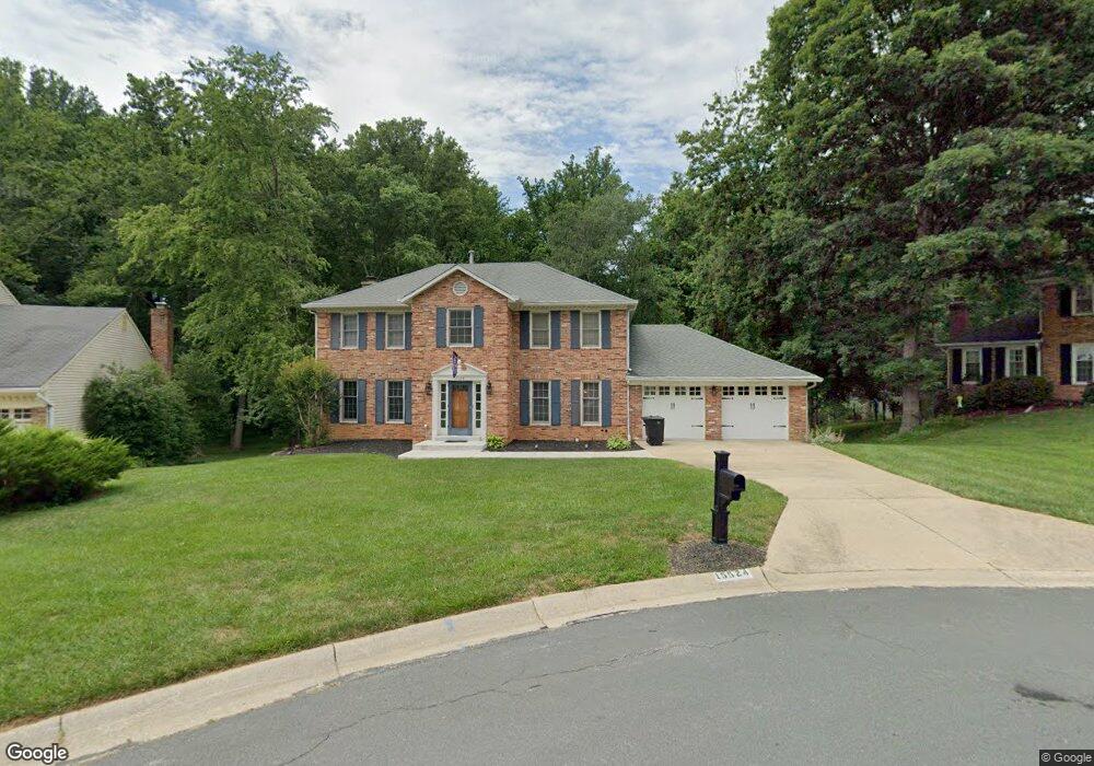
15524 Langside St Silver Spring, MD 20905
Estimated Value: $627,454 - $787,000
Studio
3
Baths
2,180
Sq Ft
$319/Sq Ft
Est. Value
About This Home
This home is located at 15524 Langside St, Silver Spring, MD 20905 and is currently estimated at $695,114, approximately $318 per square foot. 15524 Langside St is a home located in Montgomery County with nearby schools including Cloverly Elementary School, Briggs Chaney Middle School, and Paint Branch High School.
Ownership History
Date
Name
Owned For
Owner Type
Purchase Details
Closed on
Sep 5, 2017
Sold by
Madron Rick D and Madron Jacquelyn
Bought by
Duffy Stephen J and Duffy Whitney S
Current Estimated Value
Home Financials for this Owner
Home Financials are based on the most recent Mortgage that was taken out on this home.
Original Mortgage
$460,750
Outstanding Balance
$384,345
Interest Rate
3.86%
Mortgage Type
New Conventional
Estimated Equity
$310,769
Purchase Details
Closed on
Jun 24, 1988
Bought by
Madron Rick D and Madron J
Create a Home Valuation Report for This Property
The Home Valuation Report is an in-depth analysis detailing your home's value as well as a comparison with similar homes in the area
Home Values in the Area
Average Home Value in this Area
Purchase History
| Date | Buyer | Sale Price | Title Company |
|---|---|---|---|
| Duffy Stephen J | $485,000 | Freederal Title & Escrow Co | |
| Madron Rick D | $230,000 | -- |
Source: Public Records
Mortgage History
| Date | Status | Borrower | Loan Amount |
|---|---|---|---|
| Open | Duffy Stephen J | $460,750 |
Source: Public Records
Tax History Compared to Growth
Tax History
| Year | Tax Paid | Tax Assessment Tax Assessment Total Assessment is a certain percentage of the fair market value that is determined by local assessors to be the total taxable value of land and additions on the property. | Land | Improvement |
|---|---|---|---|---|
| 2025 | $6,394 | $562,933 | -- | -- |
| 2024 | $6,394 | $516,567 | $0 | $0 |
| 2023 | $6,529 | $470,200 | $228,200 | $242,000 |
| 2022 | $4,802 | $460,933 | $0 | $0 |
| 2021 | $4,519 | $451,667 | $0 | $0 |
| 2020 | $4,519 | $442,400 | $228,200 | $214,200 |
| 2019 | $4,504 | $442,400 | $228,200 | $214,200 |
| 2018 | $4,505 | $442,400 | $228,200 | $214,200 |
| 2017 | $4,803 | $461,000 | $0 | $0 |
| 2016 | -- | $453,067 | $0 | $0 |
| 2015 | $4,790 | $445,133 | $0 | $0 |
| 2014 | $4,790 | $437,200 | $0 | $0 |
Source: Public Records
Map
Nearby Homes
- 15408 Valencia St
- 15801 New Hampshire Ave
- 1225 Spencerville Rd
- 1913 Hopefield Rd
- 15533 Thompson Rd
- 1701 Maydale Dr
- 14820 Windmill Terrace
- 2307 Spencerville Rd
- 601 Bryants Nursery Rd
- 15330 Hildegard Ln
- 550 Bryants Nursery Rd
- 401 Bryants Nursery Rd
- 15101 Snowden Dr
- 1109 Cavendish Dr
- 16612 Medinah Ct
- 14612 Fairacres Rd
- 14308 Ansted Rd
- 15325 Holly Grove Rd
- 14816 Stonegate Terrace
- 2 Piping Rock Dr
- 15520 Langside St
- 15528 Langside St
- 15527 Langside St
- 1501 Foster Rd
- 15516 Langside St
- 1507 Foster Rd
- 15519 Langside St
- 1511 Foster Rd
- 1503 Foster Rd
- 15515 Langside St
- 15523 Langside St
- 1515 Foster Rd
- 15512 Langside St
- 15613 Evesham Place
- 15511 Langside St
- 15617 Evesham Place
- 1516 Urciolo Ct
- 15508 Langside St
- 1512 Urciolo Ct
- 1504 Urciolo Ct