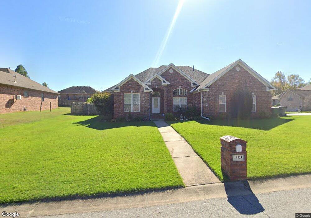
15525 Hartford St Little Rock, AR 72223
Estimated Value: $358,000 - $424,000
--
Bed
3
Baths
2,444
Sq Ft
$163/Sq Ft
Est. Value
About This Home
This home is located at 15525 Hartford St, Little Rock, AR 72223 and is currently estimated at $398,649, approximately $163 per square foot. 15525 Hartford St is a home located in Pulaski County with nearby schools including Baker Interdistrict Elementary School, Joe T. Robinson Middle School, and Joe T. Robinson High School.
Ownership History
Date
Name
Owned For
Owner Type
Purchase Details
Closed on
Oct 20, 2009
Sold by
Kennedy Joshua L and Kennedy Marcilyn R
Bought by
Mathew Rony and Easo Mini
Current Estimated Value
Home Financials for this Owner
Home Financials are based on the most recent Mortgage that was taken out on this home.
Original Mortgage
$247,435
Outstanding Balance
$161,158
Interest Rate
5.03%
Mortgage Type
FHA
Estimated Equity
$237,491
Purchase Details
Closed on
Mar 31, 2006
Sold by
M & M Development Inc
Bought by
Kennedy Joshua L and Kennedy Marcilyn R
Home Financials for this Owner
Home Financials are based on the most recent Mortgage that was taken out on this home.
Original Mortgage
$167,000
Interest Rate
6.12%
Mortgage Type
Fannie Mae Freddie Mac
Purchase Details
Closed on
Aug 18, 2005
Sold by
Capitol Lakes Management Llc
Bought by
M & M Development Inc
Create a Home Valuation Report for This Property
The Home Valuation Report is an in-depth analysis detailing your home's value as well as a comparison with similar homes in the area
Home Values in the Area
Average Home Value in this Area
Purchase History
| Date | Buyer | Sale Price | Title Company |
|---|---|---|---|
| Mathew Rony | $252,000 | Stewart Title Of Ar Inc | |
| Kennedy Joshua L | $252,000 | Multiple | |
| M & M Development Inc | $43,000 | Lenders Title Co |
Source: Public Records
Mortgage History
| Date | Status | Borrower | Loan Amount |
|---|---|---|---|
| Open | Mathew Rony | $247,435 | |
| Previous Owner | Kennedy Joshua L | $167,000 |
Source: Public Records
Tax History Compared to Growth
Tax History
| Year | Tax Paid | Tax Assessment Tax Assessment Total Assessment is a certain percentage of the fair market value that is determined by local assessors to be the total taxable value of land and additions on the property. | Land | Improvement |
|---|---|---|---|---|
| 2025 | $3,847 | $67,988 | $9,600 | $58,388 |
| 2024 | $3,527 | $67,988 | $9,600 | $58,388 |
| 2023 | $3,527 | $67,988 | $9,600 | $58,388 |
| 2022 | $3,554 | $67,988 | $9,600 | $58,388 |
| 2021 | $3,419 | $49,870 | $7,900 | $41,970 |
| 2020 | $3,019 | $49,870 | $7,900 | $41,970 |
| 2019 | $3,019 | $49,870 | $7,900 | $41,970 |
| 2018 | $3,044 | $49,870 | $7,900 | $41,970 |
| 2017 | $3,044 | $49,870 | $7,900 | $41,970 |
| 2016 | $3,377 | $52,520 | $6,800 | $45,720 |
| 2015 | $3,219 | $52,520 | $6,800 | $45,720 |
| 2014 | $3,219 | $52,520 | $6,800 | $45,720 |
Source: Public Records
Map
Nearby Homes
- 15516 Hartford St
- 901 Cape St
- 8 Pennsylvania Ct
- 728 Edgewood Cir
- 16 Driftwood Ln
- 22 Driftwood Ln
- 20 Driftwood Ln
- 102 Edgewood Cir
- 14905 Pride Valley Rd
- 27001 Kanis Rd
- 11 Flatrock Point
- 90 Copper Cir
- 208 Kanis Ridge Dr
- 8 Weatherstone Point
- 6 Weatherstone Point
- 710 Edgewood Cir
- 16300 Cooper Orbit Rd
- 301 Kanis Ridge Dr
- 515 Layman Ln
- 8 Ledge Rock Cove
- 15523 Hartford St
- 1305 Lansing St
- 1300 Lansing St
- 22 Denver St
- 1304 Lansing St
- 15526 Hartford St
- 15519 Hartford St
- 15524 Hartford St
- 15518 Hartford St
- 15528 Hartford St
- 1308 Lansing St
- 18 Denver St
- 15520 Hartford St
- 15600 Hartford St
- 1312 Lansing St
- 1317 Lansing St
- 15515 Hartford St
- 19 Denver St
- 14 Denver St
- 1316 Lansing St