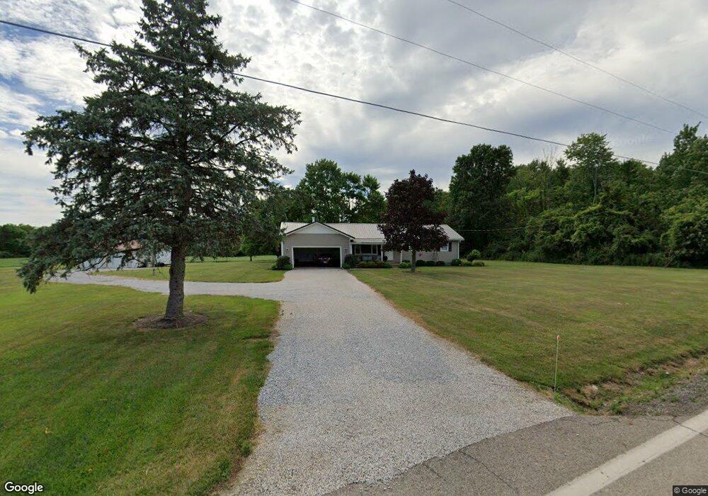
1554 State Route 603 Ashland, OH 44805
Estimated Value: $239,000 - $308,000
3
Beds
2
Baths
1,480
Sq Ft
$187/Sq Ft
Est. Value
About This Home
This home is located at 1554 State Route 603, Ashland, OH 44805 and is currently estimated at $276,105, approximately $186 per square foot. 1554 State Route 603 is a home located in Ashland County with nearby schools including Ashland High School.
Ownership History
Date
Name
Owned For
Owner Type
Purchase Details
Closed on
Nov 16, 2023
Sold by
Jewett Kenneth C and Jewett Terri J
Bought by
Haas Brandon E and Carder Mikayla J
Current Estimated Value
Home Financials for this Owner
Home Financials are based on the most recent Mortgage that was taken out on this home.
Original Mortgage
$192,000
Outstanding Balance
$188,887
Interest Rate
7.88%
Mortgage Type
New Conventional
Estimated Equity
$87,218
Purchase Details
Closed on
Nov 29, 2005
Sold by
Brindle Jack E
Bought by
Jewett Kenneth C
Purchase Details
Closed on
Jan 1, 1990
Bought by
Brindle Jack E
Create a Home Valuation Report for This Property
The Home Valuation Report is an in-depth analysis detailing your home's value as well as a comparison with similar homes in the area
Home Values in the Area
Average Home Value in this Area
Purchase History
| Date | Buyer | Sale Price | Title Company |
|---|---|---|---|
| Haas Brandon E | $240,000 | Castle Real Estate Title | |
| Jewett Kenneth C | $150,000 | -- | |
| Brindle Jack E | -- | -- |
Source: Public Records
Mortgage History
| Date | Status | Borrower | Loan Amount |
|---|---|---|---|
| Open | Haas Brandon E | $192,000 |
Source: Public Records
Tax History Compared to Growth
Tax History
| Year | Tax Paid | Tax Assessment Tax Assessment Total Assessment is a certain percentage of the fair market value that is determined by local assessors to be the total taxable value of land and additions on the property. | Land | Improvement |
|---|---|---|---|---|
| 2024 | $2,488 | $62,510 | $7,500 | $55,010 |
| 2023 | $2,370 | $62,510 | $7,500 | $55,010 |
| 2022 | $2,317 | $48,090 | $5,770 | $42,320 |
| 2021 | $2,326 | $48,090 | $5,770 | $42,320 |
| 2020 | $2,214 | $48,090 | $5,770 | $42,320 |
| 2019 | $2,192 | $44,060 | $5,870 | $38,190 |
| 2018 | $2,205 | $44,060 | $5,870 | $38,190 |
| 2017 | $2,020 | $44,060 | $5,870 | $38,190 |
| 2016 | $2,020 | $38,990 | $5,190 | $33,800 |
| 2015 | $2,004 | $38,990 | $5,190 | $33,800 |
| 2013 | $2,104 | $40,220 | $5,190 | $35,030 |
Source: Public Records
Map
Nearby Homes
- 1696 Township Road 1419
- 2244 Pavonia North Rd
- 1767 State Route 603
- 2202 Lakewood Dr
- 1170 Township Road 1426
- 2331 Fleming Falls Rd
- 1202 County Road 1356
- 1439 Township Road 1238
- 3290 Shad Dr W
- 1951 Woodmont Rd
- 959 Avalon Dr
- 1997 Hout Rd
- 1791 Beal Rd
- 1171 Hoover Rd
- 1292 Wolford Rd
- 2495 Emma Ln
- 1136 Overlook Dr
- 1910 Crider Rd
- 775 Touby Ln
- 1026 Claremont Ave
- 3310 Ohio 603
- 1564 State Route 603
- 1564 State Route 603
- 1559 State Route 603
- 1568 State Route 60
- 1570 State Route 603
- 1571 State Route 603
- 1571 State Route 603
- 1576 State Route 603
- 1576 Ohio 603
- 1581 State Route 603
- 1588 State Route 603
- 1582 State Route 603
- 1587 Ohio 603
- 1589 State Route 603
- 1418 1596
- 1587 State Route 603
- 1418 Township Road 1596
- 1408 1596