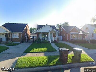
15546 Oconnor Ave Allen Park, MI 48101
Estimated Value: $184,000 - $193,000
3
Beds
1
Bath
1,126
Sq Ft
$168/Sq Ft
Est. Value
About This Home
This home is located at 15546 Oconnor Ave, Allen Park, MI 48101 and is currently estimated at $189,086, approximately $167 per square foot. 15546 Oconnor Ave is a home located in Wayne County with nearby schools including Rogers Early Elementary School, Allendale Elementary School, and Julian O. Strong Middle School.
Ownership History
Date
Name
Owned For
Owner Type
Purchase Details
Closed on
Jan 30, 2015
Sold by
Lozoya Sylvia
Bought by
Lozoya Rosa
Current Estimated Value
Purchase Details
Closed on
May 5, 2010
Sold by
Robertson Roger F
Bought by
Federal Home Loan Mortgage Corp
Purchase Details
Closed on
Apr 8, 2004
Sold by
Evanowski Thomas and Franks Cynthia
Bought by
Robertson Roger F
Home Financials for this Owner
Home Financials are based on the most recent Mortgage that was taken out on this home.
Original Mortgage
$102,000
Interest Rate
5.48%
Mortgage Type
Unknown
Create a Home Valuation Report for This Property
The Home Valuation Report is an in-depth analysis detailing your home's value as well as a comparison with similar homes in the area
Home Values in the Area
Average Home Value in this Area
Purchase History
| Date | Buyer | Sale Price | Title Company |
|---|---|---|---|
| Lozoya Rosa | -- | None Available | |
| Federal Home Loan Mortgage Corp | $61,859 | None Available | |
| Robertson Roger F | $127,500 | Multiple |
Source: Public Records
Mortgage History
| Date | Status | Borrower | Loan Amount |
|---|---|---|---|
| Previous Owner | Robertson Roger E | $102,000 |
Source: Public Records
Tax History Compared to Growth
Tax History
| Year | Tax Paid | Tax Assessment Tax Assessment Total Assessment is a certain percentage of the fair market value that is determined by local assessors to be the total taxable value of land and additions on the property. | Land | Improvement |
|---|---|---|---|---|
| 2024 | $1,439 | $81,800 | $0 | $0 |
| 2023 | $1,376 | $74,800 | $0 | $0 |
| 2022 | $1,766 | $65,900 | $0 | $0 |
| 2021 | $1,718 | $59,500 | $0 | $0 |
| 2020 | $1,697 | $55,100 | $0 | $0 |
| 2019 | $1,689 | $51,800 | $0 | $0 |
| 2018 | $1,248 | $43,000 | $0 | $0 |
| 2017 | $812 | $42,500 | $0 | $0 |
| 2016 | $1,663 | $41,100 | $0 | $0 |
| 2015 | $3,245 | $37,400 | $0 | $0 |
| 2013 | $3,144 | $31,900 | $0 | $0 |
| 2012 | $1,477 | $30,700 | $6,800 | $23,900 |
Source: Public Records
Map
Nearby Homes
- 15192 Anne Ave
- 15167 Keppen Ave
- 15836 Anne Ave
- 15933 Warwick Ave
- 15173 Horger Ave
- 15169 Horger Ave
- 15167 Horger Ave
- 15253 Dasher Ave
- 15147 University St
- 15231 Paris St
- 14829 Arlington Ave
- 15945 Horger Ave
- 14813 Anne Ave
- 15937 Meyer Ave
- 14724 Dasher Ave
- 14806 Paris Ct
- 14735 College Ave
- 2205 Hanford Ave
- 14815 Morris Ave
- 15261 Demean Ave
- 15546 Oconnor Ave
- 15542 Oconnor Ave
- 15554 Oconnor Ave
- 15532 Oconnor Ave
- 15562 Oconnor Ave
- 15526 Oconnor Ave
- 15555 Euclid Ave
- 15563 Euclid Ave
- 15547 Euclid Ave
- 15570 Oconnor Ave
- 15539 Euclid Ave Unit Bldg-Unit
- 5200 Allen Rd
- 15553 Oconnor Ave
- 15571 Euclid Ave
- 15531 Euclid Ave
- 15561 Oconnor Ave
- 15545 Oconnor Ave
- 15578 Oconnor Ave
- 15569 Oconnor Ave
- 15537 Oconnor Ave