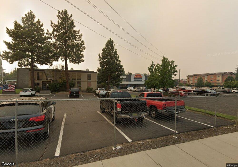
1555 NE Forbes Rd Bend, OR 97701
Larkspur NeighborhoodEstimated Value: $5,600,155
--
Bed
--
Bath
34,500
Sq Ft
$162/Sq Ft
Est. Value
About This Home
This home is located at 1555 NE Forbes Rd, Bend, OR 97701 and is currently estimated at $5,600,155, approximately $162 per square foot. 1555 NE Forbes Rd is a home located in Deschutes County with nearby schools including Bear Creek Elementary School, Bend Senior High School, and The Waldorf School of Bend.
Ownership History
Date
Name
Owned For
Owner Type
Purchase Details
Closed on
Mar 24, 2022
Sold by
Pilot Butte Properties Llc
Bought by
Essy Holding Group Llc
Current Estimated Value
Home Financials for this Owner
Home Financials are based on the most recent Mortgage that was taken out on this home.
Original Mortgage
$3,321,915
Outstanding Balance
$2,267,277
Interest Rate
3.63%
Mortgage Type
New Conventional
Estimated Equity
$3,332,878
Purchase Details
Closed on
Aug 18, 2005
Sold by
Cleveland Donnelly Llc
Bought by
Pilot Butte Properties Llc
Home Financials for this Owner
Home Financials are based on the most recent Mortgage that was taken out on this home.
Original Mortgage
$2,043,750
Interest Rate
5.56%
Mortgage Type
Credit Line Revolving
Create a Home Valuation Report for This Property
The Home Valuation Report is an in-depth analysis detailing your home's value as well as a comparison with similar homes in the area
Home Values in the Area
Average Home Value in this Area
Purchase History
| Date | Buyer | Sale Price | Title Company |
|---|---|---|---|
| Essy Holding Group Llc | $113,000 | None Listed On Document | |
| Pilot Butte Properties Llc | $2,085,000 | First Amer Title Ins Co Or |
Source: Public Records
Mortgage History
| Date | Status | Borrower | Loan Amount |
|---|---|---|---|
| Open | Essy Holding Group Llc | $3,321,915 | |
| Previous Owner | Pilot Butte Properties Llc | $2,043,750 | |
| Closed | Essy Holding Group Llc | $2,219,039 |
Source: Public Records
Tax History Compared to Growth
Tax History
| Year | Tax Paid | Tax Assessment Tax Assessment Total Assessment is a certain percentage of the fair market value that is determined by local assessors to be the total taxable value of land and additions on the property. | Land | Improvement |
|---|---|---|---|---|
| 2025 | $60,655 | $3,589,820 | -- | -- |
| 2024 | $58,356 | $3,485,270 | -- | -- |
| 2023 | $54,096 | $3,383,760 | $0 | $0 |
| 2022 | $50,470 | $3,189,530 | $0 | $0 |
| 2021 | $50,546 | $3,096,640 | $0 | $0 |
| 2020 | $47,953 | $3,096,640 | $0 | $0 |
| 2019 | $46,617 | $3,006,450 | $0 | $0 |
| 2018 | $45,301 | $2,918,890 | $0 | $0 |
| 2017 | $43,972 | $2,833,880 | $0 | $0 |
| 2016 | $41,933 | $2,751,340 | $0 | $0 |
| 2015 | $40,771 | $2,671,210 | $0 | $0 |
| 2014 | $39,412 | $2,593,410 | $0 | $0 |
Source: Public Records
Map
Nearby Homes
- 98 NE Telima Ln
- 608 NE 10th St
- 62025 NE Nate's Place
- 21019 Carl St
- 62001 NE Nates Place
- 438 NE 9th St
- 1072 NE Parkview Ct
- 1767 NE Lotus Dr Unit 1 and 2
- 845 NE 8th St
- 940 NE Purcell Blvd
- 1419 NE Lucinda Ct
- 940 NE Paula Dr Unit 21
- 1687 NE Lotus Dr
- 1401 NE 10th St
- 1622 NE Parkridge Dr
- 649 NE Kearney Ave
- 970 NE Norton Ave Unit Lot 7
- 1630 NE 13th St
- 645 NE Marshall Ave
- 643 NE Marshall Ave
- 1534 NE Wakefield Place
- 446 NE Burgess Place
- 1548 NE Wakefield Place
- 1518 NE Wakefield Place
- 434 NE Burgess Place
- 447 NE Burgess Place
- 440 NE Mccartney Dr
- 431 NE Mccartney Dr
- 416 NE Burgess Place
- 435 NE Burgess Place
- 1517 NE Wakefield Place
- 436 NE Mccartney Dr
- 1645 NE Forbes Rd
- 1521 NE Wakefield Place
- 447 NE Alpenview Ln
- 415 NE Burgess Place
- 364 NE Burgess Place
- 448 NE Alpenview Ln
- 364 NE Mccartney Dr
- 443 NE Alpenview Ln
