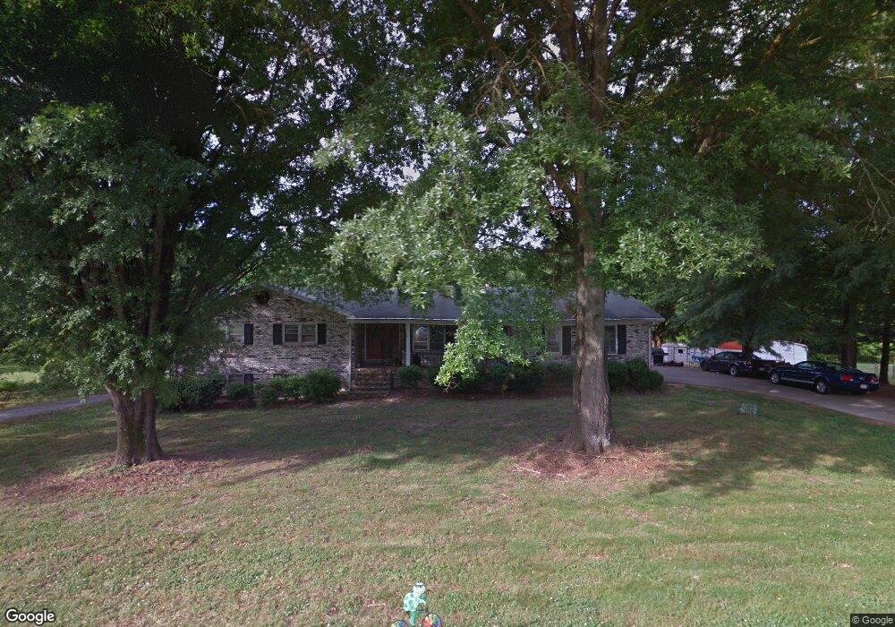
1555 Sandy Ln Lincolnton, NC 28092
Estimated Value: $268,000 - $386,343
3
Beds
3
Baths
1,463
Sq Ft
$228/Sq Ft
Est. Value
About This Home
This home is located at 1555 Sandy Ln, Lincolnton, NC 28092 and is currently estimated at $334,086, approximately $228 per square foot. 1555 Sandy Ln is a home located in Lincoln County with nearby schools including Battleground Elementary School, Lincolnton Middle School, and Lincolnton High School.
Ownership History
Date
Name
Owned For
Owner Type
Purchase Details
Closed on
Jan 20, 2010
Sold by
Stroupe Amanda Dawn
Bought by
Rhodes Phillip Samuel
Current Estimated Value
Purchase Details
Closed on
Jan 7, 2010
Sold by
Dolley Steve and Stroupe Lloyd A
Bought by
Stroupe Amanda Dawn
Purchase Details
Closed on
Feb 21, 2006
Sold by
Stroupe Lloyd Allen
Bought by
Moss Sheila E
Purchase Details
Closed on
Feb 19, 2006
Sold by
Stroupe Amanda Dawn
Bought by
Stroupe Lloyd Allen
Purchase Details
Closed on
Oct 11, 2005
Sold by
Stroupe Lloyd Allen
Bought by
Stroupe Amanda Dawn
Create a Home Valuation Report for This Property
The Home Valuation Report is an in-depth analysis detailing your home's value as well as a comparison with similar homes in the area
Home Values in the Area
Average Home Value in this Area
Purchase History
| Date | Buyer | Sale Price | Title Company |
|---|---|---|---|
| Rhodes Phillip Samuel | -- | None Available | |
| Stroupe Amanda Dawn | -- | None Available | |
| Moss Sheila E | -- | None Available | |
| Stroupe Lloyd Allen | -- | None Available | |
| Stroupe Amanda Dawn | $1,000 | None Available |
Source: Public Records
Tax History Compared to Growth
Tax History
| Year | Tax Paid | Tax Assessment Tax Assessment Total Assessment is a certain percentage of the fair market value that is determined by local assessors to be the total taxable value of land and additions on the property. | Land | Improvement |
|---|---|---|---|---|
| 2025 | $1,836 | $271,760 | $35,994 | $235,766 |
| 2024 | $1,816 | $271,760 | $35,994 | $235,766 |
| 2023 | $1,811 | $271,760 | $35,994 | $235,766 |
| 2022 | $1,531 | $190,350 | $28,795 | $161,555 |
| 2021 | $1,531 | $190,350 | $28,795 | $161,555 |
| 2020 | $1,378 | $190,350 | $28,795 | $161,555 |
| 2019 | $1,340 | $190,350 | $28,795 | $161,555 |
| 2018 | $1,114 | $141,518 | $26,695 | $114,823 |
| 2017 | $990 | $139,279 | $26,695 | $112,584 |
| 2016 | $990 | $139,279 | $26,695 | $112,584 |
| 2015 | $1,056 | $139,279 | $26,695 | $112,584 |
| 2014 | $1,292 | $175,077 | $29,294 | $145,783 |
Source: Public Records
Map
Nearby Homes
- 00 Shell St
- 00 Eastview Dr
- 141 Mallory Tai Dr
- 1156 Walker Branch Rd
- 00 Walker Branch Rd
- 0 Wilma Sigmon Rd Unit A CAR4306088
- 4586 Harris Elliot Rd
- 4582 Harris Elliot Rd
- 4578 Harris Elliot Rd
- 4552 Harris Elliot Rd
- 4548 Harris Elliot Rd
- 1235 Wilma Sigmon Rd
- 4594 Harris Elliot Rd
- 4603 Harris Elliot Rd
- 4590 Harris Elliot Rd
- 4583 Harris Elliot Rd
- 4579 Harris Elliot Rd
- 6157 Helms Ln
- 3309 Ora Smith Rd
- 3305 Ora Smith Rd
- 1571 Sandy Ln
- 1556 Sandy Ln
- 1538 Sandy Ln
- 1572 Sandy Ln
- 1525 Sandy Ln
- 1589 Sandy Ln
- 353 Bethel Church Rd
- 1520 Sandy Ln
- 377 Bethel Church Rd
- 1593 Beal Pond Trail
- 409 Bethel Church Rd
- 285 Bethel Church Rd
- 1597 Beal Pond Trail
- 257 Bethel Church Rd
- 151 Bethel Church Rd
- 229 Mull Rd
- 267 Mull Rd
- 283 Mull Rd
- 160 Bethel Church Rd
- 293 Mull Rd