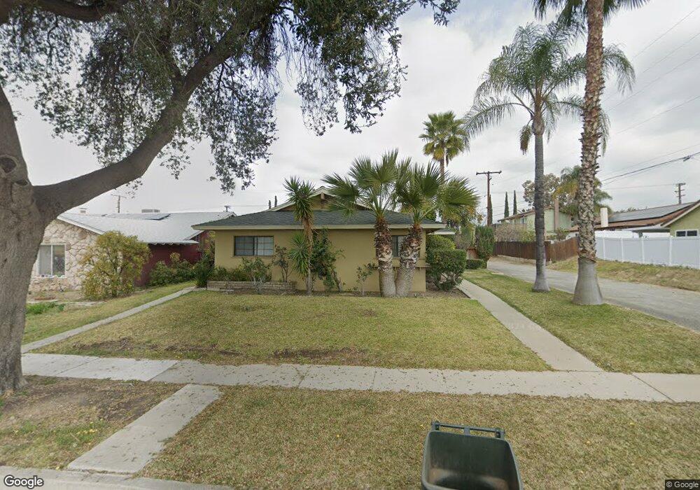
1555 Stillman Ave Redlands, CA 92374
North Redlands NeighborhoodEstimated Value: $551,508 - $713,000
3
Beds
2
Baths
1,570
Sq Ft
$397/Sq Ft
Est. Value
About This Home
This home is located at 1555 Stillman Ave, Redlands, CA 92374 and is currently estimated at $622,877, approximately $396 per square foot. 1555 Stillman Ave is a home located in San Bernardino County with nearby schools including Crafton Elementary School, Clement Middle School, and Redlands East Valley High School.
Ownership History
Date
Name
Owned For
Owner Type
Purchase Details
Closed on
Sep 21, 2006
Sold by
Mcqueen Samuel and Mcqueen Frances
Bought by
Mcqueen Samuel and Mcqueen Frances
Current Estimated Value
Home Financials for this Owner
Home Financials are based on the most recent Mortgage that was taken out on this home.
Original Mortgage
$221,000
Outstanding Balance
$131,704
Interest Rate
6.53%
Mortgage Type
New Conventional
Estimated Equity
$491,173
Purchase Details
Closed on
Oct 18, 2000
Sold by
Vega Robert and Vega Mary
Bought by
Mcqueen Samuel and Mcqueen Frances
Home Financials for this Owner
Home Financials are based on the most recent Mortgage that was taken out on this home.
Original Mortgage
$139,650
Interest Rate
7.86%
Create a Home Valuation Report for This Property
The Home Valuation Report is an in-depth analysis detailing your home's value as well as a comparison with similar homes in the area
Home Values in the Area
Average Home Value in this Area
Purchase History
| Date | Buyer | Sale Price | Title Company |
|---|---|---|---|
| Mcqueen Samuel | -- | Security Union Title | |
| Mcqueen Samuel | $155,500 | Fidelity National Title Co |
Source: Public Records
Mortgage History
| Date | Status | Borrower | Loan Amount |
|---|---|---|---|
| Open | Mcqueen Samuel | $221,000 | |
| Closed | Mcqueen Samuel | $139,650 |
Source: Public Records
Tax History Compared to Growth
Tax History
| Year | Tax Paid | Tax Assessment Tax Assessment Total Assessment is a certain percentage of the fair market value that is determined by local assessors to be the total taxable value of land and additions on the property. | Land | Improvement |
|---|---|---|---|---|
| 2025 | $2,567 | $226,032 | $52,742 | $173,290 |
| 2024 | $2,567 | $221,600 | $51,708 | $169,892 |
| 2023 | $2,562 | $217,255 | $50,694 | $166,561 |
| 2022 | $2,524 | $212,995 | $49,700 | $163,295 |
| 2021 | $2,568 | $208,818 | $48,725 | $160,093 |
| 2020 | $2,529 | $206,676 | $48,225 | $158,451 |
| 2019 | $2,457 | $202,623 | $47,279 | $155,344 |
| 2018 | $2,394 | $198,650 | $46,352 | $152,298 |
| 2017 | $2,373 | $194,755 | $45,443 | $149,312 |
| 2016 | $2,345 | $190,936 | $44,552 | $146,384 |
| 2015 | $2,326 | $188,068 | $43,883 | $144,185 |
| 2014 | $2,283 | $184,384 | $43,023 | $141,361 |
Source: Public Records
Map
Nearby Homes
- 1529 Cambridge Ave
- 313 N Dearborn St
- 907 Knightsbridge Ln
- 1582 Lisa Ln
- 312 Barrington Cir
- 450 Judson St
- 1575 Christopher Ln
- 941 Kensington Dr
- 1573 E Brockton Ave
- 1427 Laramie Ave
- 327 Naomi St
- 0 E Colton Ave
- 149 Lido St
- 1639 E Brockton Ave
- 1562 E Citrus Ave
- 626 N Dearborn St Unit 9
- 626 N Dearborn St Unit 192
- 626 N Dearborn St Unit 12
- 626 N Dearborn St Unit 134
- 1721 E Colton Ave Unit 33
- 1551 Stillman Ave
- 1561 Stillman Ave
- 707 Daisy Ct
- 1545 Stillman Ave
- 1538 E Colton Ave
- 1534 E Colton Ave
- 626 Cardinal Ln
- 1530 E Colton Ave
- 711 Daisy Ct
- 1539 Stillman Ave
- 1560 Stillman Ave
- 1526 E Colton Ave
- 622 Cardinal Ln
- 1533 Stillman Ave
- 619 Daisy Ct
- 704 Daisy Ct
- 1527 E Colton Ave
- 708 Daisy Ct
- 700 Daisy Ct
- 621 Cardinal Ln