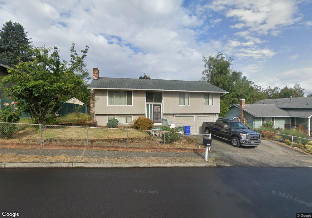
1555 SW Tegart Ave Gresham, OR 97080
Southwest Gresham NeighborhoodEstimated Value: $417,000 - $526,000
4
Beds
3
Baths
1,652
Sq Ft
$282/Sq Ft
Est. Value
About This Home
This home is located at 1555 SW Tegart Ave, Gresham, OR 97080 and is currently estimated at $466,094, approximately $282 per square foot. 1555 SW Tegart Ave is a home located in Multnomah County with nearby schools including Hollydale Elementary School, Dexter McCarty Middle School, and Gresham High School.
Ownership History
Date
Name
Owned For
Owner Type
Purchase Details
Closed on
Dec 7, 2012
Sold by
Binuya Conrado A
Bought by
Wardak Galina and Wardak Qudratullah
Current Estimated Value
Home Financials for this Owner
Home Financials are based on the most recent Mortgage that was taken out on this home.
Original Mortgage
$119,000
Outstanding Balance
$82,075
Interest Rate
3.35%
Mortgage Type
New Conventional
Estimated Equity
$384,019
Create a Home Valuation Report for This Property
The Home Valuation Report is an in-depth analysis detailing your home's value as well as a comparison with similar homes in the area
Home Values in the Area
Average Home Value in this Area
Purchase History
| Date | Buyer | Sale Price | Title Company |
|---|---|---|---|
| Wardak Galina | $179,000 | First American |
Source: Public Records
Mortgage History
| Date | Status | Borrower | Loan Amount |
|---|---|---|---|
| Open | Wardak Galina | $119,000 |
Source: Public Records
Tax History
| Year | Tax Paid | Tax Assessment Tax Assessment Total Assessment is a certain percentage of the fair market value that is determined by local assessors to be the total taxable value of land and additions on the property. | Land | Improvement |
|---|---|---|---|---|
| 2025 | $4,798 | $235,780 | -- | -- |
| 2024 | $4,593 | $228,920 | -- | -- |
| 2023 | $4,185 | $222,260 | $0 | $0 |
| 2022 | $4,068 | $215,790 | $0 | $0 |
| 2021 | $3,965 | $209,510 | $0 | $0 |
| 2020 | $3,731 | $203,410 | $0 | $0 |
| 2019 | $3,633 | $197,490 | $0 | $0 |
| 2018 | $3,464 | $191,740 | $0 | $0 |
| 2017 | $3,324 | $186,160 | $0 | $0 |
| 2016 | $2,931 | $180,740 | $0 | $0 |
Source: Public Records
Map
Nearby Homes
- 3198 SW 16th Cir
- 0 W Powell Loop
- 1963 SW Myers Place
- 3079 SW 22nd St
- 2092 SW Thomas Place
- 3756 SW 7th Ct
- 4010 SW 13th Ct
- 3749 SW 6th St
- 2398 SW Tegart Ave
- 4540 SW 11th St Unit E4540
- 3857 SW Brittany Dr
- 3605 SW 25th St
- 2263 SW Phyllis Place
- 4556 SW 11th St
- 1960 SW 13th Ct
- 3893 SW 4th St
- 2607 SW Pleasant View Dr
- 4434 W Powell Blvd
- 2401 SW Eleven Mile Dr
- 3519 SW 28th Terrace
- 1535 SW Tegart Ave
- 1585 SW Tegart Ave
- 3230 SW 14th Dr
- 3197 SW 16th Cir
- 1615 SW Tegart Ave
- 1495 SW Tegart Ave
- 3190 SW 15th Ct
- 3177 SW 16th Cir
- 3180 SW 15th Ct
- 3196 SW 16th Cir
- 3157 SW 16th Cir
- 1635 SW Tegart Ave
- 3160 SW 15th Ct
- 1475 SW Tegart Ave
- 3186 SW 16th Cir
- 3195 SW 15th Ct
- 3137 SW 16th Cir
- 3150 SW 15th Ct
- 3185 SW 15th Ct
- 3166 SW 16th Cir
Your Personal Tour Guide
Ask me questions while you tour the home.