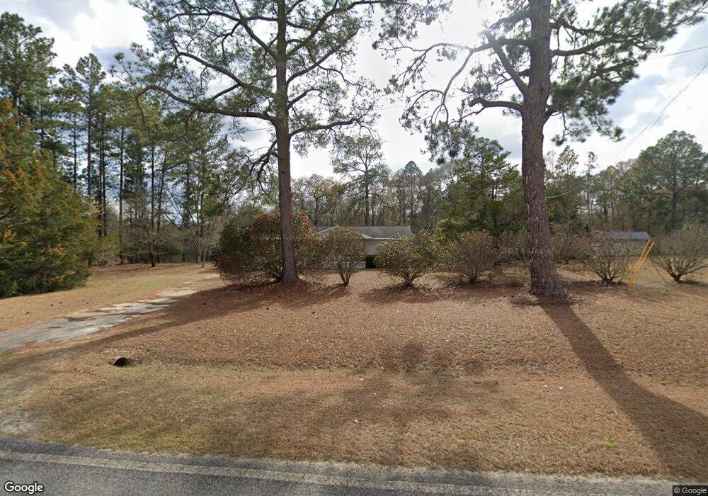
1556 Wpa Rd Eastman, GA 31023
Estimated Value: $90,611 - $120,000
--
Bed
1
Bath
875
Sq Ft
$119/Sq Ft
Est. Value
About This Home
This home is located at 1556 Wpa Rd, Eastman, GA 31023 and is currently estimated at $103,903, approximately $118 per square foot. 1556 Wpa Rd is a home located in Dodge County with nearby schools including Dodge County High School.
Ownership History
Date
Name
Owned For
Owner Type
Purchase Details
Closed on
Dec 3, 2021
Sold by
Thornton Romie G
Bought by
Thornton Christopher Michael
Current Estimated Value
Home Financials for this Owner
Home Financials are based on the most recent Mortgage that was taken out on this home.
Original Mortgage
$81,000
Outstanding Balance
$74,479
Interest Rate
3.09%
Mortgage Type
VA
Estimated Equity
$29,424
Purchase Details
Closed on
Jun 22, 2007
Sold by
York Jessica L
Bought by
Thornton Romie G and Thornton Diana Kay
Purchase Details
Closed on
Mar 24, 2006
Sold by
Jones Billy K
Bought by
York Jessica L
Home Financials for this Owner
Home Financials are based on the most recent Mortgage that was taken out on this home.
Original Mortgage
$47,250
Interest Rate
6.23%
Mortgage Type
New Conventional
Purchase Details
Closed on
Jun 30, 2004
Sold by
Thomas William C
Bought by
Jones Billy K and Jones Diana L
Purchase Details
Closed on
Jun 4, 2004
Sold by
Phagan Dewitt C
Bought by
Thomas William C
Create a Home Valuation Report for This Property
The Home Valuation Report is an in-depth analysis detailing your home's value as well as a comparison with similar homes in the area
Home Values in the Area
Average Home Value in this Area
Purchase History
| Date | Buyer | Sale Price | Title Company |
|---|---|---|---|
| Thornton Christopher Michael | $81,000 | -- | |
| Thornton Romie G | $53,000 | -- | |
| York Jessica L | $47,250 | -- | |
| Jones Billy K | $41,000 | -- | |
| Thomas William C | $35,000 | -- |
Source: Public Records
Mortgage History
| Date | Status | Borrower | Loan Amount |
|---|---|---|---|
| Open | Thornton Christopher Michael | $81,000 | |
| Previous Owner | York Jessica L | $47,250 |
Source: Public Records
Tax History Compared to Growth
Tax History
| Year | Tax Paid | Tax Assessment Tax Assessment Total Assessment is a certain percentage of the fair market value that is determined by local assessors to be the total taxable value of land and additions on the property. | Land | Improvement |
|---|---|---|---|---|
| 2024 | $583 | $22,407 | $1,900 | $20,507 |
| 2023 | $579 | $22,407 | $1,900 | $20,507 |
| 2022 | $541 | $21,028 | $1,449 | $19,579 |
| 2021 | $524 | $20,310 | $1,449 | $18,861 |
| 2020 | $527 | $20,103 | $1,242 | $18,861 |
| 2019 | $458 | $17,241 | $1,242 | $15,999 |
| 2018 | $441 | $17,241 | $1,242 | $15,999 |
| 2017 | $441 | $17,241 | $1,242 | $15,999 |
| 2016 | $429 | $16,774 | $1,242 | $15,532 |
| 2015 | -- | $16,774 | $1,242 | $15,532 |
| 2014 | -- | $16,997 | $1,242 | $15,755 |
| 2013 | -- | $16,996 | $1,241 | $15,755 |
Source: Public Records
Map
Nearby Homes
- 6515 Fred Bohannon Rd
- 0 Shady Oaks Rd Unit 10400925
- 0 Shady Oaks Rd Unit 246471
- 1348 Minter Ridge
- 0 Windy Way
- 534 Soperton Hwy
- 255 Margaret Dr
- 431 Pine Bluff Rd
- 5533 Russell Ave
- 0 Forest Ave Unit 10588959
- 5616 Beulah Ave
- 5422 1st Ave
- 5811 5th Ave
- 220 Page St
- 619 Cooper Ave
- 0 Williams Dr Unit 10632909
- 5218 4th Ave
- 781 Jordan Brown Rd
- 9 June Ln
- 5859 8th Ave