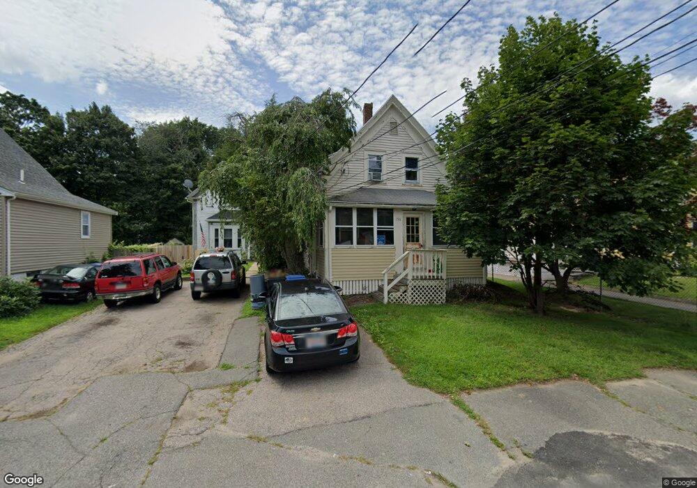
156 Beulah St Whitman, MA 02382
Estimated Value: $416,000 - $470,000
3
Beds
1
Bath
1,088
Sq Ft
$406/Sq Ft
Est. Value
About This Home
This home is located at 156 Beulah St, Whitman, MA 02382 and is currently estimated at $441,884, approximately $406 per square foot. 156 Beulah St is a home located in Plymouth County with nearby schools including St Bridget School.
Ownership History
Date
Name
Owned For
Owner Type
Purchase Details
Closed on
Jan 7, 2000
Sold by
Beulah Nt
Bought by
Garrett James P
Current Estimated Value
Purchase Details
Closed on
Oct 26, 1998
Sold by
Curry James J
Bought by
Beulah Nt
Purchase Details
Closed on
Nov 30, 1993
Sold by
Cavanaugh William P and Cavanaugh Pamela C
Bought by
Curry James J and Curry Patricia
Create a Home Valuation Report for This Property
The Home Valuation Report is an in-depth analysis detailing your home's value as well as a comparison with similar homes in the area
Home Values in the Area
Average Home Value in this Area
Purchase History
| Date | Buyer | Sale Price | Title Company |
|---|---|---|---|
| Garrett James P | $129,000 | -- | |
| Beulah Nt | $73,000 | -- | |
| Curry James J | $85,400 | -- |
Source: Public Records
Mortgage History
| Date | Status | Borrower | Loan Amount |
|---|---|---|---|
| Open | Curry James J | $183,150 | |
| Closed | Curry James J | $30,000 | |
| Closed | Curry James J | $15,000 |
Source: Public Records
Tax History Compared to Growth
Tax History
| Year | Tax Paid | Tax Assessment Tax Assessment Total Assessment is a certain percentage of the fair market value that is determined by local assessors to be the total taxable value of land and additions on the property. | Land | Improvement |
|---|---|---|---|---|
| 2025 | $4,286 | $326,700 | $139,000 | $187,700 |
| 2024 | $4,056 | $318,400 | $136,300 | $182,100 |
| 2023 | $3,893 | $286,900 | $118,200 | $168,700 |
| 2022 | $3,845 | $264,100 | $107,500 | $156,600 |
| 2021 | $3,694 | $238,300 | $98,700 | $139,600 |
| 2020 | $3,552 | $224,100 | $89,300 | $134,800 |
| 2019 | $3,334 | $216,800 | $89,300 | $127,500 |
| 2018 | $3,425 | $213,900 | $105,800 | $108,100 |
| 2017 | $3,226 | $213,900 | $105,800 | $108,100 |
| 2016 | $3,123 | $200,300 | $100,700 | $99,600 |
| 2015 | $3,189 | $204,300 | $100,700 | $103,600 |
Source: Public Records
Map
Nearby Homes
- 135-137 Temple St
- 164 Warren Ave
- 53 Temple St
- 532 Washington St
- 604 Bedford St Unit 5
- 110 South Ave Unit 14
- 110 South Ave
- 63 Dewey Ave
- 48 Day St
- 277 School St
- 66 Belmont St
- 20 Elm Place
- 150 Harvard St
- 54-56 Stetson St
- 1098 Bedford St
- 300 High St
- 159 Auburn St
- 154 Auburn St
- 501 Auburn St Unit 404
- 501 Auburn St Unit 201