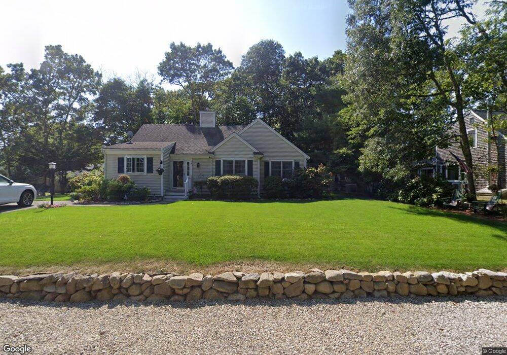
156 Captains Row Mashpee, MA 02649
Mashpee Neck NeighborhoodEstimated Value: $657,000 - $1,264,000
3
Beds
1
Bath
1,441
Sq Ft
$724/Sq Ft
Est. Value
About This Home
This home is located at 156 Captains Row, Mashpee, MA 02649 and is currently estimated at $1,043,864, approximately $724 per square foot. 156 Captains Row is a home located in Barnstable County with nearby schools including Kenneth C. Coombs School, Quashnet School, and Mashpee Middle School.
Ownership History
Date
Name
Owned For
Owner Type
Purchase Details
Closed on
May 16, 2013
Sold by
Janedy John
Bought by
Janedy Matthew
Current Estimated Value
Home Financials for this Owner
Home Financials are based on the most recent Mortgage that was taken out on this home.
Original Mortgage
$100,000
Outstanding Balance
$69,688
Interest Rate
3.57%
Mortgage Type
New Conventional
Estimated Equity
$974,176
Purchase Details
Closed on
May 6, 2013
Sold by
Ambrose J Janedy Ret and Osborne
Bought by
Jandey John
Home Financials for this Owner
Home Financials are based on the most recent Mortgage that was taken out on this home.
Original Mortgage
$100,000
Outstanding Balance
$69,688
Interest Rate
3.57%
Mortgage Type
New Conventional
Estimated Equity
$974,176
Create a Home Valuation Report for This Property
The Home Valuation Report is an in-depth analysis detailing your home's value as well as a comparison with similar homes in the area
Home Values in the Area
Average Home Value in this Area
Purchase History
We collect this data history from publicly available records. To have your information removed, we recommend requesting removal directly through your county’s website.
| Date | Buyer | Sale Price | Title Company |
|---|---|---|---|
| Janedy Matthew | $500,000 | -- | |
| Janedy Matthew A | $500,000 | -- | |
| Jandey John | -- | -- | |
| Jandey John | -- | -- |
Source: Public Records
Mortgage History
We collect this data history from publicly available records. To have your information removed, we recommend requesting removal directly through your county’s website.
| Date | Status | Borrower | Loan Amount |
|---|---|---|---|
| Open | Jandey John | $100,000 | |
| Closed | Jandey John | $100,000 |
Source: Public Records
Tax History
| Year | Tax Paid | Tax Assessment Tax Assessment Total Assessment is a certain percentage of the fair market value that is determined by local assessors to be the total taxable value of land and additions on the property. | Land | Improvement |
|---|---|---|---|---|
| 2025 | $7,731 | $1,167,800 | $847,000 | $320,800 |
| 2024 | $6,916 | $1,075,600 | $770,100 | $305,500 |
| 2023 | $6,898 | $984,000 | $733,300 | $250,700 |
| 2022 | $5,748 | $703,600 | $496,800 | $206,800 |
| 2021 | $5,636 | $621,400 | $447,500 | $173,900 |
| 2020 | $5,439 | $598,300 | $430,400 | $167,900 |
| 2019 | $5,316 | $587,400 | $430,400 | $157,000 |
| 2018 | $2,527 | $598,100 | $459,100 | $139,000 |
| 2017 | $4,854 | $528,200 | $401,700 | $126,500 |
| 2016 | $4,645 | $502,700 | $384,500 | $118,200 |
| 2015 | $4,530 | $497,300 | $384,500 | $112,800 |
| 2014 | $4,595 | $489,400 | $377,900 | $111,500 |
Source: Public Records
Map
Nearby Homes
- 20 Mutiny Way
- 35 Punkhorn Point Rd
- 67 Crawford Rd
- 140 Summersea Rd
- 17 Dry Hollow Ln
- 85 Clamshell Cove Rd
- 28 Quaker Run Rd
- 102 Summersea Rd
- 10 Shadbush Cir
- 353 Simons Narrows Rd
- 35 Spinnaker Dr W
- 86 Summersea Rd
- 80 Summersea Rd
- 80 & 86 Summersea Rd
- 11 Teal Cir
- 55 Summersea Rd
- 640 Poponessett Rd
- 640 Poponessett Rd
- 89 Degrass Rd
- 14 Herring Gull Rd
- 150 Captains Row
- 160 Captains Row
- 153 Captains Row
- 146 Captains Row
- 159 Captains Row
- 164 Captains Row
- 149 Captains Row
- 163 Captains Row
- 59 Musket Ln
- 143 Captains Row
- 53 Musket Ln
- 170 Captains Row
- 65 Musket Ln
- 140 Captains Row
- 47 Musket Ln
- 171 Captains Row
- 57 Treasure Ln
- 65 Treasure Ln
- 41 Musket Ln
- 42 Cutlass Ln
Your Personal Tour Guide
Ask me questions while you tour the home.