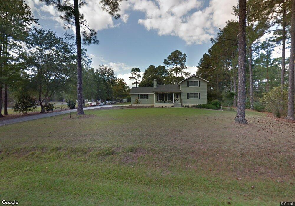
156 Flint Dr Moultrie, GA 31788
Estimated Value: $412,536 - $509,000
Studio
2
Baths
3,684
Sq Ft
$127/Sq Ft
Est. Value
About This Home
This home is located at 156 Flint Dr, Moultrie, GA 31788 and is currently estimated at $467,134, approximately $126 per square foot. 156 Flint Dr is a home located in Colquitt County with nearby schools including Sunset Elementary School, Willie J. Williams Middle School, and C.A. Gray Junior High School.
Ownership History
Date
Name
Owned For
Owner Type
Purchase Details
Closed on
Sep 24, 2018
Sold by
Bannister Hugh Randall
Bought by
Mcdaniel Stacie G and Mcdaniel Michael C
Current Estimated Value
Home Financials for this Owner
Home Financials are based on the most recent Mortgage that was taken out on this home.
Original Mortgage
$224,852
Outstanding Balance
$198,249
Interest Rate
5.5%
Mortgage Type
FHA
Estimated Equity
$268,885
Purchase Details
Closed on
Mar 4, 2010
Sold by
Bannister Hugh Randall
Bought by
Bannister Hugh Randall and Bannister Holly K
Home Financials for this Owner
Home Financials are based on the most recent Mortgage that was taken out on this home.
Original Mortgage
$144,000
Interest Rate
5.01%
Mortgage Type
New Conventional
Purchase Details
Closed on
Jan 24, 2007
Sold by
Nichols Daniel Lamar
Bought by
Bannister Hugh R
Home Financials for this Owner
Home Financials are based on the most recent Mortgage that was taken out on this home.
Original Mortgage
$129,254
Interest Rate
6.14%
Mortgage Type
New Conventional
Purchase Details
Closed on
Feb 26, 1999
Sold by
Nichols Daniel Lamar
Bought by
Nichols Daniel Lamar and Nichols Emily E
Purchase Details
Closed on
May 6, 1994
Bought by
Hortman Edwin L
Purchase Details
Closed on
Apr 5, 1988
Bought by
Swanson Donald
Create a Home Valuation Report for This Property
The Home Valuation Report is an in-depth analysis detailing your home's value as well as a comparison with similar homes in the area
Purchase History
| Date | Buyer | Sale Price | Title Company |
|---|---|---|---|
| Mcdaniel Stacie G | $229,000 | -- | |
| Bannister Hugh Randall | -- | -- | |
| Bannister Hugh R | $228,900 | -- | |
| Nichols Daniel Lamar | -- | -- | |
| Nichols Daniel Lamar | $159,000 | -- | |
| Hortman Edwin L | $98,900 | -- | |
| Swanson Donald | $76,000 | -- |
Source: Public Records
Mortgage History
| Date | Status | Borrower | Loan Amount |
|---|---|---|---|
| Open | Mcdaniel Stacie G | $224,852 | |
| Previous Owner | Bannister Hugh Randall | $144,000 | |
| Previous Owner | Bannister Hugh R | $129,254 |
Source: Public Records
Tax History
| Year | Tax Paid | Tax Assessment Tax Assessment Total Assessment is a certain percentage of the fair market value that is determined by local assessors to be the total taxable value of land and additions on the property. | Land | Improvement |
|---|---|---|---|---|
| 2025 | $4,262 | $214,292 | $9,200 | $205,092 |
| 2024 | $4,262 | $190,705 | $9,200 | $181,505 |
| 2023 | $4,022 | $132,709 | $9,200 | $123,509 |
| 2022 | $2,821 | $118,476 | $9,200 | $109,276 |
| 2021 | $2,596 | $106,908 | $9,200 | $97,708 |
| 2020 | $2,471 | $99,974 | $9,200 | $90,774 |
| 2019 | $2,520 | $98,240 | $9,200 | $89,040 |
| 2018 | $2,327 | $90,973 | $9,200 | $81,773 |
| 2017 | $2,421 | $90,973 | $9,200 | $81,773 |
| 2016 | $2,454 | $90,973 | $9,200 | $81,773 |
| 2015 | $2,477 | $90,973 | $9,200 | $81,773 |
| 2014 | $2,430 | $90,973 | $9,200 | $81,773 |
| 2013 | -- | $90,972 | $9,200 | $81,772 |
Source: Public Records
Map
Nearby Homes
- 144 Flint Dr
- 3208 Tallokas Rd
- 151 Upper Trail
- 31 31st Ave SE
- 72 Packer Pride Dr SE
- 69 Packer Pride Dr SE
- 0 Old Timey Trail
- 270 Old Timey Trail
- 410 Indian Trail
- 85 Cobblestone Blvd SE
- 4 Baldwin Place SE
- 35 Cobblestone Blvd SE
- 36 Cobblestone Blvd SE
- 104 Inner Cir
- 0 Belt Ln Unit 914599
- 111 Belt Ln
- 107 Belt Ln
- 0 Sunbelt Dr Unit 915605
- 182 Horseshoe Dr
- 96 Baell Trace Ct SE